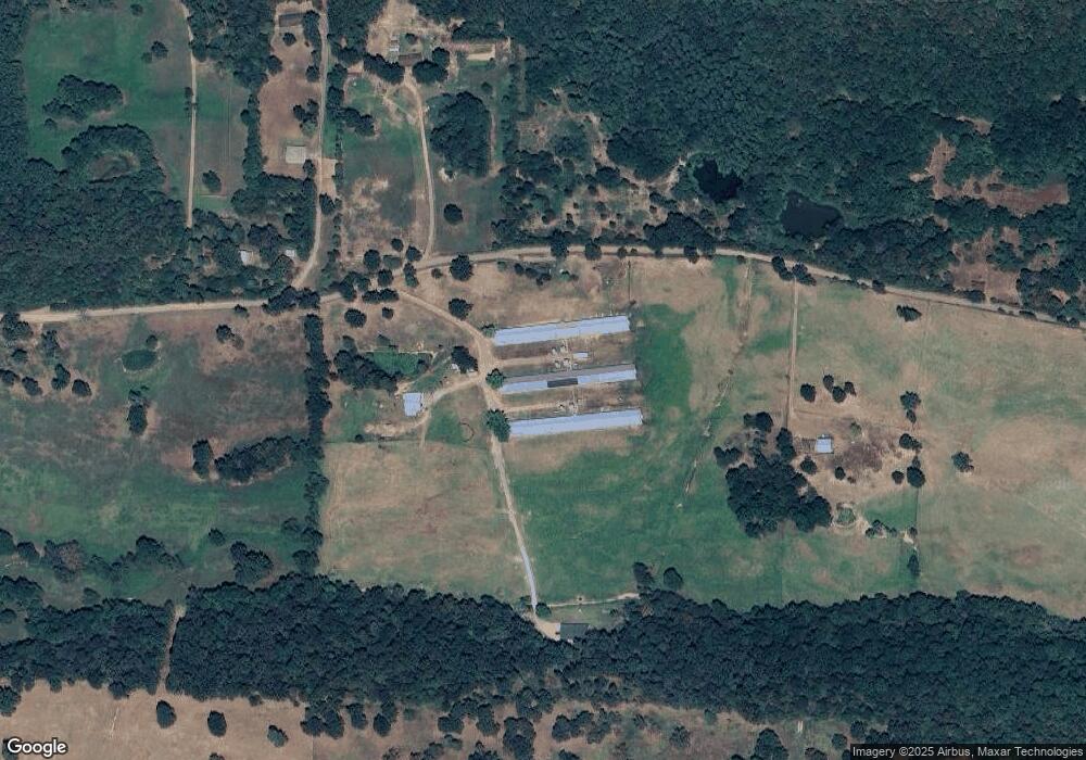
1357 Square Rock Rd Waldron, AR 72958
Estimated Value: $282,000 - $598,000
Studio
2
Baths
2,292
Sq Ft
$206/Sq Ft
Est. Value
About This Home
This home is located at 1357 Square Rock Rd, Waldron, AR 72958 and is currently estimated at $471,283, approximately $205 per square foot. 1357 Square Rock Rd is a home located in Scott County with nearby schools including Waldron Elementary School, Waldron Middle School, and Waldron High School.
Ownership History
Date
Name
Owned For
Owner Type
Purchase Details
Closed on
Aug 28, 2018
Sold by
Collett Randall A and Collett Narisara
Bought by
Byler Bonnie and Byler Edward
Current Estimated Value
Purchase Details
Closed on
Jun 9, 2006
Sold by
Russell Donna K and Russell Joel B
Bought by
Hanna Leslie C
Home Financials for this Owner
Home Financials are based on the most recent Mortgage that was taken out on this home.
Original Mortgage
$102,300
Interest Rate
6.72%
Mortgage Type
Credit Line Revolving
Purchase Details
Closed on
Aug 6, 1987
Bought by
Hanna Kenneth and Hanna Carolyn
Create a Home Valuation Report for This Property
The Home Valuation Report is an in-depth analysis detailing your home's value as well as a comparison with similar homes in the area
Purchase History
| Date | Buyer | Sale Price | Title Company |
|---|---|---|---|
| Byler Bonnie | $450,000 | Scott Cnty Title Corp | |
| Hanna Leslie C | $100,000 | -- | |
| Hanna Kenneth | $48,000 | -- |
Source: Public Records
Mortgage History
| Date | Status | Borrower | Loan Amount |
|---|---|---|---|
| Previous Owner | Hanna Leslie C | $102,300 |
Source: Public Records
Tax History Compared to Growth
Tax History
| Year | Tax Paid | Tax Assessment Tax Assessment Total Assessment is a certain percentage of the fair market value that is determined by local assessors to be the total taxable value of land and additions on the property. | Land | Improvement |
|---|---|---|---|---|
| 2025 | $1,019 | $83,870 | $2,050 | $81,820 |
| 2024 | $1,019 | $83,870 | $2,050 | $81,820 |
| 2023 | $1,013 | $83,870 | $2,050 | $81,820 |
| 2022 | $982 | $83,870 | $2,050 | $81,820 |
| 2021 | $901 | $83,870 | $2,050 | $81,820 |
| 2020 | $1,193 | $31,080 | $1,820 | $29,260 |
| 2019 | $821 | $31,860 | $2,600 | $29,260 |
| 2018 | $876 | $31,860 | $2,600 | $29,260 |
| 2017 | $1,223 | $29,260 | $2,600 | $26,660 |
| 2015 | -- | $47,860 | $2,270 | $45,590 |
| 2014 | -- | $47,860 | $2,270 | $45,590 |
| 2013 | -- | $47,860 | $2,270 | $45,590 |
Source: Public Records
Map
Nearby Homes
- 1150 White Oak Rd
- 1565 White oak White Oak Rd
- 1347 White Oak Rd
- 2541 N Main St
- 2572 N Main St
- 6 Lots Northgate Subdivision
- 25 Lots Country Elite Estates
- Lot 23 Grandstaff Ave
- Lot 15 Grandstaff Ave
- Lot 4 Grandstaff Ave
- Lot 2 Grandstaff Ave
- Lot 14 Grandstaff Ave
- Lot 1 Grandstaff Ave
- 952 N Main St
- OFF N Main St
- 772 N Main St
- 1346 N Main St
- 1342 N Main St
- 124 City Lake Rd
- 743 743 N Main St
- 1124 Foxy Ln
- 1086 Foxy Ln
- 1336 Square Rock Rd
- 1336 Square Rock Rd
- 1081 Foxy Ln
- 1123 Foxy Ln
- 1360 Square Rock Rd
- 1173 Foxy Ln
- 1466 Square Rock Rd
- 1310 Square Rock Rd
- 1261 Square Rock Rd
- 1534 Square Rock Rd
- 2317 White Oak Rd
- 3941 Highway 71 N
- 2281 White Oak Rd
- 2223 White Oak Rd
- 1091 Link Rd
- 4431 Highway 71 N
- 2207 White Oak Rd
- 2332 White Oak Rd
