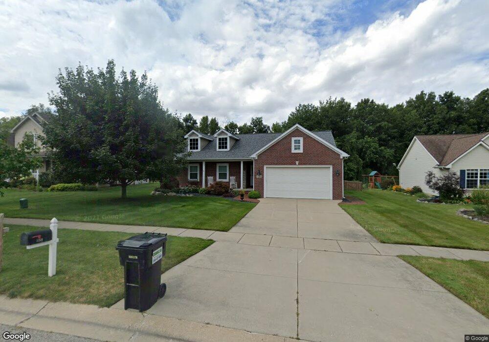
1359 Ashwood Ln Unit 27 Howell, MI 48843
Estimated Value: $379,652 - $407,000
--
Bed
2
Baths
1,654
Sq Ft
$237/Sq Ft
Est. Value
About This Home
This home is located at 1359 Ashwood Ln Unit 27, Howell, MI 48843 and is currently estimated at $392,663, approximately $237 per square foot. 1359 Ashwood Ln Unit 27 is a home located in Livingston County with nearby schools including Northwest Elementary School, Highlander Way Middle School, and Howell High School.
Ownership History
Date
Name
Owned For
Owner Type
Purchase Details
Closed on
Mar 3, 2005
Sold by
Hayes Robert P and Hayes Sarah M
Bought by
Bonkowski Terren J
Current Estimated Value
Purchase Details
Closed on
Jul 9, 2003
Sold by
Hayes Robert P
Bought by
Hayes Robert P and Hayes Sarah M
Purchase Details
Closed on
Jan 5, 2000
Sold by
Hayes Dennis A and Hayes Kay M
Bought by
Hayes Robert P
Purchase Details
Closed on
Oct 25, 1999
Sold by
Broadmoor Const & Development Corp
Bought by
Hayes Dennis L and Hayes Kay M
Create a Home Valuation Report for This Property
The Home Valuation Report is an in-depth analysis detailing your home's value as well as a comparison with similar homes in the area
Home Values in the Area
Average Home Value in this Area
Purchase History
| Date | Buyer | Sale Price | Title Company |
|---|---|---|---|
| Bonkowski Terren J | $213,500 | Landmark Title Services | |
| Hayes Robert P | -- | Pioneer Title | |
| Hayes Robert P | -- | Select Title Company | |
| Hayes Dennis L | $39,500 | Select Title Company |
Source: Public Records
Tax History Compared to Growth
Tax History
| Year | Tax Paid | Tax Assessment Tax Assessment Total Assessment is a certain percentage of the fair market value that is determined by local assessors to be the total taxable value of land and additions on the property. | Land | Improvement |
|---|---|---|---|---|
| 2025 | $1,715 | $189,300 | $0 | $0 |
| 2024 | $1,666 | $181,400 | $0 | $0 |
| 2023 | $1,591 | $154,600 | $0 | $0 |
| 2022 | $738 | $129,700 | $0 | $0 |
| 2021 | $2,205 | $135,300 | $0 | $0 |
| 2020 | $2,230 | $129,700 | $0 | $0 |
| 2019 | $2,198 | $121,200 | $0 | $0 |
| 2018 | $2,150 | $106,400 | $0 | $0 |
| 2017 | $2,136 | $104,100 | $0 | $0 |
| 2016 | $2,106 | $101,100 | $0 | $0 |
| 2014 | $2,385 | $86,900 | $0 | $0 |
| 2012 | $2,385 | $82,100 | $0 | $0 |
Source: Public Records
Map
Nearby Homes
- 1400 Oakcrest Rd
- 1633 Frech Ln
- 1570 Princewood Blvd
- 2511 Kerria Dr Unit 42
- 3040 Bogues View Dr
- VACANT LOT Thompson Shore Dr
- 475 Cannonade Loop
- 571 Cannonade Loop
- 523 Cannonade Loop
- 583 Cannonade Loop
- 559 Cannonade Loop
- 2653 Ravine Side N
- 3224 Waverly Woods Ln
- 3227 Waverly Woods Ln
- The Austin Plan at Broadmoor
- The Charlotte Plan at Broadmoor
- The Harrison Plan at Broadmoor
- The Bloomington Plan at Broadmoor
- The Columbia Plan at Broadmoor
- 2700 Court Ln N
- 1341 Ashwood Ln Unit 26
- 1377 Ashwood Ln
- 0 Ashwood Ln
- 1323 Ashwood Ln Unit 25
- 1395 Ashwood Ln
- 1356 Ashwood Ln
- 1318 Heather Glens Ct Unit 35
- 1334 Heather Glens Ct Unit 34
- 1338 Ashwood Ln Unit 92
- 1374 Ashwood Ln Unit 90
- 1305 Ashwood Ln Unit 24
- 1413 Ashwood Ln
- 1320 Ashwood Ln Unit 93
- 1302 Heather Glens Ct Unit 36
- 1302 Ashwood Ln
- 1420 Ashwood Ln
- 1287 Ashwood Ln
- 1286 Heather Glens Ct
- 1331 Heather Glens Ct Unit 33
- 1371 Maple Leaf Ln Unit 89