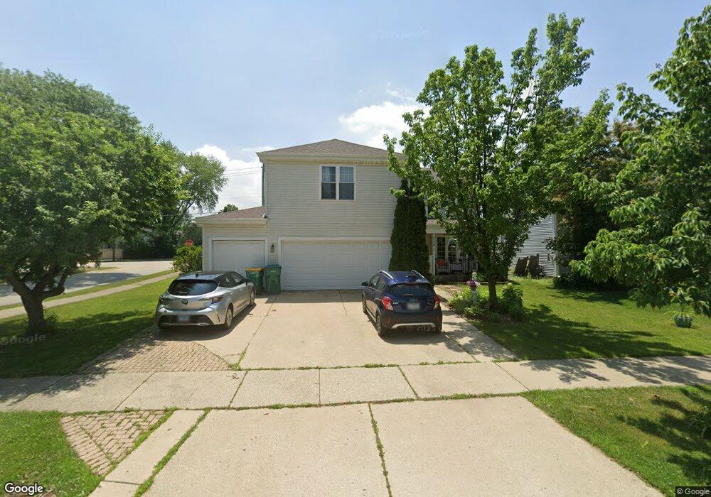
1359 Devonshire Rd Buffalo Grove, IL 60089
Prairie Park-Lake County NeighborhoodEstimated Value: $526,687 - $649,000
Studio
3
Baths
2,532
Sq Ft
$230/Sq Ft
Est. Value
About This Home
This home is located at 1359 Devonshire Rd, Buffalo Grove, IL 60089 and is currently estimated at $582,422, approximately $230 per square foot. 1359 Devonshire Rd is a home located in Lake County with nearby schools including Prairie Elementary School, Twin Groves Middle School, and Adlai E Stevenson High School.
Ownership History
Date
Name
Owned For
Owner Type
Purchase Details
Closed on
Nov 14, 2001
Sold by
Small Dorothy and Small Marc J
Bought by
Small Marc J and Small Bettina K
Current Estimated Value
Home Financials for this Owner
Home Financials are based on the most recent Mortgage that was taken out on this home.
Original Mortgage
$108,000
Interest Rate
6.64%
Purchase Details
Closed on
Apr 28, 1993
Sold by
Smal Marc J and Schweigel Small Bettina K
Bought by
Small Marc J and Schweigel Small Bettina K
Create a Home Valuation Report for This Property
The Home Valuation Report is an in-depth analysis detailing your home's value as well as a comparison with similar homes in the area
Home Values in the Area
Average Home Value in this Area
Purchase History
| Date | Buyer | Sale Price | Title Company |
|---|---|---|---|
| Small Marc J | -- | -- | |
| Small Marc J | -- | -- |
Source: Public Records
Mortgage History
| Date | Status | Borrower | Loan Amount |
|---|---|---|---|
| Closed | Small Marc J | $108,000 |
Source: Public Records
Tax History
| Year | Tax Paid | Tax Assessment Tax Assessment Total Assessment is a certain percentage of the fair market value that is determined by local assessors to be the total taxable value of land and additions on the property. | Land | Improvement |
|---|---|---|---|---|
| 2024 | $15,152 | $165,026 | $22,130 | $142,896 |
| 2023 | $14,350 | $155,714 | $20,881 | $134,833 |
| 2022 | $14,350 | $143,619 | $19,259 | $124,360 |
| 2021 | $13,807 | $142,070 | $19,051 | $123,019 |
| 2020 | $13,481 | $142,555 | $19,116 | $123,439 |
| 2019 | $13,295 | $142,030 | $19,046 | $122,984 |
| 2018 | $12,967 | $142,882 | $18,823 | $124,059 |
| 2017 | $12,722 | $139,547 | $18,384 | $121,163 |
| 2016 | $12,392 | $133,627 | $17,604 | $116,023 |
| 2015 | $12,068 | $124,967 | $16,463 | $108,504 |
| 2014 | $10,716 | $110,122 | $17,682 | $92,440 |
| 2012 | $10,666 | $110,342 | $17,717 | $92,625 |
Source: Public Records
Map
Nearby Homes
- 1152 Courtland Dr Unit 406
- 1234 Devonshire Rd
- 1161 Parker Ln
- 1120 Courtland Dr
- 1265 Devonshire Rd
- 1328 Larchmont Dr
- 962 Thompson Blvd
- 1135 Thompson Blvd
- 1318 Gail Dr Unit 4
- 5107 N Arlington Heights Rd
- 810 Silver Rock Ln
- 1217 Franklin Ln Unit G5
- 327 Lasalle Ln
- 736 Clohesey Dr
- 5152 Bridlewood Ln
- 5176 Aptakisic Rd
- 1602 Brittany Ln
- 711 Woodhollow Ln
- 1005 Cooper Ct
- 5135 Bridlewood Ct
- 1357 Devonshire Rd
- 1355 Devonshire Rd
- 1109 Devonshire Rd
- 1358 Devonshire Rd
- 1360 Devonshire Rd
- 1356 Devonshire Rd
- 1353 Devonshire Rd
- 1104 Devonshire Rd
- 951 Belmar Ln
- 1113 Devonshire Rd
- 1354 Devonshire Rd
- 961 Belmar Ln
- 941 Belmar Ln
- 971 Belmar Ln
- 1351 Devonshire Rd
- 1350 Devonshire Rd
- 931 Belmar Ln
- 1201 Dannet Ct
- 1200 Dannet Ct
- 1117 Devonshire Rd
Your Personal Tour Guide
Ask me questions while you tour the home.