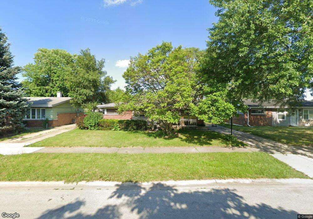
1359 Stanley Blvd Calumet City, IL 60409
Estimated Value: $142,000 - $171,000
3
Beds
1
Bath
1,000
Sq Ft
$153/Sq Ft
Est. Value
About This Home
This home is located at 1359 Stanley Blvd, Calumet City, IL 60409 and is currently estimated at $152,666, approximately $152 per square foot. 1359 Stanley Blvd is a home located in Cook County with nearby schools including Hoover Elementary School, Schrum Memorial Middle School, and Thornton Fractional North High School.
Ownership History
Date
Name
Owned For
Owner Type
Purchase Details
Closed on
Jun 14, 2011
Sold by
Thompson Rexford Lee
Bought by
Robinson Marcus W and Robinson Marlene K
Current Estimated Value
Home Financials for this Owner
Home Financials are based on the most recent Mortgage that was taken out on this home.
Original Mortgage
$63,352
Outstanding Balance
$43,653
Interest Rate
4.62%
Mortgage Type
FHA
Estimated Equity
$109,013
Purchase Details
Closed on
Jun 8, 2001
Sold by
Thompson Robert R and Thompson Edith
Bought by
Thompson Robert R and Thompson Edith
Create a Home Valuation Report for This Property
The Home Valuation Report is an in-depth analysis detailing your home's value as well as a comparison with similar homes in the area
Home Values in the Area
Average Home Value in this Area
Purchase History
| Date | Buyer | Sale Price | Title Company |
|---|---|---|---|
| Robinson Marcus W | $65,000 | Attorneys Title Guaranty Fun | |
| Thompson Robert R | -- | -- |
Source: Public Records
Mortgage History
| Date | Status | Borrower | Loan Amount |
|---|---|---|---|
| Open | Robinson Marcus W | $63,352 |
Source: Public Records
Tax History Compared to Growth
Tax History
| Year | Tax Paid | Tax Assessment Tax Assessment Total Assessment is a certain percentage of the fair market value that is determined by local assessors to be the total taxable value of land and additions on the property. | Land | Improvement |
|---|---|---|---|---|
| 2024 | $3,967 | $12,000 | $2,618 | $9,382 |
| 2023 | $777 | $12,000 | $2,618 | $9,382 |
| 2022 | $777 | $7,069 | $2,310 | $4,759 |
| 2021 | $1,210 | $7,068 | $2,310 | $4,758 |
| 2020 | $1,210 | $7,068 | $2,310 | $4,758 |
| 2019 | $0 | $5,946 | $2,156 | $3,790 |
| 2018 | $0 | $5,946 | $2,156 | $3,790 |
| 2017 | $0 | $5,946 | $2,156 | $3,790 |
| 2016 | $1,210 | $6,384 | $2,002 | $4,382 |
| 2015 | $2,497 | $6,384 | $2,002 | $4,382 |
| 2014 | $1,265 | $6,384 | $2,002 | $4,382 |
| 2013 | $1,882 | $6,567 | $2,002 | $4,565 |
Source: Public Records
Map
Nearby Homes
- 1373 Stanley Blvd
- 1375 Forest Place
- 1395 Freeland Ave
- 1351 Gordon Ave
- 1341 Gordon Ave
- 1404 Wentworth Ave Unit 1
- 1420 Wentworth Ave
- 1304 Freeland Ave
- 1313 Gordon Ave
- 1387 Price Ave
- 1374 Kenilworth Dr
- 1366 Price Ave
- 302 161st St
- 1481 Lincoln Ave
- 107 163rd St
- 1481 Lincoln Place
- 1461 Wentworth Ave
- 1354 Hirsch Ave
- 305 River Oaks Dr
- 1473 Wentworth Ave
- 1353 Stanley Blvd
- 1363 Stanley Blvd
- 1360 Forest Place
- 1369 Stanley Blvd
- 1364 Forest Place
- 1354 Forest Place
- 1360 Stanley Blvd
- 1364 Stanley Blvd
- 1370 Stanley Blvd
- 1350 Stanley Blvd
- 1379 Stanley Blvd
- 1374 Stanley Blvd
- 1380 Forest Place
- 1351 Forest Place Unit 2
- 1380 Stanley Blvd
- 1383 Stanley Blvd
- 1361 Freeland Ave
- 1365 Freeland Ave
- 1384 Forest Place
- 1384 Stanley Blvd