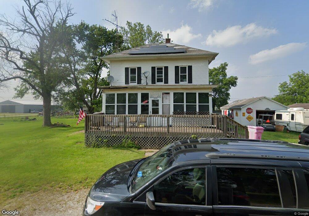
13591 E 2104 Rd N Pontiac, IL 61764
Estimated Value: $110,000 - $193,000
4
Beds
2
Baths
1,834
Sq Ft
$83/Sq Ft
Est. Value
About This Home
This home is located at 13591 E 2104 Rd N, Pontiac, IL 61764 and is currently estimated at $152,074, approximately $82 per square foot. 13591 E 2104 Rd N is a home located in Livingston County with nearby schools including Central Elementary School, Lincoln Elementary School, and Washington Elementary School.
Ownership History
Date
Name
Owned For
Owner Type
Purchase Details
Closed on
Mar 25, 2016
Sold by
Vanover Jennifer J and Vanover Terry L
Bought by
Vanover Jennifer J and Vanover Terry L
Current Estimated Value
Purchase Details
Closed on
Jun 2, 2011
Sold by
Lockwood Joan Marie
Bought by
Vanover Jennifer
Home Financials for this Owner
Home Financials are based on the most recent Mortgage that was taken out on this home.
Original Mortgage
$63,352
Interest Rate
5.5%
Mortgage Type
FHA
Create a Home Valuation Report for This Property
The Home Valuation Report is an in-depth analysis detailing your home's value as well as a comparison with similar homes in the area
Home Values in the Area
Average Home Value in this Area
Purchase History
| Date | Buyer | Sale Price | Title Company |
|---|---|---|---|
| Vanover Jennifer J | -- | None Available | |
| Vanover Jennifer | $65,000 | -- |
Source: Public Records
Mortgage History
| Date | Status | Borrower | Loan Amount |
|---|---|---|---|
| Previous Owner | Vanover Jennifer | $63,352 |
Source: Public Records
Tax History Compared to Growth
Tax History
| Year | Tax Paid | Tax Assessment Tax Assessment Total Assessment is a certain percentage of the fair market value that is determined by local assessors to be the total taxable value of land and additions on the property. | Land | Improvement |
|---|---|---|---|---|
| 2024 | $2,445 | $38,063 | $917 | $37,146 |
| 2023 | $2,298 | $34,729 | $837 | $33,892 |
| 2022 | $2,285 | $33,181 | $805 | $32,376 |
| 2021 | $1,858 | $27,806 | $757 | $27,049 |
| 2020 | $1,814 | $26,737 | $728 | $26,009 |
| 2019 | $1,851 | $26,737 | $728 | $26,009 |
| 2018 | $1,608 | $23,926 | $693 | $23,233 |
| 2017 | $1,534 | $23,005 | $666 | $22,339 |
| 2016 | $1,456 | $22,120 | $640 | $21,480 |
| 2015 | $1,565 | $23,042 | $667 | $22,375 |
| 2013 | $1,478 | $22,852 | $685 | $22,167 |
Source: Public Records
Map
Nearby Homes
- 19097 1330 Rd E
- 13301 E 1875 North Rd
- 00 E 2400 Rd N
- 34 Westwood Ave
- 113 Park Estate Ave
- 1810 Cardinal Ct
- 1620 Meadowlark Dr
- 1713 W Bob o Link Dr
- 1635 Mockingbird Ln
- 618 W Sherman Ave
- Lot 14 W Sherman Ave
- Lot 3 W Cleary St
- 1310 N Aurora St
- 606 N Ladd St
- 1122 N Prairie View Ln
- 819 N Chicago St
- 225 E Pierce St
- 765 N Main St
- 503 W Livingston St
- 804 N Walnut St
- 13617 E 2104 Rd N
- 21059 N 1366 East Rd
- 21059 Centre St
- 13591 E 2104 North Rd
- 13616 Prairie St
- 21054 N 1366 East Rd
- 21093 N 1358 East Rd
- 21090 N 1366 East Rd
- 21099 N 1366 East Rd
- 13616 E 2111 North Rd
- 21014 Centre St
- 13630 E 2100 North Rd
- 21014 N 1366 East Rd
- 21129 N 1366 East Rd
- 21129 Centre St
- 13553 E 2100 North Rd
- 21147 N 1366 East Rd
- 13564 E 2100 North Rd
- 13497 E 2100 North Rd
- 13634 E 2118 North Rd