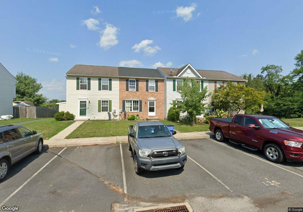
136 Apple Grove Ln Unit 423 Littlestown, PA 17340
Estimated Value: $221,000 - $249,000
3
Beds
2
Baths
1,080
Sq Ft
$213/Sq Ft
Est. Value
About This Home
This home is located at 136 Apple Grove Ln Unit 423, Littlestown, PA 17340 and is currently estimated at $230,035, approximately $212 per square foot. 136 Apple Grove Ln Unit 423 is a home located in Adams County with nearby schools including Rolling Acres El School, Maple Avenue Middle School, and Littlestown Senior High School.
Ownership History
Date
Name
Owned For
Owner Type
Purchase Details
Closed on
Aug 19, 2005
Sold by
Tregoning Jo Ann
Bought by
Gamber James E
Current Estimated Value
Home Financials for this Owner
Home Financials are based on the most recent Mortgage that was taken out on this home.
Original Mortgage
$26,300
Interest Rate
5.38%
Mortgage Type
Stand Alone Second
Purchase Details
Closed on
Aug 26, 2004
Bought by
Gamber James E
Create a Home Valuation Report for This Property
The Home Valuation Report is an in-depth analysis detailing your home's value as well as a comparison with similar homes in the area
Home Values in the Area
Average Home Value in this Area
Purchase History
| Date | Buyer | Sale Price | Title Company |
|---|---|---|---|
| Gamber James E | $131,500 | -- | |
| Gamber James E | $131,500 | -- |
Source: Public Records
Mortgage History
| Date | Status | Borrower | Loan Amount |
|---|---|---|---|
| Closed | Gamber James E | $26,300 | |
| Open | Gamber James E | $105,200 |
Source: Public Records
Tax History Compared to Growth
Tax History
| Year | Tax Paid | Tax Assessment Tax Assessment Total Assessment is a certain percentage of the fair market value that is determined by local assessors to be the total taxable value of land and additions on the property. | Land | Improvement |
|---|---|---|---|---|
| 2025 | $3,299 | $143,500 | $27,100 | $116,400 |
| 2024 | $3,179 | $143,500 | $27,100 | $116,400 |
| 2023 | $3,056 | $143,500 | $27,100 | $116,400 |
| 2022 | $3,037 | $143,500 | $27,100 | $116,400 |
| 2021 | $2,947 | $143,500 | $27,100 | $116,400 |
| 2020 | $2,912 | $143,500 | $27,100 | $116,400 |
| 2019 | $2,825 | $143,500 | $27,100 | $116,400 |
| 2018 | $2,773 | $143,500 | $27,100 | $116,400 |
| 2017 | $2,702 | $143,500 | $27,100 | $116,400 |
| 2016 | -- | $143,500 | $27,100 | $116,400 |
| 2015 | -- | $143,500 | $27,100 | $116,400 |
| 2014 | -- | $143,500 | $27,100 | $116,400 |
Source: Public Records
Map
Nearby Homes
- 140 Apple Grove Ln Unit 425
- 135 Apple Grove Ln Unit 438
- 52 Stayman Way Unit 81
- 440 N Queen St
- 22 Rita Marie Ave
- 129 W King St
- 161 Stoners Cir
- 115 Charles St
- 117 Charles St
- 162 Newark St
- 58 Windsor Ct
- 48 Windsor Ct
- 61 E King St
- 20c Locust Dr
- 0 Locust Dr Unit PAAD2015910
- 20 Locust Dr
- 211 E King St
- 41 Smith Cir
- 1024 Frederick Pike Unit 6
- 449 Glenwyn Dr
- 138 Apple Grove Ln Unit 424
- 134 Apple Grove Ln Unit 422
- 132 Apple Grove Ln Unit 421
- 130 Apple Grove Ln Unit 420
- 128 Apple Grove Ln Unit 419
- 126 Apple Grove Ln Unit 418
- 124 Apple Grove Ln Unit 417
- 133 Apple Grove Ln Unit 439
- 122 Apple Grove Ln Unit 416
- 137 Apple Grove Ln
- 137 Apple Grove Ln Unit 437
- 120 Apple Grove Ln Unit 415
- 139 Apple Grove Ln Unit 436
- 118 Apple Grove Ln Unit 414
- 116 Apple Grove Ln Unit 413
- 107 S Gala Unit 440
- 145 Apple Grove Ln Unit 433
- 147 Apple Grove Ln Unit 432
- 141 Apple Grove Ln Unit 435
- 149 Apple Grove Ln Unit 431