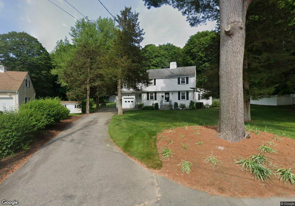
136 Birchtree Dr Westwood, MA 02090
Estimated Value: $1,081,000 - $1,498,000
4
Beds
4
Baths
2,269
Sq Ft
$564/Sq Ft
Est. Value
About This Home
This home is located at 136 Birchtree Dr, Westwood, MA 02090 and is currently estimated at $1,278,878, approximately $563 per square foot. 136 Birchtree Dr is a home located in Norfolk County with nearby schools including Westwood High School, St Catherine Of Siena School, and Xaverian Brothers High School.
Ownership History
Date
Name
Owned For
Owner Type
Purchase Details
Closed on
Nov 30, 2022
Sold by
Edel David E and Edel Joanne B
Bought by
David E Edel 2022 T
Current Estimated Value
Purchase Details
Closed on
Mar 1, 1977
Bought by
Edel David E and Edel Joanne B
Create a Home Valuation Report for This Property
The Home Valuation Report is an in-depth analysis detailing your home's value as well as a comparison with similar homes in the area
Home Values in the Area
Average Home Value in this Area
Purchase History
| Date | Buyer | Sale Price | Title Company |
|---|---|---|---|
| David E Edel 2022 T | -- | None Available | |
| Edel David E | -- | -- |
Source: Public Records
Mortgage History
| Date | Status | Borrower | Loan Amount |
|---|---|---|---|
| Previous Owner | Edel David E | $5,490 | |
| Previous Owner | Edel David E | $7,700 |
Source: Public Records
Tax History Compared to Growth
Tax History
| Year | Tax Paid | Tax Assessment Tax Assessment Total Assessment is a certain percentage of the fair market value that is determined by local assessors to be the total taxable value of land and additions on the property. | Land | Improvement |
|---|---|---|---|---|
| 2025 | $11,715 | $914,500 | $514,800 | $399,700 |
| 2024 | $11,715 | $914,500 | $514,800 | $399,700 |
| 2023 | $10,924 | $763,900 | $429,100 | $334,800 |
| 2022 | $10,924 | $680,800 | $362,900 | $317,900 |
| 2021 | $9,973 | $674,750 | $345,600 | $329,150 |
| 2020 | $9,667 | $666,250 | $345,600 | $320,650 |
| 2019 | $9,212 | $628,800 | $329,250 | $299,550 |
| 2018 | $9,127 | $604,850 | $329,250 | $275,600 |
| 2017 | $8,655 | $594,000 | $329,250 | $264,750 |
| 2016 | $8,604 | $586,900 | $329,250 | $257,650 |
| 2015 | $8,360 | $548,550 | $329,250 | $219,300 |
Source: Public Records
Map
Nearby Homes
- 670-672 High St Unit 3
- 18 Longmeadow Dr
- 20 Longmeadow Dr
- 401 Sandy Valley Rd
- 26 Longmeadow Dr
- 314 Grove St
- 4 Shoestring Ln
- 60 Warwick Dr
- 49 Fisher St
- 300 Summer St
- 298 Summer St
- 20 Lakeshore Dr
- 429 Summer St
- 48 Lakeshore Dr
- 36 Kingswood Rd
- 216 Clapboardtree St
- 300 Nahatan St
- 86 Lakeshore Dr
- 131 Bay Colony Dr
- 223 Robert Rd
- 130 Birchtree Dr
- 142 Birchtree Dr
- 515 High St
- 515 High S
- 129 Birchtree Dr
- 60 Dover Terrace
- 152 Birchtree Dr
- 120 Birchtree Dr
- 509 High St
- 149 Birchtree Dr
- 149 Birch Tree Dr
- 107 Birchtree Dr
- 48 Dover Terrace
- 162 Birchtree Dr
- 162 Birch Tree Dr
- 61 Dover Terrace
- 161 Birchtree Dr
- 549 High St Unit 549
- 551 High St Unit 551
- 114 Birchtree Dr