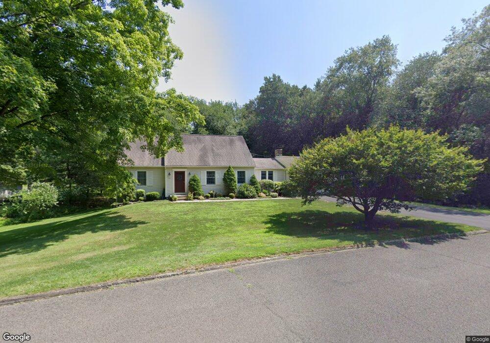
136 Cardinal Dr Guilford, CT 06437
Estimated Value: $523,000 - $594,000
4
Beds
2
Baths
2,162
Sq Ft
$262/Sq Ft
Est. Value
About This Home
This home is located at 136 Cardinal Dr, Guilford, CT 06437 and is currently estimated at $565,881, approximately $261 per square foot. 136 Cardinal Dr is a home located in New Haven County with nearby schools including A. Baldwin Middle School, E.C. Adams Middle School, and Guilford High School.
Ownership History
Date
Name
Owned For
Owner Type
Purchase Details
Closed on
Oct 24, 2024
Sold by
Bruton Paul P and Bruton Jocelyn J
Bought by
Paul and Paul Jocelyn Bruton
Current Estimated Value
Purchase Details
Closed on
Oct 22, 1999
Sold by
Steidley Catherine J
Bought by
Bruton Paul P and Bruton Jocelyn J
Create a Home Valuation Report for This Property
The Home Valuation Report is an in-depth analysis detailing your home's value as well as a comparison with similar homes in the area
Home Values in the Area
Average Home Value in this Area
Purchase History
| Date | Buyer | Sale Price | Title Company |
|---|---|---|---|
| Paul | -- | None Available | |
| Paul | -- | None Available | |
| Bruton Paul P | $247,500 | -- | |
| Bruton Paul P | $247,500 | -- |
Source: Public Records
Mortgage History
| Date | Status | Borrower | Loan Amount |
|---|---|---|---|
| Previous Owner | Bruton Paul P | $50,000 | |
| Previous Owner | Bruton Paul P | $320,000 | |
| Previous Owner | Bruton Paul P | $190,000 |
Source: Public Records
Tax History
| Year | Tax Paid | Tax Assessment Tax Assessment Total Assessment is a certain percentage of the fair market value that is determined by local assessors to be the total taxable value of land and additions on the property. | Land | Improvement |
|---|---|---|---|---|
| 2025 | $8,994 | $325,290 | $147,490 | $177,800 |
| 2024 | $8,646 | $325,290 | $147,490 | $177,800 |
| 2023 | $8,317 | $321,370 | $147,490 | $173,880 |
| 2022 | $8,290 | $249,310 | $133,180 | $116,130 |
| 2021 | $8,132 | $249,310 | $133,180 | $116,130 |
| 2020 | $8,055 | $249,310 | $133,180 | $116,130 |
| 2019 | $7,985 | $249,310 | $133,180 | $116,130 |
| 2018 | $7,798 | $249,310 | $133,180 | $116,130 |
| 2017 | $7,846 | $267,220 | $138,790 | $128,430 |
| 2016 | $7,661 | $267,220 | $138,790 | $128,430 |
| 2015 | $7,546 | $267,220 | $138,790 | $128,430 |
| 2014 | $7,327 | $267,220 | $138,790 | $128,430 |
Source: Public Records
Map
Nearby Homes
- 0 Tamarack Ln Unit Lot 19 24071360
- 2125 Long Hill Rd
- 2064 Long Hill Rd
- 42 Harrison Rd
- 250 Elm St
- 154 Wilburs Ln
- 71 Glenwood Rd
- 375 Sea Hill Rd
- 286 Weatherly Trail
- 134 Janeway Dr
- 77 Pinebrook Cir
- 1789 Foxon Rd Unit 5D
- 2111 Jennifers Dr
- 360 Jefferson Dr
- 72 Notch Hill Rd
- 24 Echo Point Rd
- LOT 28B Bruce Ln Unit MAP 83
- 87 White Birch Dr
- 20 Long Hill Farm
- 83 Long Hill Farm Unit 83
- 2350 Long Hill Rd
- 141 Cardinal Dr
- 20 Oriole Cir
- 2370 Long Hill Rd
- 2349 Long Hill Rd
- 2310 Long Hill Rd
- 43 Sage Hollow Rd
- 44 Oriole Cir
- 2321 Long Hill Rd
- 2396 Long Hill Rd
- 78 Cardinal Dr
- 15 Oriole Cir
- 2294 Long Hill Rd
- 2329 Long Hill Rd
- 31 Oriole Cir
- 50 Oriole Cir
- 70 Cardinal Dr
- 2400 Long Hill Rd
- 2295 Long Hill Rd
- 68 Oriole Cir
Your Personal Tour Guide
Ask me questions while you tour the home.