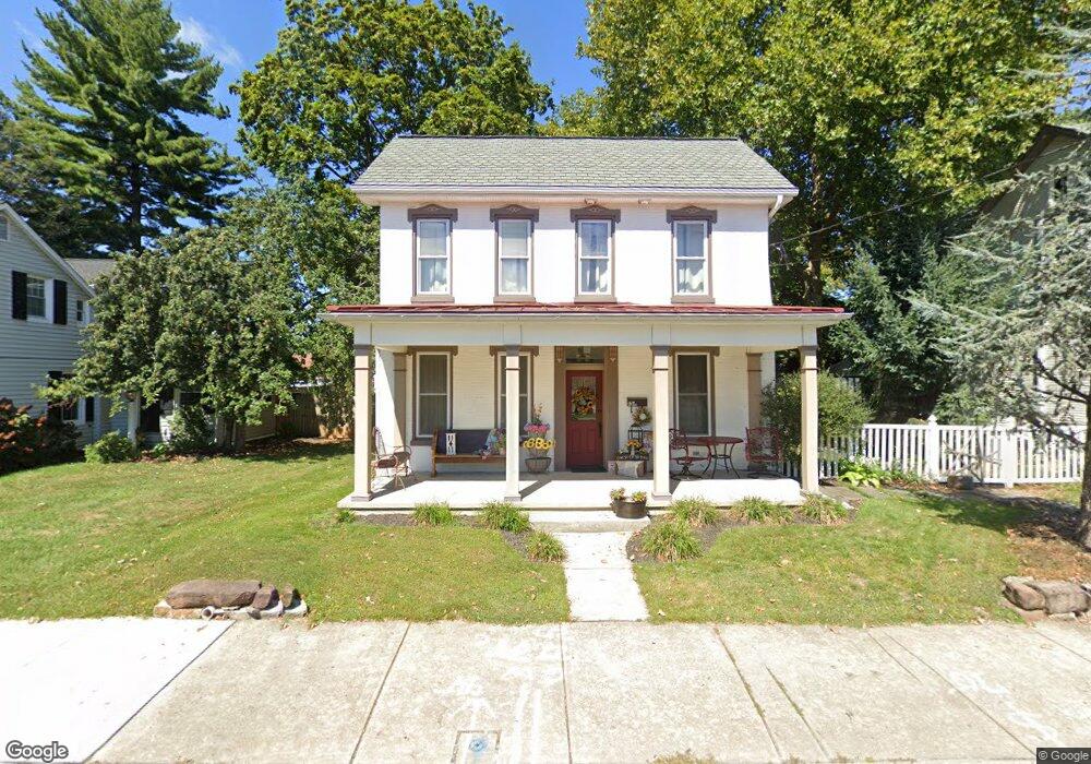
136 E High St Manheim, PA 17545
Estimated Value: $464,000 - $557,000
5
Beds
4
Baths
2,997
Sq Ft
$167/Sq Ft
Est. Value
About This Home
This home is located at 136 E High St, Manheim, PA 17545 and is currently estimated at $500,161, approximately $166 per square foot. 136 E High St is a home located in Lancaster County with nearby schools including Manheim Central Senior High School, Manheim Christian Day School, and Sporting Hill Christian School.
Ownership History
Date
Name
Owned For
Owner Type
Purchase Details
Closed on
Nov 29, 2011
Sold by
Northwest Savings Bank
Bought by
Shenk Ronald L and Shenk Kelly R
Current Estimated Value
Home Financials for this Owner
Home Financials are based on the most recent Mortgage that was taken out on this home.
Original Mortgage
$196,000
Outstanding Balance
$134,655
Interest Rate
4.1%
Mortgage Type
New Conventional
Estimated Equity
$365,506
Purchase Details
Closed on
Mar 30, 2011
Sold by
Till Brian S and Till Jill L
Bought by
Northwest Savings Bank
Purchase Details
Closed on
Feb 6, 2001
Sold by
Snyder Damon R
Bought by
Fulton Bank
Purchase Details
Closed on
Sep 28, 1999
Sold by
Calmco Servicing Lp
Bought by
Snyder Damon R
Home Financials for this Owner
Home Financials are based on the most recent Mortgage that was taken out on this home.
Original Mortgage
$56,000
Interest Rate
7.85%
Create a Home Valuation Report for This Property
The Home Valuation Report is an in-depth analysis detailing your home's value as well as a comparison with similar homes in the area
Home Values in the Area
Average Home Value in this Area
Purchase History
| Date | Buyer | Sale Price | Title Company |
|---|---|---|---|
| Shenk Ronald L | $245,000 | None Available | |
| Northwest Savings Bank | $6,491 | None Available | |
| Fulton Bank | -- | -- | |
| Snyder Damon R | $113,450 | -- |
Source: Public Records
Mortgage History
| Date | Status | Borrower | Loan Amount |
|---|---|---|---|
| Open | Shenk Ronald L | $196,000 | |
| Previous Owner | Snyder Damon R | $56,000 | |
| Closed | Snyder Damon R | $125,000 |
Source: Public Records
Tax History
| Year | Tax Paid | Tax Assessment Tax Assessment Total Assessment is a certain percentage of the fair market value that is determined by local assessors to be the total taxable value of land and additions on the property. | Land | Improvement |
|---|---|---|---|---|
| 2025 | $6,494 | $269,500 | $58,700 | $210,800 |
| 2024 | $6,494 | $269,500 | $58,700 | $210,800 |
| 2023 | $6,378 | $269,500 | $58,700 | $210,800 |
| 2022 | $6,172 | $269,500 | $58,700 | $210,800 |
| 2021 | $5,986 | $269,500 | $58,700 | $210,800 |
| 2020 | $5,986 | $269,500 | $58,700 | $210,800 |
| 2019 | $5,897 | $269,500 | $58,700 | $210,800 |
| 2018 | $3,746 | $269,500 | $58,700 | $210,800 |
| 2017 | $5,359 | $195,900 | $43,400 | $152,500 |
| 2016 | $5,203 | $195,900 | $43,400 | $152,500 |
| 2015 | $1,721 | $195,900 | $43,400 | $152,500 |
| 2014 | $3,245 | $195,900 | $43,400 | $152,500 |
Source: Public Records
Map
Nearby Homes
- 33 E Gramby St
- 125 E Ferdinand St
- 29 W Gramby St
- 57 N Charlotte St
- 2 S Charlotte St
- 37 W Ferdinand St
- 186 N Laurel St
- 126 N Charlotte St
- 209 N Laurel St
- 216 N Charlotte St
- 130 Julia Ln
- 433 Elwyn Terrace
- 68 Daffodil Dr
- 600 Park Hill Dr
- 612 Park Hill Dr
- 467 Hamilton Ct
- 742 Power Rd
- 425 Zachary Dr
- 820 Cambridge Dr Unit 77
- 988 Cambridge Dr
- 140 E High St
- 144 E High St
- 12 N Linden St
- 122 E High St
- 146 E High St
- 118 E High St
- 116 E High St
- 127 E High St
- 108 E High St
- 133 E High St
- 123 E High St
- 123 E High St Unit 2
- 131 E High St
- 118 E Scout Aly
- 147 E High St
- 106 E High St
- 212 E High St
- 203 E High St
- 0 Wyndmour Design Unit 1004730693
- 0 Wyndmour Design Unit 1004725727