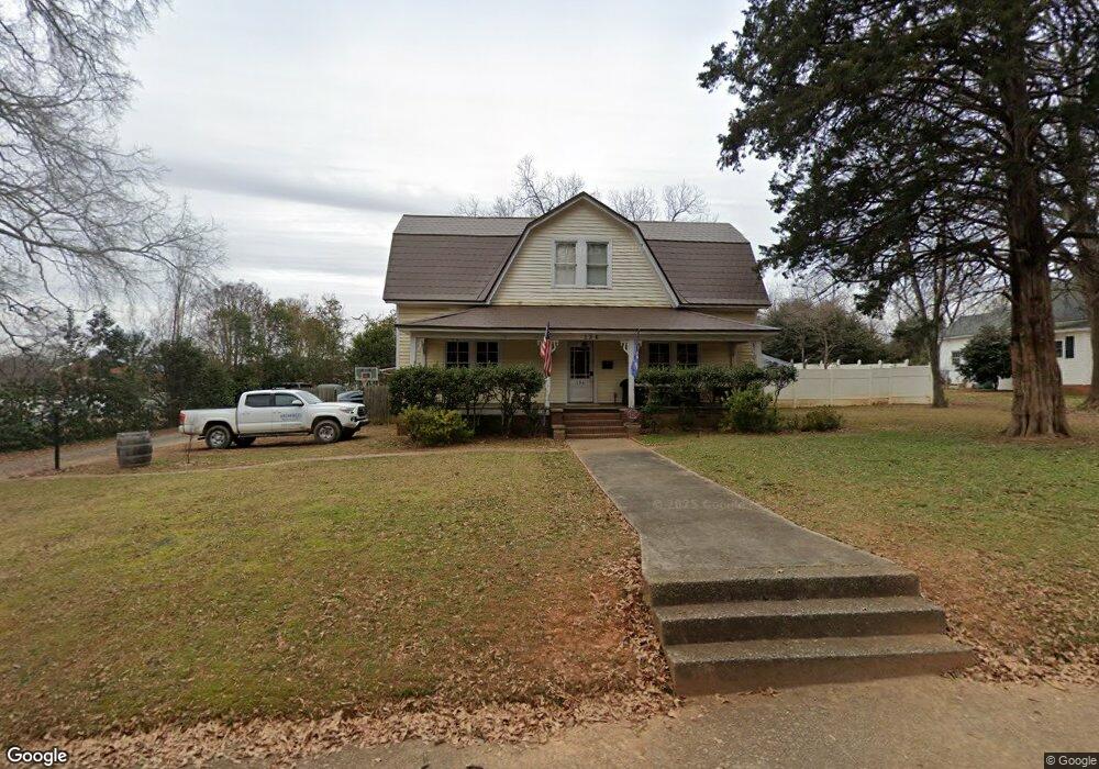
136 Forrest St Fort Mill, SC 29715
Estimated Value: $506,915 - $584,000
4
Beds
2
Baths
2,513
Sq Ft
$215/Sq Ft
Est. Value
About This Home
This home is located at 136 Forrest St, Fort Mill, SC 29715 and is currently estimated at $539,729, approximately $214 per square foot. 136 Forrest St is a home located in York County with nearby schools including Riverview Elementary School, Banks Trail Middle School, and Catawba Ridge High School.
Ownership History
Date
Name
Owned For
Owner Type
Purchase Details
Closed on
May 30, 2007
Sold by
Knox James H and Knox Ella C
Bought by
Sprague Paul D and Sprague Alisha L
Current Estimated Value
Home Financials for this Owner
Home Financials are based on the most recent Mortgage that was taken out on this home.
Original Mortgage
$220,000
Outstanding Balance
$134,106
Interest Rate
6.12%
Mortgage Type
New Conventional
Estimated Equity
$405,623
Purchase Details
Closed on
Jan 16, 2003
Sold by
Mulvaney Properties/South Carolina Llc
Bought by
Shea Homes Llc
Purchase Details
Closed on
Jun 12, 2002
Sold by
Davis Cynthia Ann
Bought by
Knox James H and Knox Ella C
Create a Home Valuation Report for This Property
The Home Valuation Report is an in-depth analysis detailing your home's value as well as a comparison with similar homes in the area
Home Values in the Area
Average Home Value in this Area
Purchase History
| Date | Buyer | Sale Price | Title Company |
|---|---|---|---|
| Sprague Paul D | $220,000 | None Available | |
| Shea Homes Llc | $366,670 | -- | |
| Knox James H | $175,500 | -- |
Source: Public Records
Mortgage History
| Date | Status | Borrower | Loan Amount |
|---|---|---|---|
| Open | Sprague Paul D | $220,000 |
Source: Public Records
Tax History Compared to Growth
Tax History
| Year | Tax Paid | Tax Assessment Tax Assessment Total Assessment is a certain percentage of the fair market value that is determined by local assessors to be the total taxable value of land and additions on the property. | Land | Improvement |
|---|---|---|---|---|
| 2024 | $1,949 | $7,835 | $2,400 | $5,435 |
| 2023 | $1,907 | $7,835 | $2,400 | $5,435 |
| 2022 | $1,853 | $7,839 | $2,400 | $5,439 |
| 2021 | -- | $7,839 | $2,400 | $5,439 |
| 2020 | $1,927 | $7,839 | $0 | $0 |
| 2019 | $1,994 | $7,000 | $0 | $0 |
| 2018 | $2,082 | $7,000 | $0 | $0 |
| 2017 | $2,003 | $7,000 | $0 | $0 |
| 2016 | $1,996 | $7,000 | $0 | $0 |
| 2014 | $1,509 | $7,000 | $2,000 | $5,000 |
| 2013 | $1,509 | $7,020 | $2,000 | $5,020 |
Source: Public Records
Map
Nearby Homes
- 114 Country Club Dr
- 114 Lazenby Dr
- 116 E Hill St
- 2026 Bonds Ln
- 406 Williamson St
- 2081 Bonds Ln Unit 27
- 2085 Bonds Ln Unit 26
- 1177 Doby Ct
- 2087 Bonds Ln
- 101 Randolph St
- 122 Leonidas St
- 220 Avery St
- 224 Grier St
- 408 Joe Louis St
- 925 Cobbled Way
- 2133 Bowie Stone Ct
- 4211 Skyboat Cir
- 147 Morning Gap Pkwy
- 1228 N Dobys Bridge Rd
- 206 Coburn Ct
- 130 Forrest St
- 140 Forrest St
- 135 Forrest St
- 135 Forrest St
- 133 Forrest St
- 126 Forrest St
- 125 Forrest St
- 221 Confederate St
- 121 Forrest St
- 114 Forrest St
- 301 Confederate St
- 119 Forrest St
- 210 Mack St
- 124 Ginger Ln
- 311 Confederate St
- 112 Forrest St
- 109 Mack St
- 123 Ginger Ln
- 117 Forrest St
- .32 acre Morgan St