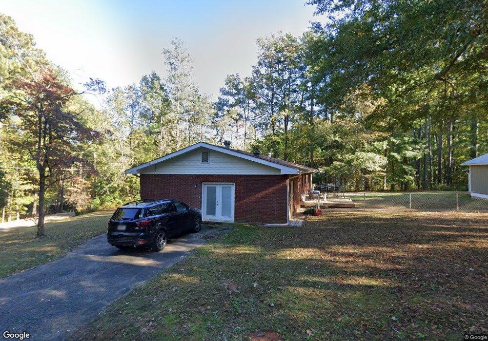
136 Kimberly Rd Canton, GA 30115
Estimated Value: $381,000 - $414,436
3
Beds
1
Bath
1,718
Sq Ft
$232/Sq Ft
Est. Value
About This Home
This home is located at 136 Kimberly Rd, Canton, GA 30115 and is currently estimated at $397,718, approximately $231 per square foot. 136 Kimberly Rd is a home located in Cherokee County with nearby schools including Holly Springs Elementary School, Rusk Middle School, and Sequoyah High School.
Ownership History
Date
Name
Owned For
Owner Type
Purchase Details
Closed on
Feb 22, 2005
Sold by
Shipman Jasper F and Shipman Debra
Bought by
Reece Dennis L
Current Estimated Value
Purchase Details
Closed on
Jan 7, 1998
Sold by
Bricker J Mark
Bought by
Shipman Jasper F and Shipman Debra A
Home Financials for this Owner
Home Financials are based on the most recent Mortgage that was taken out on this home.
Original Mortgage
$85,481
Interest Rate
7.18%
Purchase Details
Closed on
Nov 10, 1997
Sold by
Manous Don
Bought by
Bricker J Mark
Home Financials for this Owner
Home Financials are based on the most recent Mortgage that was taken out on this home.
Original Mortgage
$85,481
Interest Rate
7.18%
Create a Home Valuation Report for This Property
The Home Valuation Report is an in-depth analysis detailing your home's value as well as a comparison with similar homes in the area
Home Values in the Area
Average Home Value in this Area
Purchase History
| Date | Buyer | Sale Price | Title Company |
|---|---|---|---|
| Reece Dennis L | $94,000 | -- | |
| Shipman Jasper F | $87,500 | -- | |
| Bricker J Mark | $92,000 | -- |
Source: Public Records
Mortgage History
| Date | Status | Borrower | Loan Amount |
|---|---|---|---|
| Previous Owner | Shipman Jasper F | $85,481 | |
| Previous Owner | Bricker J Mark | $69,000 |
Source: Public Records
Tax History
| Year | Tax Paid | Tax Assessment Tax Assessment Total Assessment is a certain percentage of the fair market value that is determined by local assessors to be the total taxable value of land and additions on the property. | Land | Improvement |
|---|---|---|---|---|
| 2025 | $7,830 | $155,120 | $28,000 | $127,120 |
| 2024 | $4,089 | $137,080 | $24,000 | $113,080 |
| 2023 | $4,176 | $138,000 | $24,000 | $114,000 |
| 2022 | $3,145 | $102,800 | $24,000 | $78,800 |
| 2021 | $2,070 | $82,480 | $17,320 | $65,160 |
| 2020 | $2,476 | $74,000 | $15,200 | $58,800 |
| 2019 | $1,611 | $64,080 | $14,400 | $49,680 |
| 2018 | $2,142 | $62,840 | $14,400 | $48,440 |
| 2017 | $1,911 | $141,900 | $13,200 | $43,560 |
| 2016 | $1,343 | $130,400 | $12,000 | $40,160 |
| 2015 | $1,296 | $124,800 | $12,000 | $37,920 |
| 2014 | $1,171 | $112,500 | $12,000 | $33,000 |
Source: Public Records
Map
Nearby Homes
- 3132 Holly Springs Pkwy
- 3072 Holly Springs Pkwy
- 134 Childers Rd
- 246 Manous Way
- 216 Manous Way
- 482 Palm St
- 542 Palm St
- 554 Palm St
- 152 Palm St
- 164 Palm St
- 408 Candy Ln
- 1021 Palm St
- 1600 Mountain Trace
- 400 Fernstone Dr
- 1418 Palm St
- 417 Crestmont Ln
- 415 Crestmont Ln
- 456 Northside Dr
- 319 Hillgrove Dr
- 2550 Mountain Brook Rd
- 109 Childers Rd
- 135 Kimberly Rd
- 134 Kimberly Rd
- 103 Childers Rd
- 111 Childers Rd
- 123 Kimberly Rd
- 106 Childers Rd
- 104 Childers Rd
- 105 Childers Rd
- 113 Childers Rd
- 130 Kimberly Rd
- 130 Kimberly Rd
- 130 Kimberly Rd
- 130 Kimberly Rd
- 3262 Holly Springs Pkwy
- 125 Kimberly Rd
- 115 Childers Rd
- 100 Jacee Cir Unit 2
- 112 Childers Rd
- 117 Childers Rd
Your Personal Tour Guide
Ask me questions while you tour the home.