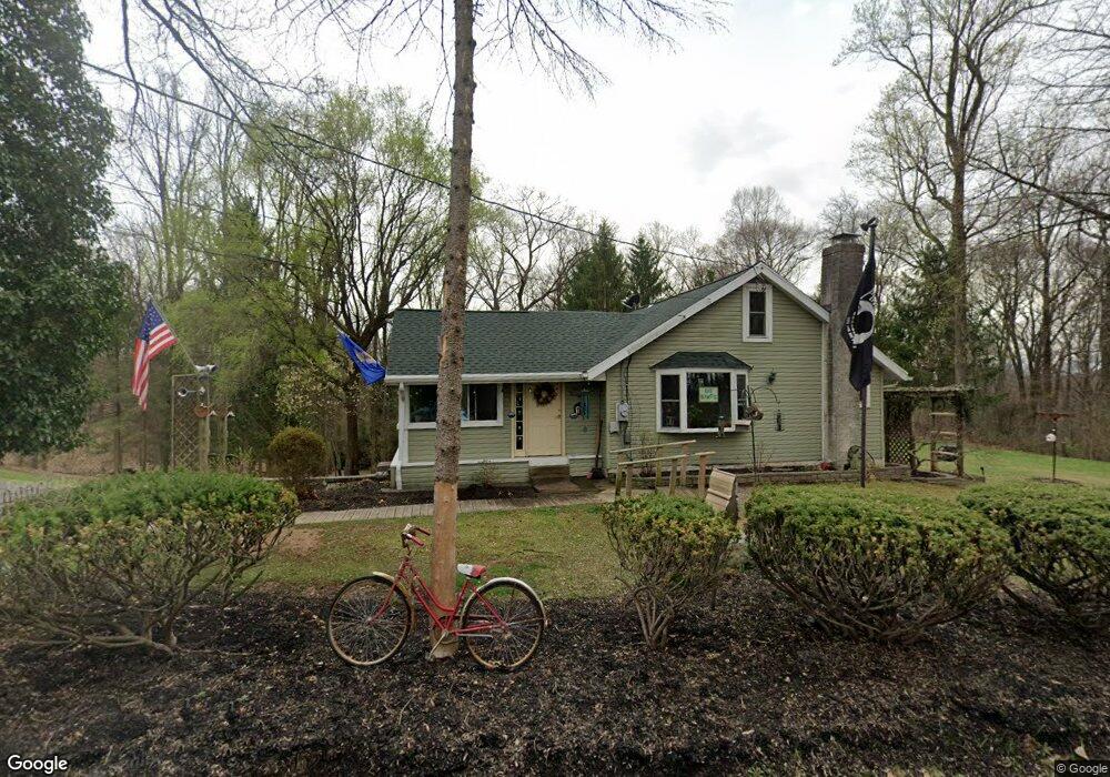
136 Mail Route Rd Reading, PA 19608
Estimated Value: $349,957 - $399,000
3
Beds
2
Baths
1,676
Sq Ft
$219/Sq Ft
Est. Value
About This Home
This home is located at 136 Mail Route Rd, Reading, PA 19608 and is currently estimated at $367,739, approximately $219 per square foot. 136 Mail Route Rd is a home located in Berks County with nearby schools including Shiloh Hills Elementary School, Wilson Southern Middle School, and Wilson High School.
Ownership History
Date
Name
Owned For
Owner Type
Purchase Details
Closed on
Sep 15, 2003
Sold by
Dziamba Michael A and Dziamba Mary E
Bought by
Dziamba Michael A and Dziamba Mary E
Current Estimated Value
Home Financials for this Owner
Home Financials are based on the most recent Mortgage that was taken out on this home.
Original Mortgage
$88,500
Interest Rate
5.66%
Mortgage Type
Purchase Money Mortgage
Create a Home Valuation Report for This Property
The Home Valuation Report is an in-depth analysis detailing your home's value as well as a comparison with similar homes in the area
Home Values in the Area
Average Home Value in this Area
Purchase History
| Date | Buyer | Sale Price | Title Company |
|---|---|---|---|
| Dziamba Michael A | -- | Fidelity National Title Ins |
Source: Public Records
Mortgage History
| Date | Status | Borrower | Loan Amount |
|---|---|---|---|
| Closed | Dziamba Michael A | $88,500 |
Source: Public Records
Tax History
| Year | Tax Paid | Tax Assessment Tax Assessment Total Assessment is a certain percentage of the fair market value that is determined by local assessors to be the total taxable value of land and additions on the property. | Land | Improvement |
|---|---|---|---|---|
| 2025 | $1,819 | $90,700 | $56,300 | $34,400 |
| 2024 | $3,881 | $90,700 | $56,300 | $34,400 |
| 2023 | $3,698 | $90,700 | $56,300 | $34,400 |
| 2022 | $3,607 | $90,700 | $56,300 | $34,400 |
| 2021 | $3,480 | $90,700 | $56,300 | $34,400 |
| 2020 | $3,480 | $90,700 | $56,300 | $34,400 |
| 2019 | $3,381 | $90,700 | $56,300 | $34,400 |
| 2018 | $3,352 | $90,700 | $56,300 | $34,400 |
| 2017 | $3,295 | $90,700 | $56,300 | $34,400 |
| 2016 | $983 | $90,700 | $56,300 | $34,400 |
| 2015 | $983 | $90,700 | $56,300 | $34,400 |
| 2014 | $983 | $90,700 | $56,300 | $34,400 |
Source: Public Records
Map
Nearby Homes
- 1192 Fritztown Rd
- 1181 LOT 3 Fritztown Rd
- 1185 Fritztown Rd
- 310 Mail Route Rd
- 63 Preston Rd
- 90 Preston Rd
- 110 S Cacoosing Dr
- 3137 E Galen Hall Rd
- 0 Cushion Peak Rd
- 3 James Rd
- 13 Eagles Ln
- 0 Preston Rd
- 120 Great Bend Way
- 124 Mesa Dr
- 20 Mellowbrook Dr
- 500 Mohns Hill Rd
- 13 Ligaro Way
- 457 Epsilon Dr Unit 45
- 447 Epsilon Dr
- 0 Mohns Hill Rd
- 137 Mail Route Rd
- 143 Mail Route Rd
- 140 Mail Route Rd
- 144 Mail Route Rd
- 139 Mail Route Rd
- 147 Mail Route Rd
- 160 Mail Route Rd
- 160 Mail Route Rd
- 132 Mail Route Rd
- 125 Mail Route Rd
- 121 Mail Route Rd
- 117 Mail Route Rd
- 115 Mail Route Rd
- 126 Bran Rd
- 126 Mail Route Rd
- 168 Mail Route Rd
- 145 Shearers Rd
- 113 Mail Route Rd
- 133 Shearers Rd
- 118 Mail Route Rd
Your Personal Tour Guide
Ask me questions while you tour the home.