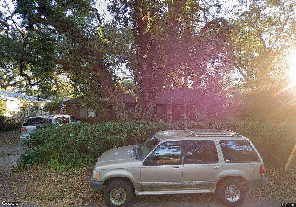
136 Meadows Dr Saint Simons Island, GA 31522
Estimated Value: $740,000 - $946,000
3
Beds
3
Baths
1,687
Sq Ft
$492/Sq Ft
Est. Value
About This Home
This home is located at 136 Meadows Dr, Saint Simons Island, GA 31522 and is currently estimated at $830,012, approximately $492 per square foot. 136 Meadows Dr is a home located in Glynn County with nearby schools including St. Simons Elementary School, Glynn Middle School, and Glynn Academy.
Ownership History
Date
Name
Owned For
Owner Type
Purchase Details
Closed on
Aug 18, 2010
Sold by
Baker Anthony C
Bought by
Baker Lavada and Baker Anthony C
Current Estimated Value
Home Financials for this Owner
Home Financials are based on the most recent Mortgage that was taken out on this home.
Original Mortgage
$170,900
Outstanding Balance
$113,267
Interest Rate
4.59%
Mortgage Type
New Conventional
Estimated Equity
$716,745
Create a Home Valuation Report for This Property
The Home Valuation Report is an in-depth analysis detailing your home's value as well as a comparison with similar homes in the area
Home Values in the Area
Average Home Value in this Area
Purchase History
| Date | Buyer | Sale Price | Title Company |
|---|---|---|---|
| Baker Lavada | -- | -- |
Source: Public Records
Mortgage History
| Date | Status | Borrower | Loan Amount |
|---|---|---|---|
| Open | Baker Lavada | $170,900 |
Source: Public Records
Tax History Compared to Growth
Tax History
| Year | Tax Paid | Tax Assessment Tax Assessment Total Assessment is a certain percentage of the fair market value that is determined by local assessors to be the total taxable value of land and additions on the property. | Land | Improvement |
|---|---|---|---|---|
| 2025 | $6,084 | $242,600 | $155,200 | $87,400 |
| 2024 | $6,084 | $242,600 | $155,200 | $87,400 |
| 2023 | $525 | $254,400 | $174,600 | $79,800 |
| 2022 | $645 | $245,600 | $174,600 | $71,000 |
| 2021 | $660 | $131,360 | $62,080 | $69,280 |
| 2020 | $674 | $120,640 | $62,080 | $58,560 |
| 2019 | $1,823 | $101,240 | $42,680 | $58,560 |
| 2018 | $1,823 | $101,240 | $42,680 | $58,560 |
| 2017 | $1,823 | $91,360 | $42,680 | $48,680 |
| 2016 | $1,707 | $91,360 | $42,680 | $48,680 |
| 2015 | $1,707 | $91,360 | $42,680 | $48,680 |
| 2014 | $1,707 | $79,760 | $42,680 | $37,080 |
Source: Public Records
Map
Nearby Homes
- 207 Military Rd
- 524 Wesley Oak Cir
- 121 Killgriffe St
- 10 Fern Ln
- 135 Stewart St
- 516 Postell Dr
- 242 Mcintosh Ave
- 240 Peachtree St
- 211 Mcintosh Ave
- 238 Broadway St
- 239 Broadway St
- 295 Mcintosh Ave
- 202 Vassar Point Dr
- 220 Tennessee Ave
- 103 Cater St
- 1704 Frederica Rd Unit 237
- 1704 Frederica Rd Unit 602
- 1704 Frederica Rd Unit 621
- 1704 Frederica Rd Unit 628 + 31 garage
- 1704 Frederica Rd Unit 723
- 138 Meadows Dr
- 134 Meadows Dr
- 303 Bloody Marsh Rd
- 137 Meadows Dr
- 301 Bloody Marsh Rd
- 139 Meadows Dr
- 307 Bloody Marsh Rd
- 135 Meadows Dr
- 140 Meadows Dr
- 141 Meadows Dr
- 133 Meadows Dr
- 508 Wesley Oak Cir
- 510 Wesley Oak Cir
- 142 Meadows Dr
- 217 Military Rd
- 512 Wesley Oak Cir
- 215 Military Rd
- 143 Meadows Dr
- 309 Bloody Marsh Rd
- 302 Bloody Marsh Rd