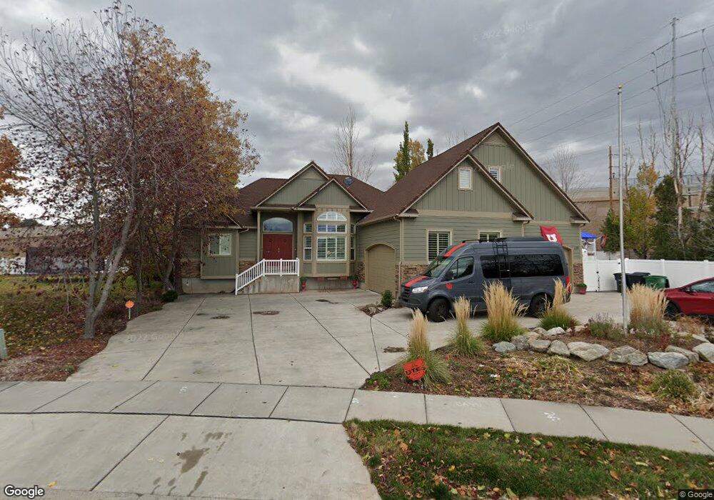
136 N 700 W Kaysville, UT 84037
West Kaysville NeighborhoodEstimated Value: $783,000 - $1,133,000
5
Beds
3
Baths
4,817
Sq Ft
$190/Sq Ft
Est. Value
About This Home
This home is located at 136 N 700 W, Kaysville, UT 84037 and is currently estimated at $914,963, approximately $189 per square foot. 136 N 700 W is a home located in Davis County with nearby schools including Kaysville Elementary School, Farmington High, and Centennial Junior High School.
Ownership History
Date
Name
Owned For
Owner Type
Purchase Details
Closed on
Jan 8, 2024
Sold by
Williamson Alayna K
Bought by
Troy And Alayna Williamson Family Trust and Williamson
Current Estimated Value
Home Financials for this Owner
Home Financials are based on the most recent Mortgage that was taken out on this home.
Original Mortgage
$244,900
Outstanding Balance
$234,687
Interest Rate
7.22%
Mortgage Type
Credit Line Revolving
Estimated Equity
$680,276
Purchase Details
Closed on
Jan 21, 2021
Sold by
Williamson Troy L and Williamson Alayna K
Bought by
Williamson Troy L and Williamson Alayna K
Home Financials for this Owner
Home Financials are based on the most recent Mortgage that was taken out on this home.
Original Mortgage
$389,500
Interest Rate
2.71%
Mortgage Type
New Conventional
Purchase Details
Closed on
Jan 20, 2021
Sold by
Williamson Tray L and Williamson Alayna K
Bought by
Williamson Tray L and Williamson Alayna K
Home Financials for this Owner
Home Financials are based on the most recent Mortgage that was taken out on this home.
Original Mortgage
$389,500
Interest Rate
2.71%
Mortgage Type
New Conventional
Purchase Details
Closed on
Oct 17, 2016
Sold by
Williamson Troy L and Williamson Alayna K
Bought by
Williamson Troy L and Williamson Family Trust
Purchase Details
Closed on
Nov 13, 2009
Sold by
Williamson Troy L and Williamson Alayna K F
Bought by
Williamson Troy L and Williamson Alayna K
Purchase Details
Closed on
Apr 4, 2002
Sold by
Toucan Investment Real Estate & Developm
Bought by
Williamson Troy L and Williamson Alayna K F
Home Financials for this Owner
Home Financials are based on the most recent Mortgage that was taken out on this home.
Original Mortgage
$183,000
Interest Rate
6.78%
Create a Home Valuation Report for This Property
The Home Valuation Report is an in-depth analysis detailing your home's value as well as a comparison with similar homes in the area
Home Values in the Area
Average Home Value in this Area
Purchase History
| Date | Buyer | Sale Price | Title Company |
|---|---|---|---|
| Troy And Alayna Williamson Family Trust | -- | First American Title Insurance | |
| Williamson Alayna K | -- | First American Title Insurance | |
| Williamson Troy L | -- | First American Title | |
| Williamson Troy L | -- | First American Title | |
| Williamson Tray L | -- | None Available | |
| Williamson Troy L | -- | Security Title | |
| Williamson Troy L | -- | Security Title | |
| Williamson Troy L | -- | None Available | |
| Williamson Troy L | -- | Bonneville Title Company Inc |
Source: Public Records
Mortgage History
| Date | Status | Borrower | Loan Amount |
|---|---|---|---|
| Open | Williamson Alayna K | $244,900 | |
| Previous Owner | Williamson Troy L | $389,500 | |
| Previous Owner | Williamson Troy L | $183,000 |
Source: Public Records
Tax History Compared to Growth
Tax History
| Year | Tax Paid | Tax Assessment Tax Assessment Total Assessment is a certain percentage of the fair market value that is determined by local assessors to be the total taxable value of land and additions on the property. | Land | Improvement |
|---|---|---|---|---|
| 2025 | $3,990 | $441,650 | $160,710 | $280,940 |
| 2024 | $3,990 | $420,750 | $153,020 | $267,730 |
| 2023 | $3,974 | $742,000 | $269,528 | $472,472 |
| 2022 | $3,948 | $413,600 | $147,022 | $266,578 |
| 2021 | $3,720 | $584,000 | $176,868 | $407,132 |
| 2020 | $3,349 | $512,000 | $151,549 | $360,451 |
| 2019 | $3,210 | $482,000 | $150,260 | $331,740 |
| 2018 | $3,006 | $450,000 | $127,657 | $322,343 |
| 2016 | $2,564 | $201,740 | $59,506 | $142,234 |
| 2015 | $2,618 | $195,580 | $59,506 | $136,074 |
| 2014 | $2,420 | $184,052 | $56,108 | $127,944 |
| 2013 | -- | $185,839 | $58,717 | $127,122 |
Source: Public Records
Map
Nearby Homes
- 1087 Barnes Dr
- 48 S Flint St
- 444 Creekside Way
- 424 W Creekside Ln
- 917 S Main St Unit H
- 203 S Larkin Ln
- 895 S Main St Unit E
- 454 S Jay St W
- 593 N 150 W
- 1429 W Lincoln Way
- 680 N Main St Unit B19
- 52 S Grandison Ct E Unit 83-R
- 1346 W Blackbird Ln Unit 3
- 109 S Rock Loft Ridge Dr Unit 56-R
- 159 S Rock Loft Ridge Dr Unit 59-R
- 209 N Rock Loft Ridge E Unit 32-R
- 180 S Rock Loft Ridge Dr E Unit 7-R
- 246 N Rock Loft Ridge Dr Unit 36-R
- 22 S Rock Loft Ridge Dr Unit 16-R
- 34 S Rock Loft Ridge Dr Unit 85-R