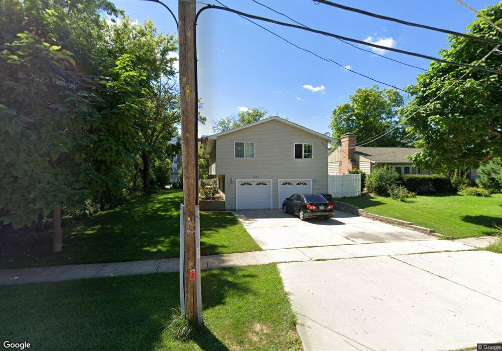
136 N Cedar St Palatine, IL 60067
Downtown Palatine NeighborhoodEstimated Value: $350,000 - $424,478
3
Beds
4
Baths
1,355
Sq Ft
$294/Sq Ft
Est. Value
About This Home
This home is located at 136 N Cedar St, Palatine, IL 60067 and is currently estimated at $398,870, approximately $294 per square foot. 136 N Cedar St is a home located in Cook County with nearby schools including Stuart R Paddock School, Plum Grove Jr High School, and William Fremd High School.
Ownership History
Date
Name
Owned For
Owner Type
Purchase Details
Closed on
May 24, 1999
Sold by
Tarsitano William A
Bought by
Campillo Jesus and Campillo Rosa
Current Estimated Value
Home Financials for this Owner
Home Financials are based on the most recent Mortgage that was taken out on this home.
Original Mortgage
$40,000
Outstanding Balance
$10,730
Interest Rate
7.5%
Estimated Equity
$388,140
Purchase Details
Closed on
Nov 18, 1997
Sold by
Hauswirth Bertrand F
Bought by
Tarsitano William A
Home Financials for this Owner
Home Financials are based on the most recent Mortgage that was taken out on this home.
Original Mortgage
$39,200
Interest Rate
8.5%
Create a Home Valuation Report for This Property
The Home Valuation Report is an in-depth analysis detailing your home's value as well as a comparison with similar homes in the area
Home Values in the Area
Average Home Value in this Area
Purchase History
| Date | Buyer | Sale Price | Title Company |
|---|---|---|---|
| Campillo Jesus | $50,000 | -- | |
| Tarsitano William A | $49,000 | -- |
Source: Public Records
Mortgage History
| Date | Status | Borrower | Loan Amount |
|---|---|---|---|
| Open | Campillo Jesus | $40,000 | |
| Previous Owner | Tarsitano William A | $39,200 |
Source: Public Records
Tax History Compared to Growth
Tax History
| Year | Tax Paid | Tax Assessment Tax Assessment Total Assessment is a certain percentage of the fair market value that is determined by local assessors to be the total taxable value of land and additions on the property. | Land | Improvement |
|---|---|---|---|---|
| 2024 | $7,385 | $28,262 | $5,239 | $23,023 |
| 2023 | $7,840 | $28,262 | $5,239 | $23,023 |
| 2022 | $7,840 | $30,794 | $5,239 | $25,555 |
| 2021 | $5,602 | $20,579 | $3,056 | $17,523 |
| 2020 | $5,591 | $20,579 | $3,056 | $17,523 |
| 2019 | $5,912 | $24,045 | $3,056 | $20,989 |
| 2018 | $6,072 | $22,973 | $2,837 | $20,136 |
| 2017 | $7,272 | $27,227 | $2,837 | $24,390 |
| 2016 | $7,012 | $27,227 | $2,837 | $24,390 |
| 2015 | $5,965 | $22,038 | $2,619 | $19,419 |
| 2014 | $6,693 | $24,620 | $2,619 | $22,001 |
| 2013 | $6,373 | $26,056 | $2,619 | $23,437 |
Source: Public Records
Map
Nearby Homes
- 435 W Wood St Unit 402A
- 390 W Mahogany Ct Unit 606
- 410 W Mahogany Ct Unit 309
- 480 W Wood St Unit 3
- Lot 1 W Wilson St
- 470 W Mahogany Ct Unit 408
- 566 W Bridge View Ct
- 235 N Smith St Unit 401
- 133 W Palatine Rd Unit 107A
- 315 Johnson St
- 241 N Brockway St
- 87 W Station St
- 77 N Quentin Rd Unit 414
- 248 W Fairview Way Unit 4
- 24 W Station St Unit 403W
- 222 S Maple St
- 2 E Slade St
- 4 E Slade St
- 3 E Slade St
- 635 W Kenilworth Ave
- 142 N Cedar St
- 120 N Cedar St
- 150 N Cedar St
- 118 N Cedar St
- 141 N Cedar St
- 135 N Cedar St
- 114 N Cedar St
- 129 N Cedar St
- 145 N Cedar St
- 110 N Cedar St
- 153 N Cedar St
- 455 W Wood St Unit 307
- 455 W Wood St Unit 212
- 455 W Wood St Unit 411
- 455 W Wood St Unit 412
- 455 W Wood St Unit 211
- 455 W Wood St Unit 413
- 455 W Wood St Unit 206
- 455 W Wood St Unit 414
- 455 W Wood St Unit 301