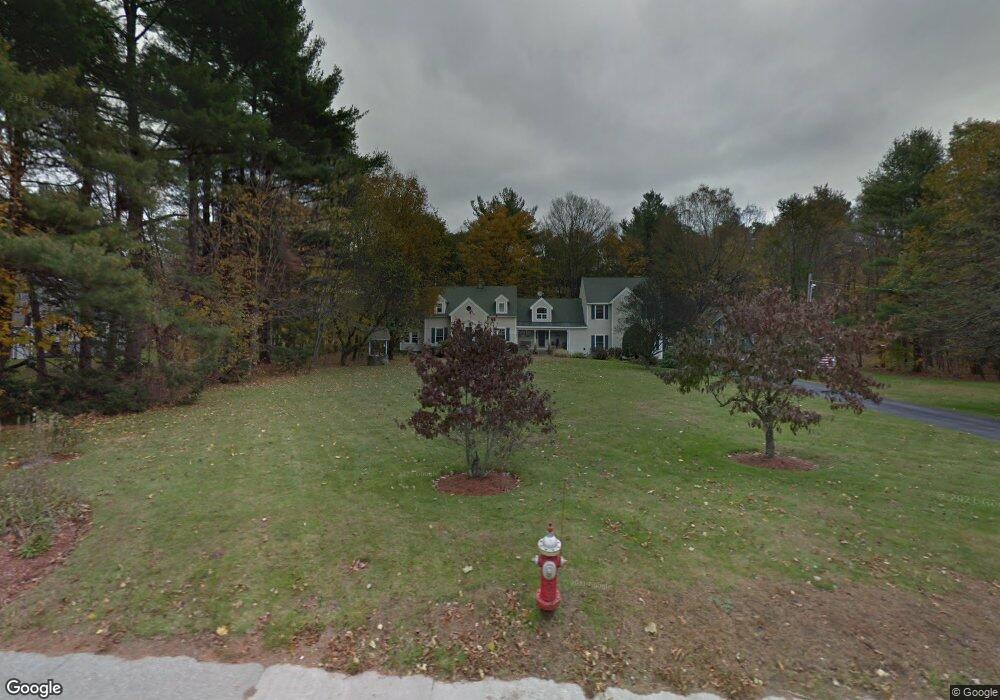
136 N Main St West Boylston, MA 01583
Estimated Value: $694,000 - $838,000
3
Beds
4
Baths
3,038
Sq Ft
$255/Sq Ft
Est. Value
About This Home
This home is located at 136 N Main St, West Boylston, MA 01583 and is currently estimated at $775,945, approximately $255 per square foot. 136 N Main St is a home located in Worcester County with nearby schools including Major Edwards Elementary School and West Boylston Junior/Senior High School.
Ownership History
Date
Name
Owned For
Owner Type
Purchase Details
Closed on
Dec 17, 1992
Sold by
Forrest William R and Forrest Nancy
Bought by
Colangelo Matthew P and Colangelo Amy
Current Estimated Value
Create a Home Valuation Report for This Property
The Home Valuation Report is an in-depth analysis detailing your home's value as well as a comparison with similar homes in the area
Home Values in the Area
Average Home Value in this Area
Purchase History
| Date | Buyer | Sale Price | Title Company |
|---|---|---|---|
| Colangelo Matthew P | $146,500 | -- |
Source: Public Records
Mortgage History
| Date | Status | Borrower | Loan Amount |
|---|---|---|---|
| Open | Colangelo Matthew P | $100,000 | |
| Open | Colangelo Matthew P | $175,000 | |
| Closed | Colangelo Matthew P | $12,000 | |
| Closed | Colangelo Matthew P | $139,000 |
Source: Public Records
Tax History Compared to Growth
Tax History
| Year | Tax Paid | Tax Assessment Tax Assessment Total Assessment is a certain percentage of the fair market value that is determined by local assessors to be the total taxable value of land and additions on the property. | Land | Improvement |
|---|---|---|---|---|
| 2025 | $105 | $755,400 | $138,700 | $616,700 |
| 2024 | $10,278 | $695,400 | $140,900 | $554,500 |
| 2023 | $10,219 | $655,900 | $138,700 | $517,200 |
| 2022 | $9,328 | $527,600 | $138,700 | $388,900 |
| 2021 | $409 | $494,500 | $116,000 | $378,500 |
| 2020 | $8,894 | $478,700 | $116,000 | $362,700 |
| 2019 | $8,616 | $457,100 | $116,000 | $341,100 |
| 2018 | $517 | $446,300 | $116,000 | $330,300 |
| 2017 | $7,885 | $419,400 | $116,000 | $303,400 |
| 2016 | $7,633 | $413,700 | $108,600 | $305,100 |
| 2015 | $7,268 | $396,300 | $107,800 | $288,500 |
Source: Public Records
Map
Nearby Homes
- 16 N Main St
- 287 Laurel St
- 20 Winthrop St
- 0 Boutelle Rd
- 136 Sterling St Unit A3
- 61 Boutelle Rd
- 2 Lakeview Ave
- 223 Worcester Rd
- 18 Laurel Ave
- 21 Myrtle Ave
- 0 North St
- 4 Jewett Rd Unit B
- 4 Jewett Rd Unit A
- Lot 1 Manning St
- 156 Prospect St
- 152 Worcester St Unit 8
- 15 N Cove Rd
- 9 Michael Ln
- 43 Chace Hill Rd
- 54 Maple St
- 6 Stillwater Heights Dr
- 4 Stillwater Heights Dr
- 128 N Main St
- 12 Stillwater Heights Dr
- 8 Stillwater Heights Dr
- 16 Stillwater Heights Dr
- 135 N Main St
- 127 N Main St
- 127 N Main St Unit 1
- 3 Stillwater Heights Dr
- 122 N Main St
- 5 Stillwater Heights Dr
- 143 N Main St
- 7 Stillwater Heights Dr
- 11 Stillwater Heights Dr
- 19 Stillwater Heights Dr
- 121 N Main St
- 118 N Main St
- 43 Stillwater Heights Dr
- 20 Stillwater Heights Dr