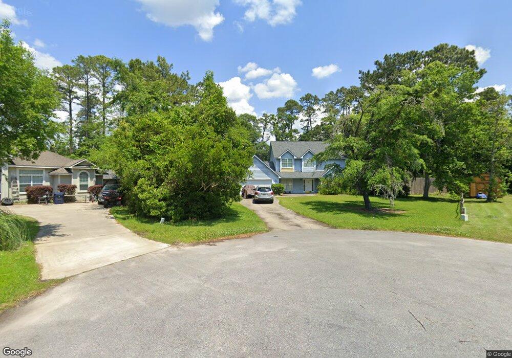
136 Northeaster Ct Woodbine, GA 31569
Estimated Value: $289,000 - $363,000
4
Beds
3
Baths
1,656
Sq Ft
$189/Sq Ft
Est. Value
About This Home
This home is located at 136 Northeaster Ct, Woodbine, GA 31569 and is currently estimated at $313,603, approximately $189 per square foot. 136 Northeaster Ct is a home located in Camden County with nearby schools including Mamie Lou Gross Elementary School, Saint Marys Middle School, and Camden County High School.
Ownership History
Date
Name
Owned For
Owner Type
Purchase Details
Closed on
May 28, 2009
Sold by
Pope Marvin E
Bought by
Barfield Jason R
Current Estimated Value
Home Financials for this Owner
Home Financials are based on the most recent Mortgage that was taken out on this home.
Original Mortgage
$96,500
Outstanding Balance
$60,970
Interest Rate
4.77%
Mortgage Type
FHA
Estimated Equity
$252,633
Create a Home Valuation Report for This Property
The Home Valuation Report is an in-depth analysis detailing your home's value as well as a comparison with similar homes in the area
Home Values in the Area
Average Home Value in this Area
Purchase History
| Date | Buyer | Sale Price | Title Company |
|---|---|---|---|
| Barfield Jason R | $100,000 | -- |
Source: Public Records
Mortgage History
| Date | Status | Borrower | Loan Amount |
|---|---|---|---|
| Open | Barfield Jason R | $96,500 |
Source: Public Records
Tax History Compared to Growth
Tax History
| Year | Tax Paid | Tax Assessment Tax Assessment Total Assessment is a certain percentage of the fair market value that is determined by local assessors to be the total taxable value of land and additions on the property. | Land | Improvement |
|---|---|---|---|---|
| 2024 | $1,465 | $95,119 | $6,000 | $89,119 |
| 2023 | $1,512 | $95,119 | $6,000 | $89,119 |
| 2022 | $1,488 | $80,606 | $6,000 | $74,606 |
| 2021 | $1,573 | $55,368 | $6,000 | $49,368 |
| 2020 | $1,618 | $53,627 | $6,000 | $47,627 |
| 2019 | $1,631 | $53,627 | $6,000 | $47,627 |
| 2018 | $1,466 | $53,627 | $6,000 | $47,627 |
| 2017 | $1,383 | $49,058 | $6,000 | $43,058 |
| 2016 | $1,309 | $46,754 | $6,000 | $40,754 |
| 2015 | $1,268 | $46,754 | $6,000 | $40,754 |
| 2014 | $1,263 | $46,754 | $6,000 | $40,754 |
Source: Public Records
Map
Nearby Homes
- 0 Sheffield Island Rd Unit 1657408
- 0 Sheffield Island Rd Unit 3
- 0 Sheffield Island Rd Unit 1657085
- 0 Sheffield Island Rd Unit 2
- 0 Sheffield Island Rd Unit 1656907
- 0 Sheffield Island Rd Unit 6 10613099
- 0 Sheffield Island Rd Unit 1656491
- 0 Sheffield Island Rd Unit 5 10597696
- 0 Sheffield Island Rd Unit 1656363
- 0 Sheffield Island Rd Unit 4 10593732
- 416 Deals Cir S
- 58 Deals Cir S
- 273 Village Dr
- 0 Simmons Bluff Rd Unit 10371213
- 0 Simmons Bluff Rd Unit 147462
- 226 Bristol Hammock Ct
- 14 Bristol Hammock Ct
- 220 Deerwood Village Dr
- 88 Rainbow Ln
- 0 Serenity Farms Rd Unit 10614957
- 122 Northeaster Ct
- 133 Northeaster Ct
- 129 Northeaster Ct
- 106 Northeaster Ct
- 0 Northeaster Ct Unit 7103682
- 0 Northeaster Ct Unit 8565879
- 0 Northeaster Ct Unit 8527692
- 0 Northeaster Ct Unit 8131242
- 0 Northeaster Ct Unit 3193930
- 0 Northeaster Ct Unit 8363234
- 0 Northeaster Ct Unit 8061686
- 0 Northeaster Ct Unit 7433345
- 0 Northeaster Ct Unit 7586722
- 0 Northeaster Ct Unit 8660947
- 0 Northeaster Ct Unit 8098680
- 0 Northeaster Ct Unit 8007596
- 0 Northeaster Ct Unit 8002986
- 0 Northeaster Ct Unit 7355038
- 0 Northeaster Ct Unit 3276523
- 0 Northeaster Ct Unit 3114650