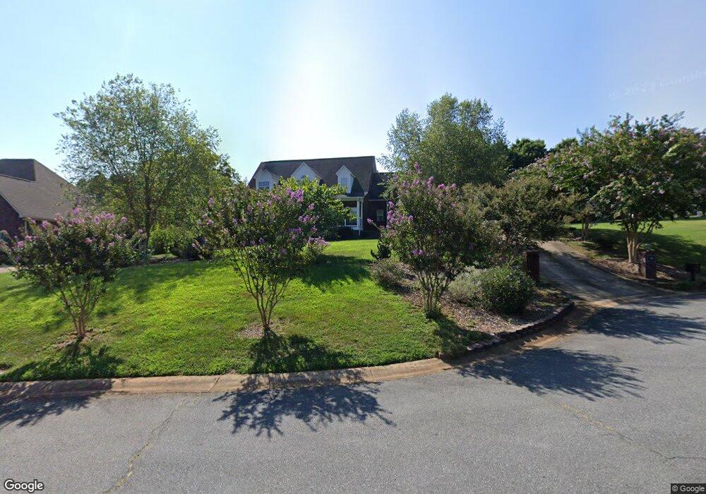
136 Pointer Ct SE Concord, NC 28025
Estimated Value: $490,042 - $539,000
3
Beds
3
Baths
2,947
Sq Ft
$176/Sq Ft
Est. Value
About This Home
This home is located at 136 Pointer Ct SE, Concord, NC 28025 and is currently estimated at $519,761, approximately $176 per square foot. 136 Pointer Ct SE is a home located in Cabarrus County with nearby schools including W.M. Irvin Elementary School, Mount Pleasant Middle School, and Mount Pleasant High School.
Ownership History
Date
Name
Owned For
Owner Type
Purchase Details
Closed on
Sep 17, 2002
Sold by
Ward Kevin B and Ward Valerie B
Bought by
Criffield Kenneth E and Cook Cathy Ann
Current Estimated Value
Home Financials for this Owner
Home Financials are based on the most recent Mortgage that was taken out on this home.
Original Mortgage
$120,000
Outstanding Balance
$50,713
Interest Rate
6.4%
Estimated Equity
$469,048
Purchase Details
Closed on
Jul 1, 1996
Bought by
Ward Kevin B and Wife Valerie B
Create a Home Valuation Report for This Property
The Home Valuation Report is an in-depth analysis detailing your home's value as well as a comparison with similar homes in the area
Home Values in the Area
Average Home Value in this Area
Purchase History
| Date | Buyer | Sale Price | Title Company |
|---|---|---|---|
| Criffield Kenneth E | $222,500 | -- | |
| Ward Kevin B | $28,500 | -- |
Source: Public Records
Mortgage History
| Date | Status | Borrower | Loan Amount |
|---|---|---|---|
| Open | Criffield Kenneth E | $120,000 | |
| Closed | Criffield Kenneth E | $65,000 |
Source: Public Records
Tax History
| Year | Tax Paid | Tax Assessment Tax Assessment Total Assessment is a certain percentage of the fair market value that is determined by local assessors to be the total taxable value of land and additions on the property. | Land | Improvement |
|---|---|---|---|---|
| 2025 | $4,630 | $464,850 | $94,000 | $370,850 |
| 2024 | $4,630 | $464,850 | $94,000 | $370,850 |
| 2023 | $3,608 | $295,770 | $60,000 | $235,770 |
| 2022 | $3,608 | $295,770 | $60,000 | $235,770 |
| 2021 | $3,608 | $295,770 | $60,000 | $235,770 |
| 2020 | $3,608 | $295,770 | $60,000 | $235,770 |
| 2019 | $3,183 | $260,930 | $42,000 | $218,930 |
| 2018 | $3,131 | $260,930 | $42,000 | $218,930 |
| 2017 | $3,079 | $260,930 | $42,000 | $218,930 |
| 2016 | $1,827 | $258,070 | $42,000 | $216,070 |
| 2015 | $3,045 | $258,070 | $42,000 | $216,070 |
| 2014 | $3,045 | $258,070 | $42,000 | $216,070 |
Source: Public Records
Map
Nearby Homes
- 125 Pointer Ct SE
- 207 Krimminger Ave SE
- 53 Ridge Ct SE
- 94 Cumberland Ct SW
- 104 Mcarthur Ave SE
- 847 Kathryn Dr SE
- 267 Ikerd Dr SE
- 2511 Willow Pond Ln SE
- 2522 Willow Pond Ln SE
- 271 Ikerd Dr SE
- 2427 Baxter Place SE
- 3560-C U S 601
- 1160 Crestmont Dr SE Unit A3
- 783 Union St S
- 1193 Tangle Ridge Dr SE
- 782 Union St S
- 80 Pounds Ave SW
- 79 Fryling Ave SW
- 750 Spring St SW
- 1144 Tangle Ridge Dr SE
- 134 Pointer Ct SE
- 124 Cottontail Ln SE
- 120 Cottontail Ln SE
- 126 Cottontail Ln SE
- 132 Pointer Ct SE
- 135 Pointer Ct SE
- 137 Pointer Ct SE
- 118 Cottontail Ln SE
- 128 Cottontail Ln SE
- 133 Pointer Ct SE
- 122 Pointer Ct SE
- 131 Pointer Ct SE
- 123 Cottontail Ln SE
- 125 Cottontail Ln SE
- 121 Cottontail Ln SE
- 119 Cottontail Ln SE
- 132 Cottontail Ln SE
- 129 Pointer Ct SE
- 129 Cottontail Ln SE
- 57 Old Airport Rd
Your Personal Tour Guide
Ask me questions while you tour the home.