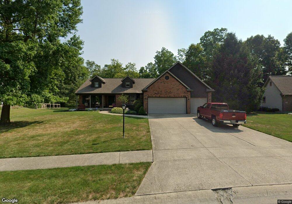
136 Shawnee Loop N Pataskala, OH 43062
Estimated Value: $422,000 - $445,218
3
Beds
2
Baths
2,398
Sq Ft
$181/Sq Ft
Est. Value
About This Home
This home is located at 136 Shawnee Loop N, Pataskala, OH 43062 and is currently estimated at $434,555, approximately $181 per square foot. 136 Shawnee Loop N is a home located in Licking County with nearby schools including Pataskala Elementary School, Etna Elementary School, and Watkins Middle School.
Ownership History
Date
Name
Owned For
Owner Type
Purchase Details
Closed on
Sep 12, 2017
Sold by
Brown Chester E and Brown Janice M
Bought by
Brown Chester E and Brown Janice M
Current Estimated Value
Purchase Details
Closed on
Jul 25, 1995
Sold by
Custom Key Homes Inc
Bought by
Brown Chester E and Brown Janice M
Home Financials for this Owner
Home Financials are based on the most recent Mortgage that was taken out on this home.
Original Mortgage
$172,000
Interest Rate
6.5%
Mortgage Type
New Conventional
Create a Home Valuation Report for This Property
The Home Valuation Report is an in-depth analysis detailing your home's value as well as a comparison with similar homes in the area
Home Values in the Area
Average Home Value in this Area
Purchase History
| Date | Buyer | Sale Price | Title Company |
|---|---|---|---|
| Brown Chester E | -- | None Available | |
| Brown Chester E | $212,000 | -- |
Source: Public Records
Mortgage History
| Date | Status | Borrower | Loan Amount |
|---|---|---|---|
| Closed | Brown Chester E | $172,000 |
Source: Public Records
Tax History Compared to Growth
Tax History
| Year | Tax Paid | Tax Assessment Tax Assessment Total Assessment is a certain percentage of the fair market value that is determined by local assessors to be the total taxable value of land and additions on the property. | Land | Improvement |
|---|---|---|---|---|
| 2024 | $5,300 | $137,380 | $39,900 | $97,480 |
| 2023 | $5,321 | $137,380 | $39,900 | $97,480 |
| 2022 | $4,478 | $101,080 | $26,950 | $74,130 |
| 2021 | $4,612 | $101,080 | $26,950 | $74,130 |
| 2020 | $4,683 | $101,080 | $26,950 | $74,130 |
| 2019 | $4,008 | $81,730 | $19,950 | $61,780 |
| 2018 | $4,023 | $0 | $0 | $0 |
| 2017 | $3,986 | $0 | $0 | $0 |
| 2016 | $3,751 | $0 | $0 | $0 |
| 2015 | $4,263 | $0 | $0 | $0 |
| 2014 | $5,981 | $0 | $0 | $0 |
| 2013 | $4,196 | $0 | $0 | $0 |
Source: Public Records
Map
Nearby Homes
- 204 S Fork Cir
- 280 Blacks Rd
- 388 S Township Rd
- 218 Blacks Rd
- 0 Blacks Rd Unit 215031989
- 0 Blacks Rd Unit Lot 10
- 81 Town St
- 238 S Vine St
- 475 Washington St
- 1128 Legacy Ln
- 164 W Mill St
- 1333 Andy Way
- 6690 Watkins Rd SW
- 282 River Forest Rd
- 210 Cedar St Unit 156b
- 1555 Tammy Louise Dr
- 1320 Harold Stewart Pkwy
- 303 Levi Dr Unit Lot 7
- 186 Markway Dr Unit Lot 12
- 305 Levi Dr Unit Lot 6
- 132 Shawnee Loop N
- 140 Shawnee Loop N
- 128 Shawnee Loop N
- 144 Shawnee Loop N
- 131 Shawnee Loop N
- 139 Shawnee Loop N
- 124 Shawnee Loop N
- 148 Shawnee Loop N
- 103 Mohican Ln
- 112 Mohican Ln
- 145 Shawnee Loop N
- 120 Shawnee Loop N
- 152 Shawnee Loop N
- 115 Shawnee Loop N
- 113 Shawnee Loop N
- 109 Mohican Ln
- 116 Mohican Ln
- 149 Shawnee Loop N
- 118 Mohican Ln
- 116 Shawnee Loop N