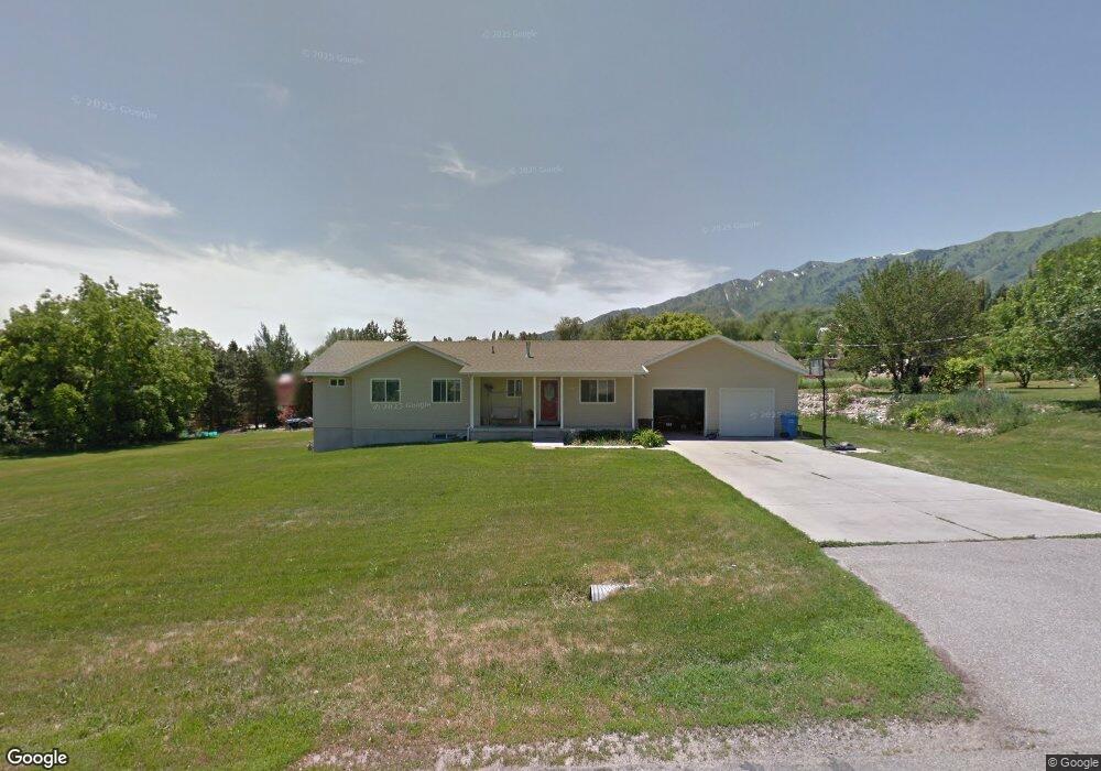
136 W 100 S Mendon, UT 84325
Estimated Value: $598,000 - $696,000
--
Bed
--
Bath
1,448
Sq Ft
$434/Sq Ft
Est. Value
About This Home
This home is located at 136 W 100 S, Mendon, UT 84325 and is currently estimated at $628,535, approximately $434 per square foot. 136 W 100 S is a home with nearby schools including Mountainside School, South Cache Middle School, and Mountain Crest High School.
Ownership History
Date
Name
Owned For
Owner Type
Purchase Details
Closed on
Sep 21, 2020
Sold by
Jarrett David M
Bought by
Jarrett David and Jarrett Kristen
Current Estimated Value
Purchase Details
Closed on
Dec 28, 2018
Sold by
Jarrett David
Bought by
Jarrett David and Jarrett Kristen
Home Financials for this Owner
Home Financials are based on the most recent Mortgage that was taken out on this home.
Original Mortgage
$258,400
Interest Rate
4.8%
Mortgage Type
New Conventional
Create a Home Valuation Report for This Property
The Home Valuation Report is an in-depth analysis detailing your home's value as well as a comparison with similar homes in the area
Home Values in the Area
Average Home Value in this Area
Purchase History
| Date | Buyer | Sale Price | Title Company |
|---|---|---|---|
| Jarrett David | -- | Hickman Land Title Logan | |
| Jarrett David | -- | Hickman Land Title Co | |
| Jarrett David M | -- | Hickman Land Title Co |
Source: Public Records
Mortgage History
| Date | Status | Borrower | Loan Amount |
|---|---|---|---|
| Closed | Jarrett David M | $258,400 |
Source: Public Records
Tax History Compared to Growth
Tax History
| Year | Tax Paid | Tax Assessment Tax Assessment Total Assessment is a certain percentage of the fair market value that is determined by local assessors to be the total taxable value of land and additions on the property. | Land | Improvement |
|---|---|---|---|---|
| 2024 | $2,719 | $337,195 | $0 | $0 |
| 2023 | $2,628 | $309,675 | $0 | $0 |
| 2022 | $2,646 | $309,670 | $0 | $0 |
| 2021 | $2,149 | $377,745 | $60,750 | $316,995 |
| 2020 | $1,847 | $300,468 | $60,750 | $239,718 |
| 2019 | $1,947 | $300,467 | $60,750 | $239,717 |
| 2018 | $1,751 | $269,200 | $60,750 | $208,450 |
| 2017 | $1,708 | $137,640 | $0 | $0 |
| 2016 | $1,688 | $132,140 | $0 | $0 |
| 2015 | $1,376 | $111,305 | $0 | $0 |
| 2014 | $1,343 | $111,305 | $0 | $0 |
| 2013 | -- | $111,305 | $0 | $0 |
Source: Public Records
Map
Nearby Homes
- 847 W 50 N Unit 69
- 915 W 50 N Unit 67
- 1811 S 5900 W
- 848 N 100 E Unit 73
- 814 N 100 E Unit 71
- 535 Pheaant Hollow Ln
- 518 N 220 E
- 203 E 600 N
- 941 N 75 W Unit 62
- 73 W 1050 N Unit 17
- 972 N 75 W Unit 12
- 876 N 75 W Unit 9
- 802 N 75 W Unit 8
- 74 W 850 N Unit 7
- 42 W 850 N Unit 5
- 915 N 75 W Unit 61
- 850 N 73 W Unit 60
- 850 N 51 W Unit 59
- 26 W 850 N Unit 4
- 4700 W 2900 S