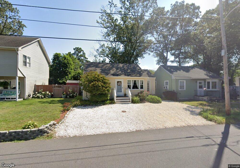
136 W Long Branch Ave Ocean Gate, NJ 08740
Estimated Value: $331,000 - $396,000
2
Beds
1
Bath
780
Sq Ft
$462/Sq Ft
Est. Value
About This Home
This home is located at 136 W Long Branch Ave, Ocean Gate, NJ 08740 and is currently estimated at $360,044, approximately $461 per square foot. 136 W Long Branch Ave is a home located in Ocean County with nearby schools including Ocean Gate Elementary School, Central Regional Middle School, and Central Regional High School.
Ownership History
Date
Name
Owned For
Owner Type
Purchase Details
Closed on
Mar 30, 2007
Sold by
Matthias Tammy
Bought by
Garrison Jennifer
Current Estimated Value
Home Financials for this Owner
Home Financials are based on the most recent Mortgage that was taken out on this home.
Original Mortgage
$221,500
Outstanding Balance
$134,586
Interest Rate
6.24%
Mortgage Type
Purchase Money Mortgage
Estimated Equity
$225,458
Purchase Details
Closed on
Aug 28, 1998
Sold by
Johnson Robert W and Johnson Carol A
Bought by
Diana Leonard and Diana Margaret
Home Financials for this Owner
Home Financials are based on the most recent Mortgage that was taken out on this home.
Original Mortgage
$67,433
Interest Rate
6.9%
Mortgage Type
FHA
Create a Home Valuation Report for This Property
The Home Valuation Report is an in-depth analysis detailing your home's value as well as a comparison with similar homes in the area
Home Values in the Area
Average Home Value in this Area
Purchase History
| Date | Buyer | Sale Price | Title Company |
|---|---|---|---|
| Garrison Jennifer | $221,500 | Stewart Title Guaranty Co | |
| Diana Leonard | $67,500 | -- |
Source: Public Records
Mortgage History
| Date | Status | Borrower | Loan Amount |
|---|---|---|---|
| Open | Garrison Jennifer | $221,500 | |
| Previous Owner | Diana Leonard | $67,433 |
Source: Public Records
Tax History Compared to Growth
Tax History
| Year | Tax Paid | Tax Assessment Tax Assessment Total Assessment is a certain percentage of the fair market value that is determined by local assessors to be the total taxable value of land and additions on the property. | Land | Improvement |
|---|---|---|---|---|
| 2025 | $4,237 | $257,700 | $146,000 | $111,700 |
| 2024 | $3,556 | $257,700 | $146,000 | $111,700 |
| 2023 | $3,276 | $117,800 | $60,700 | $57,100 |
| 2022 | $3,276 | $117,800 | $60,700 | $57,100 |
| 2021 | $3,136 | $117,800 | $60,700 | $57,100 |
| 2020 | $3,161 | $117,800 | $60,700 | $57,100 |
| 2019 | $3,084 | $117,800 | $60,700 | $57,100 |
| 2018 | $2,977 | $117,800 | $60,700 | $57,100 |
| 2017 | $2,954 | $117,800 | $60,700 | $57,100 |
| 2016 | $2,931 | $117,800 | $60,700 | $57,100 |
| 2015 | $3,332 | $163,500 | $100,000 | $63,500 |
| 2014 | $3,347 | $163,500 | $100,000 | $63,500 |
Source: Public Records
Map
Nearby Homes
- 553 Ocean Gate Dr
- 3 Sheila Ct
- 36 W Point Pleasant Ave
- 0 Jane Ave
- 803 Ocean Gate Dr
- 253 Shore Blvd
- 32 E Long Branch Ave
- 39 Ivy Ct
- 257 Ocean Gate Turnpike
- 238 Lakewood Ave
- 142 E Lakewood Ave
- 227 Chelsea Ave
- 221 E Lakewood Ave
- 99 Holly Ln
- 318 E Cape May Ave
- 87 Puffin Glade Unit 87
- 416 Monmouth Ave
- 530 E Point Pleasant Ave
- 409 Newport Ave
- 315 Tudor Ave
- 130 W Long Branch Ave
- 140 W Long Branch Ave
- 135 W Point Pleasant Ave
- 143 W Point Pleasant Ave
- 125 W Point Pleasant Ave
- 126 W Long Branch Ave
- 129 W Long Branch Ave
- 123 W Point Pleasant Ave
- 609 Red Bank Ave
- 120 W Long Branch Ave
- 125 W Long Branch Ave
- 141 W Point Pleasant Ave
- 617 Red Bank Ave
- 117 W Point Pleasant Ave
- 110 W Long Branch Ave
- 136 W Point Pleasant Ave
- 142 W Point Pleasant Ave
- 115 W Long Branch Ave
- 124 W Point Pleasant Ave
- 602 Navesink Ave