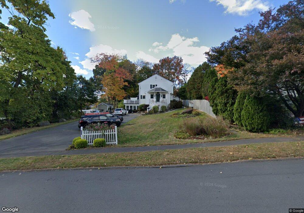
136 Westbrook Rd Plantsville, CT 06479
Estimated Value: $363,000 - $434,000
6
Beds
5
Baths
3,008
Sq Ft
$133/Sq Ft
Est. Value
About This Home
This home is located at 136 Westbrook Rd, Plantsville, CT 06479 and is currently estimated at $401,000, approximately $133 per square foot. 136 Westbrook Rd is a home located in Hartford County with nearby schools including John F. Kennedy Middle School, Southington High School, and Southington Catholic School.
Ownership History
Date
Name
Owned For
Owner Type
Purchase Details
Closed on
Jun 25, 2004
Sold by
Nicholas Lois
Bought by
Mcadoo Jonathan T and Mcadoo Wendy C
Current Estimated Value
Home Financials for this Owner
Home Financials are based on the most recent Mortgage that was taken out on this home.
Original Mortgage
$211,900
Outstanding Balance
$106,554
Interest Rate
6.32%
Mortgage Type
Purchase Money Mortgage
Estimated Equity
$294,446
Create a Home Valuation Report for This Property
The Home Valuation Report is an in-depth analysis detailing your home's value as well as a comparison with similar homes in the area
Home Values in the Area
Average Home Value in this Area
Purchase History
| Date | Buyer | Sale Price | Title Company |
|---|---|---|---|
| Mcadoo Jonathan T | $145,000 | -- |
Source: Public Records
Mortgage History
| Date | Status | Borrower | Loan Amount |
|---|---|---|---|
| Closed | Mcadoo Jonathan T | $50,000 | |
| Open | Mcadoo Jonathan T | $122,000 | |
| Open | Mcadoo Jonathan T | $211,900 | |
| Previous Owner | Mcadoo Jonathan T | $37,000 |
Source: Public Records
Tax History Compared to Growth
Tax History
| Year | Tax Paid | Tax Assessment Tax Assessment Total Assessment is a certain percentage of the fair market value that is determined by local assessors to be the total taxable value of land and additions on the property. | Land | Improvement |
|---|---|---|---|---|
| 2025 | $7,405 | $222,970 | $50,930 | $172,040 |
| 2024 | $7,010 | $222,970 | $50,930 | $172,040 |
| 2023 | $6,769 | $222,970 | $50,930 | $172,040 |
| 2022 | $6,495 | $222,970 | $50,930 | $172,040 |
| 2021 | $6,473 | $222,970 | $50,930 | $172,040 |
| 2020 | $6,323 | $206,440 | $51,960 | $154,480 |
| 2019 | $6,325 | $206,440 | $51,960 | $154,480 |
| 2018 | $6,282 | $206,090 | $51,960 | $154,130 |
| 2017 | $6,282 | $206,090 | $51,960 | $154,130 |
| 2016 | $6,109 | $206,090 | $51,960 | $154,130 |
| 2015 | $6,109 | $209,660 | $49,480 | $160,180 |
| 2014 | $5,946 | $209,660 | $49,480 | $160,180 |
Source: Public Records
Map
Nearby Homes
- 246 West St
- 34 Ford St
- 20 Wolf Hill Rd
- 93 Bishop Ave
- 194 W Center St
- 308 Bristol St
- 178 Empress Dr
- 449 Mill St
- 84 Empress Dr
- 59 Water St
- 152 Old Turnpike Rd
- 36 Buckland St Unit 22
- 316 Old Turnpike Rd
- 240 Jude Ln
- 42 Vermont Ave
- 349 Marion Ave Unit 12
- 349 Marion Ave Unit 23
- 349 Marion Ave Unit 24
- 349 Marion Ave Unit 21
- 349 Marion Ave Unit 25
- 155 Walnut St
- 65 Maxwell Dr
- 71 Maxwell Dr
- 59 Maxwell Dr
- 73 Maxwell Dr
- 137 Westbrook Rd
- 127 Westbrook Rd
- 135 Walnut St Unit 137
- 49 Maxwell Dr
- 119 Westbrook Rd
- 154 Walnut St
- 162 Walnut St
- 146 Walnut St
- 170 Walnut St
- 123 Walnut St
- 41 Maxwell Dr
- 70 Maxwell Dr
- 138 Walnut St
- 109 Westbrook Rd
- 178 Walnut St