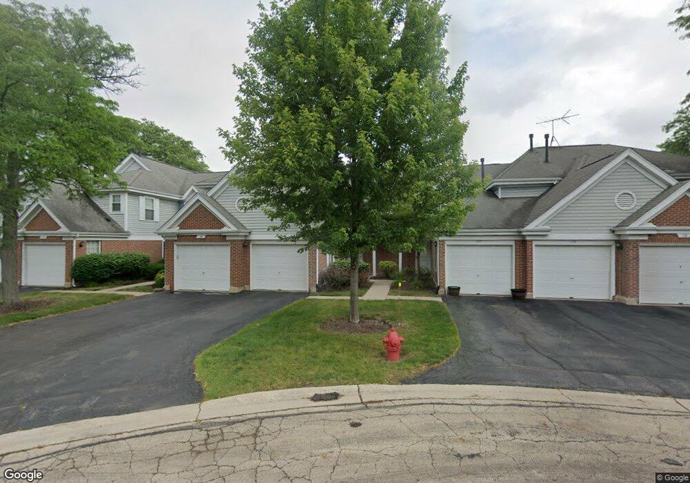
136 White Branch Ct Buffalo Grove, IL 60089
Estimated Value: $279,853 - $328,000
--
Bed
2
Baths
1,017
Sq Ft
$303/Sq Ft
Est. Value
About This Home
This home is located at 136 White Branch Ct, Buffalo Grove, IL 60089 and is currently estimated at $307,713, approximately $302 per square foot. 136 White Branch Ct is a home located in Lake County with nearby schools including Meridian Middle School, Tripp Elementary School, and Aptakisic Junior High School.
Ownership History
Date
Name
Owned For
Owner Type
Purchase Details
Closed on
Sep 27, 2000
Sold by
Botwin Russell
Bought by
Fierstein Rhoda B
Current Estimated Value
Home Financials for this Owner
Home Financials are based on the most recent Mortgage that was taken out on this home.
Original Mortgage
$85,000
Outstanding Balance
$31,154
Interest Rate
7.99%
Estimated Equity
$276,559
Purchase Details
Closed on
Dec 28, 1998
Sold by
Lynn Bruce
Bought by
Botwin Russell
Home Financials for this Owner
Home Financials are based on the most recent Mortgage that was taken out on this home.
Original Mortgage
$132,000
Interest Rate
6.79%
Create a Home Valuation Report for This Property
The Home Valuation Report is an in-depth analysis detailing your home's value as well as a comparison with similar homes in the area
Home Values in the Area
Average Home Value in this Area
Purchase History
| Date | Buyer | Sale Price | Title Company |
|---|---|---|---|
| Fierstein Rhoda B | $160,000 | -- | |
| Botwin Russell | $132,000 | -- |
Source: Public Records
Mortgage History
| Date | Status | Borrower | Loan Amount |
|---|---|---|---|
| Open | Fierstein Rhoda B | $85,000 | |
| Previous Owner | Botwin Russell | $132,000 |
Source: Public Records
Tax History Compared to Growth
Tax History
| Year | Tax Paid | Tax Assessment Tax Assessment Total Assessment is a certain percentage of the fair market value that is determined by local assessors to be the total taxable value of land and additions on the property. | Land | Improvement |
|---|---|---|---|---|
| 2024 | $5,980 | $78,491 | $23,922 | $54,569 |
| 2023 | $5,992 | $74,062 | $22,572 | $51,490 |
| 2022 | $5,992 | $72,327 | $22,043 | $50,284 |
| 2021 | $5,771 | $71,547 | $21,805 | $49,742 |
| 2020 | $5,661 | $71,791 | $21,879 | $49,912 |
| 2019 | $5,518 | $71,526 | $21,798 | $49,728 |
| 2018 | $4,116 | $56,257 | $23,694 | $32,563 |
| 2017 | $4,053 | $54,944 | $23,141 | $31,803 |
| 2016 | $3,876 | $52,613 | $22,159 | $30,454 |
| 2015 | $3,742 | $49,203 | $20,723 | $28,480 |
| 2014 | $3,177 | $43,053 | $16,694 | $26,359 |
| 2012 | $4,730 | $55,307 | $22,302 | $33,005 |
Source: Public Records
Map
Nearby Homes
- 148 White Branch Ct
- 1157 Russellwood Ct
- 60 E Fabish Dr
- 381 Bentley Place
- 1012 Hobson Dr
- 15 Thompson Ct
- 1272 Sandhurst Dr
- 51 W Fabish Dr
- 12 Aberdeen Ct
- 938 Hidden Lake Dr
- 720 Dunhill Dr
- 620 Cobblestone Ln
- 1113 Lockwood Dr
- 20665 N Weiland Rd
- 16202 W Aptakisic Rd
- 625 Marseilles Cir
- 20772 N William Ave
- 1118 Larraway Dr
- 22118 N Prairie Rd
- 603 Cherbourg Ct N
- 134 White Branch Ct
- 138 White Branch Ct
- 132 White Branch Ct
- 140 White Branch Ct
- 130 White Branch Ct
- 142 White Branch Ct
- 144 White Branch Ct
- 146 White Branch Ct
- 166 White Branch Ct
- 164 White Branch Ct
- 162 White Branch Ct
- 160 White Branch Ct
- 110 White Branch Ct
- 112 White Branch Ct
- 156 White Branch Ct
- 114 White Branch Ct
- 116 White Branch Ct
- 120 White Branch Ct
- 154 White Branch Ct
- 122 White Branch Ct