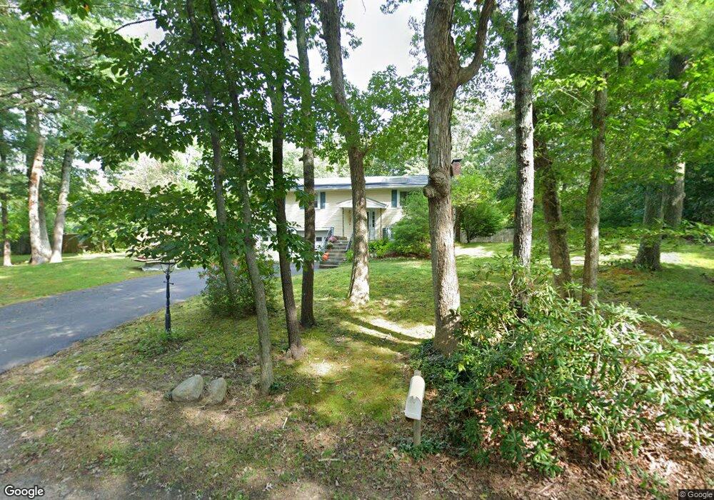
136 Whitman St Hanson, MA 02341
Estimated Value: $583,319 - $635,000
3
Beds
2
Baths
1,547
Sq Ft
$393/Sq Ft
Est. Value
About This Home
This home is located at 136 Whitman St, Hanson, MA 02341 and is currently estimated at $608,580, approximately $393 per square foot. 136 Whitman St is a home located in Plymouth County with nearby schools including The Master's Academy.
Ownership History
Date
Name
Owned For
Owner Type
Purchase Details
Closed on
Feb 12, 2013
Sold by
Counter Michelle M
Bought by
136 Whitman Street Rt
Current Estimated Value
Purchase Details
Closed on
Sep 25, 2006
Sold by
Ingle Stephen A and Ingle Linda J
Bought by
Counter Michelle M
Home Financials for this Owner
Home Financials are based on the most recent Mortgage that was taken out on this home.
Original Mortgage
$160,000
Interest Rate
6.59%
Mortgage Type
Purchase Money Mortgage
Create a Home Valuation Report for This Property
The Home Valuation Report is an in-depth analysis detailing your home's value as well as a comparison with similar homes in the area
Home Values in the Area
Average Home Value in this Area
Purchase History
| Date | Buyer | Sale Price | Title Company |
|---|---|---|---|
| 136 Whitman Street Rt | -- | -- | |
| Counter Michelle M | $366,000 | -- |
Source: Public Records
Mortgage History
| Date | Status | Borrower | Loan Amount |
|---|---|---|---|
| Previous Owner | Counter Michelle M | $138,500 | |
| Previous Owner | Counter Michelle M | $160,000 | |
| Previous Owner | Counter Michelle M | $213,000 | |
| Previous Owner | Counter Michelle M | $20,000 |
Source: Public Records
Tax History
| Year | Tax Paid | Tax Assessment Tax Assessment Total Assessment is a certain percentage of the fair market value that is determined by local assessors to be the total taxable value of land and additions on the property. | Land | Improvement |
|---|---|---|---|---|
| 2025 | $6,283 | $469,600 | $172,300 | $297,300 |
| 2024 | $6,104 | $456,200 | $167,400 | $288,800 |
| 2023 | $5,997 | $422,900 | $167,400 | $255,500 |
| 2022 | $5,352 | $354,700 | $152,100 | $202,600 |
| 2021 | $4,832 | $320,000 | $146,300 | $173,700 |
| 2020 | $4,764 | $312,000 | $141,300 | $170,700 |
| 2019 | $4,608 | $296,700 | $138,600 | $158,100 |
| 2018 | $4,521 | $285,600 | $133,300 | $152,300 |
| 2017 | $4,385 | $274,400 | $126,900 | $147,500 |
| 2016 | $4,473 | $270,300 | $126,900 | $143,400 |
| 2015 | $4,219 | $265,000 | $126,900 | $138,100 |
Source: Public Records
Map
Nearby Homes
- 139 Fairwood Dr
- 430 Brook Bend Rd
- 108 Waterford Dr
- 26 Stonebridge Dr
- Lot 5 Princeton Way
- 84 Liberty St
- 724 Whitman St
- 161 Winter St Unit 11
- 168 Spring St
- 339 State St
- 17 Hayford Trail Unit 12
- 7 Hayford Trail Unit 12
- 5 Hayford Trail Unit 11
- 22 Howland Trail Unit 34
- 842 Whitman St
- Lot 6 Way
- 353 Cross St
- 95 Tecumseh Dr
- 177 Dwelley St
- 134 Crescent St
- 152 Whitman St
- 112 Whitman St
- Lot One Whitman
- 103 Whitman St
- 98 Whitman St
- 145 Whitman St
- 161 Whitman St
- 174 Whitman St
- 86 Whitman St
- 175 Whitman St
- 488 E Washington St
- 488 E Washington St
- 131 Whitman St
- 68 Whitman St
- 484 E Washington St
- 558 E Washington St
- 480 E Washington St
- 564 E Washington St
- 454 E Washington St
- 497 E Washington St
Your Personal Tour Guide
Ask me questions while you tour the home.