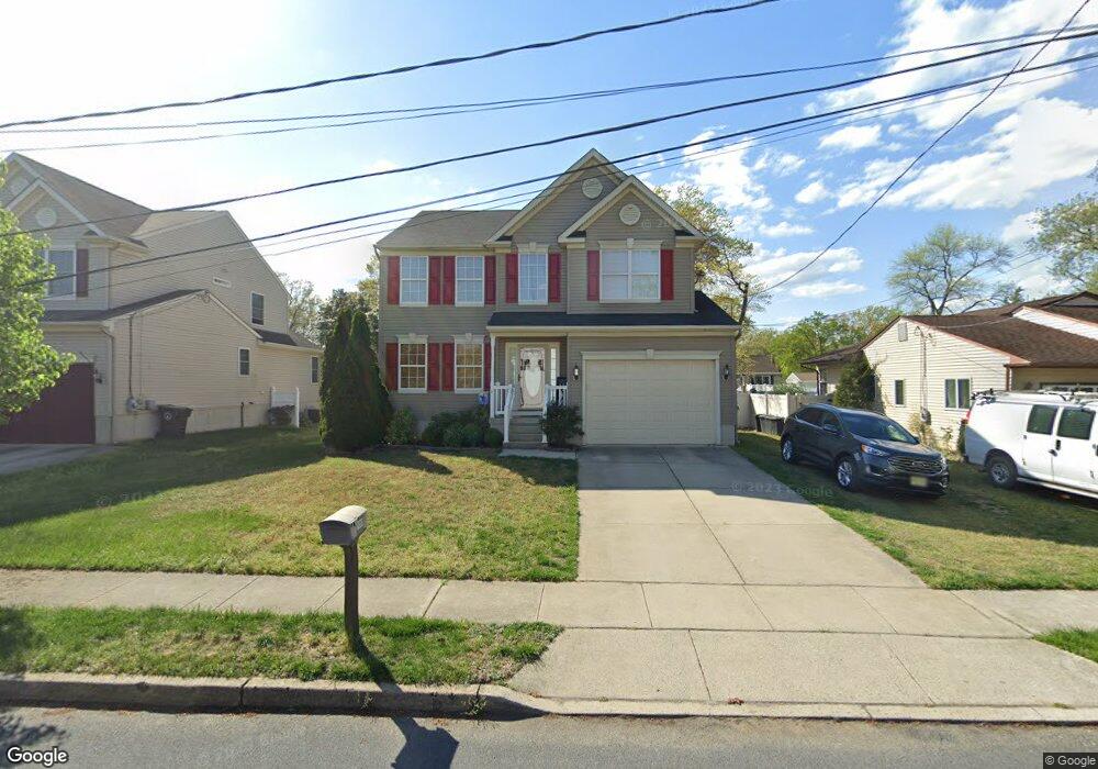
1360 Riley Ave West Deptford, NJ 08093
West Deptford Township NeighborhoodEstimated Value: $366,019 - $438,000
--
Bed
--
Bath
2,082
Sq Ft
$198/Sq Ft
Est. Value
About This Home
This home is located at 1360 Riley Ave, West Deptford, NJ 08093 and is currently estimated at $412,755, approximately $198 per square foot. 1360 Riley Ave is a home located in Gloucester County with nearby schools including Oakview Elementary School, Red Bank Elementary School, and Green-Fields Elementary School.
Ownership History
Date
Name
Owned For
Owner Type
Purchase Details
Closed on
Oct 19, 2007
Sold by
Route 536 South Corp Inc
Bought by
Cesaro James W and Cesaro Michelle A
Current Estimated Value
Home Financials for this Owner
Home Financials are based on the most recent Mortgage that was taken out on this home.
Original Mortgage
$214,900
Outstanding Balance
$135,702
Interest Rate
6.43%
Mortgage Type
Purchase Money Mortgage
Estimated Equity
$277,053
Create a Home Valuation Report for This Property
The Home Valuation Report is an in-depth analysis detailing your home's value as well as a comparison with similar homes in the area
Home Values in the Area
Average Home Value in this Area
Purchase History
| Date | Buyer | Sale Price | Title Company |
|---|---|---|---|
| Cesaro James W | $274,285 | Foundation Title Llc |
Source: Public Records
Mortgage History
| Date | Status | Borrower | Loan Amount |
|---|---|---|---|
| Open | Cesaro James W | $214,900 |
Source: Public Records
Tax History Compared to Growth
Tax History
| Year | Tax Paid | Tax Assessment Tax Assessment Total Assessment is a certain percentage of the fair market value that is determined by local assessors to be the total taxable value of land and additions on the property. | Land | Improvement |
|---|---|---|---|---|
| 2025 | $8,318 | $238,200 | $42,700 | $195,500 |
| 2024 | $8,211 | $238,200 | $42,700 | $195,500 |
| 2023 | $8,211 | $238,200 | $42,700 | $195,500 |
| 2022 | $8,144 | $238,200 | $42,700 | $195,500 |
| 2021 | $8,144 | $238,200 | $42,700 | $195,500 |
| 2020 | $8,125 | $238,200 | $42,700 | $195,500 |
| 2019 | $7,899 | $238,200 | $42,700 | $195,500 |
| 2018 | $7,684 | $238,200 | $42,700 | $195,500 |
| 2017 | $7,506 | $238,200 | $42,700 | $195,500 |
| 2016 | $7,296 | $238,200 | $42,700 | $195,500 |
| 2015 | $7,651 | $262,200 | $48,600 | $213,600 |
| 2014 | $7,271 | $262,200 | $48,600 | $213,600 |
Source: Public Records
Map
Nearby Homes
- 1372 Riley Ave
- 1009 Hessian Ave
- 1346 Verga Ave
- 1448 Victory Ave
- 1156 Hessian Ave
- 1174 Harker Ave
- 541 Elberne Ave
- 210 Lawnton Ave
- 1676 Miller Ave
- 120 Progress Ave
- 112 Progress Ave
- 193 Dubois Ave
- 176 Columbia Ave
- 121 Crescent Ave
- 66 Hessian Ave
- 1029 Tatum St
- 131 Watkins Ave
- 0 S Jefferson Ave Unit NJGL2053472
- 1113 Hessian Ave
- 70 Crescent Ave
- 1366 Riley Ave
- 1352 Riley Ave
- 1359 Lesher Ave
- 1353 Lesher Ave
- 1348 Riley Ave
- 1051 Frontage Ave
- 1369 Lesher Ave
- 1349 Lesher Ave
- 1349 Riley Ave
- 1375 Lesher Ave
- 1055 Frontage Ave
- 1359 Park Place
- 1057 Frontage Ave
- 1353 Park Place
- 1350 Bertha Ave
- 1367 Park Place
- 1346 Bertha Ave
- 1342 Bertha Ave
- 1375 Park Place
- 1347 Park Place