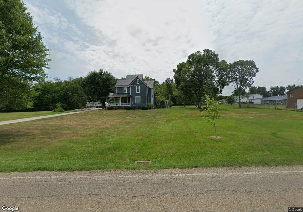
1360 W Main St Alliance, OH 44601
Estimated Value: $130,000 - $379,559
4
Beds
3
Baths
2,942
Sq Ft
$96/Sq Ft
Est. Value
About This Home
This home is located at 1360 W Main St, Alliance, OH 44601 and is currently estimated at $283,140, approximately $96 per square foot. 1360 W Main St is a home located in Stark County with nearby schools including Marlington High School and Regina Coeli/St Joseph School.
Ownership History
Date
Name
Owned For
Owner Type
Purchase Details
Closed on
Oct 4, 1999
Sold by
Hughes Kenneth and Polen Robert
Bought by
Jarvis Steven W and Jarvis Elizabeth A
Current Estimated Value
Home Financials for this Owner
Home Financials are based on the most recent Mortgage that was taken out on this home.
Original Mortgage
$147,250
Outstanding Balance
$44,461
Interest Rate
7.83%
Estimated Equity
$238,679
Purchase Details
Closed on
Sep 28, 1988
Create a Home Valuation Report for This Property
The Home Valuation Report is an in-depth analysis detailing your home's value as well as a comparison with similar homes in the area
Home Values in the Area
Average Home Value in this Area
Purchase History
| Date | Buyer | Sale Price | Title Company |
|---|---|---|---|
| Jarvis Steven W | $156,000 | Union Title Company | |
| -- | $45,000 | -- |
Source: Public Records
Mortgage History
| Date | Status | Borrower | Loan Amount |
|---|---|---|---|
| Open | Jarvis Steven W | $147,250 |
Source: Public Records
Tax History Compared to Growth
Tax History
| Year | Tax Paid | Tax Assessment Tax Assessment Total Assessment is a certain percentage of the fair market value that is determined by local assessors to be the total taxable value of land and additions on the property. | Land | Improvement |
|---|---|---|---|---|
| 2025 | -- | $111,300 | $37,590 | $73,710 |
| 2024 | -- | $111,300 | $37,590 | $73,710 |
| 2023 | $2,019 | $56,950 | $25,620 | $31,330 |
| 2022 | $2,026 | $56,950 | $25,620 | $31,330 |
| 2021 | $2,033 | $56,950 | $25,620 | $31,330 |
| 2020 | $1,944 | $48,520 | $22,090 | $26,430 |
| 2019 | $1,931 | $48,520 | $22,090 | $26,430 |
| 2018 | $1,934 | $48,520 | $22,090 | $26,430 |
| 2017 | $1,523 | $35,850 | $11,900 | $23,950 |
| 2016 | $1,479 | $34,800 | $11,410 | $23,390 |
| 2015 | $1,409 | $34,800 | $11,410 | $23,390 |
| 2014 | $1,568 | $35,390 | $11,620 | $23,770 |
| 2013 | $780 | $35,390 | $11,620 | $23,770 |
Source: Public Records
Map
Nearby Homes
- 0 W Main St Unit 5090123
- 432 Johnson Ave
- 616 Johnson Ave
- 000 Klinger Ave
- 520 W Cambridge St
- 1039 Glamorgan St
- 479 W High St
- 725 W Summit St
- 118 S Mckinley Ave
- 329 1/2 W Main St
- 970 Kingsway St
- 264 W Market St
- 1030 Sunset Dr
- 1050 Parkway Blvd
- 1201 Overlook Dr
- 228 W Oxford St
- 000 Meadowbrook Ave
- 1136 Parkway Blvd
- 163 W Market St
- 0 Meadowbrook Ave
- 1378 W Main St
- 94 Briarcliff Ave
- 72 Briarcliff Ave
- 1310 W Main St
- 142 Briarcliff Ave
- 192 Briarcliff Ave
- 190 Briarcliff Ave
- 190 192 Briarcliff
- 115 Briarcliff Ave
- 105 Florence Ave
- 1305 W Main St
- 1421 W Main St
- 29 Florence Ave
- 113 Florence Ave
- 228 Briarcliff Ave
- 121 Florence Ave
- 15 Florence Ave
- 171 Briarcliff Ave
- 129 Florence Ave
- 138 Bennington Rd NE