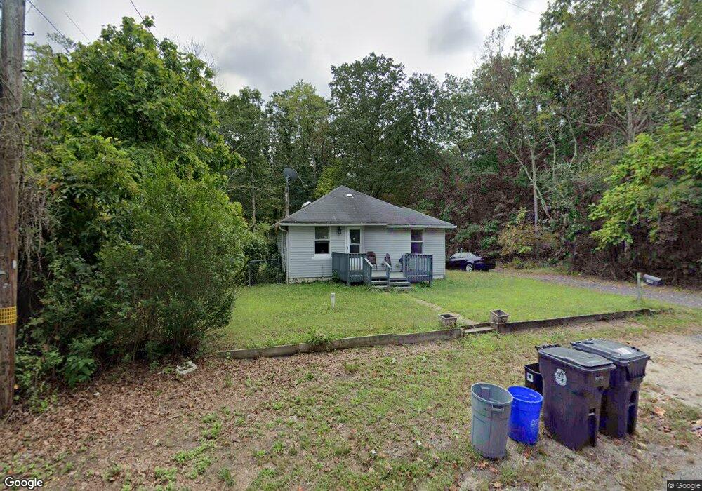
1360 W Point Ave Mays Landing, NJ 08330
Estimated Value: $146,000 - $172,000
2
Beds
1
Bath
720
Sq Ft
$215/Sq Ft
Est. Value
About This Home
This home is located at 1360 W Point Ave, Mays Landing, NJ 08330 and is currently estimated at $154,580, approximately $214 per square foot. 1360 W Point Ave is a home located in Atlantic County with nearby schools including Joseph Shaner School, George L. Hess Educational Complex, and William Davies Middle School.
Ownership History
Date
Name
Owned For
Owner Type
Purchase Details
Closed on
Sep 18, 2017
Sold by
West Sharon D and United State Od America
Bought by
Melton Kim
Current Estimated Value
Purchase Details
Closed on
Dec 23, 2003
Sold by
Repko Steven
Bought by
West Sharon D
Home Financials for this Owner
Home Financials are based on the most recent Mortgage that was taken out on this home.
Original Mortgage
$90,000
Interest Rate
6.01%
Mortgage Type
USDA
Purchase Details
Closed on
Jul 3, 2001
Sold by
Wells Fargo Bank Na
Bought by
Repko Steven
Home Financials for this Owner
Home Financials are based on the most recent Mortgage that was taken out on this home.
Original Mortgage
$46,550
Interest Rate
7.14%
Mortgage Type
Purchase Money Mortgage
Purchase Details
Closed on
Mar 13, 2001
Sold by
North Daniel A
Bought by
Wells Fargo Bank Na
Purchase Details
Closed on
Jul 28, 1999
Sold by
North Nicole
Bought by
North Daniel A
Home Financials for this Owner
Home Financials are based on the most recent Mortgage that was taken out on this home.
Original Mortgage
$56,250
Interest Rate
10.75%
Purchase Details
Closed on
Nov 8, 1991
Sold by
Upshaw Hattie
Bought by
North Daniel A and North Nicole
Create a Home Valuation Report for This Property
The Home Valuation Report is an in-depth analysis detailing your home's value as well as a comparison with similar homes in the area
Home Values in the Area
Average Home Value in this Area
Purchase History
| Date | Buyer | Sale Price | Title Company |
|---|---|---|---|
| Melton Kim | $13,700 | None Available | |
| West Sharon D | $79,900 | Fidelity National Title | |
| Repko Steven | $49,000 | -- | |
| Wells Fargo Bank Na | -- | -- | |
| North Daniel A | -- | -- | |
| North Daniel A | $35,000 | -- |
Source: Public Records
Mortgage History
| Date | Status | Borrower | Loan Amount |
|---|---|---|---|
| Previous Owner | West Sharon D | $90,000 | |
| Previous Owner | Repko Steven | $46,550 | |
| Previous Owner | North Daniel A | $56,250 |
Source: Public Records
Tax History Compared to Growth
Tax History
| Year | Tax Paid | Tax Assessment Tax Assessment Total Assessment is a certain percentage of the fair market value that is determined by local assessors to be the total taxable value of land and additions on the property. | Land | Improvement |
|---|---|---|---|---|
| 2025 | $2,302 | $67,100 | $25,400 | $41,700 |
| 2024 | $2,302 | $67,100 | $25,400 | $41,700 |
| 2023 | $2,165 | $67,100 | $25,400 | $41,700 |
| 2022 | $2,165 | $67,100 | $25,400 | $41,700 |
| 2021 | $2,160 | $67,100 | $25,400 | $41,700 |
| 2020 | $2,160 | $67,100 | $25,400 | $41,700 |
| 2019 | $2,165 | $67,100 | $25,400 | $41,700 |
| 2018 | $2,089 | $67,100 | $25,400 | $41,700 |
| 2017 | $2,057 | $67,100 | $25,400 | $41,700 |
| 2016 | $1,999 | $67,100 | $25,400 | $41,700 |
| 2015 | $1,931 | $67,100 | $25,400 | $41,700 |
| 2014 | $2,007 | $76,400 | $30,600 | $45,800 |
Source: Public Records
Map
Nearby Homes
- 1362 Annapolis Ave
- 1368 Sitka Ave
- 6917 Market St
- 6422 Strand Ave
- 6414 Strand Ave
- 1516 Thirty Third St
- 6839 Harding Hwy
- 0 Railroad Blvd
- 0 San Francisco Ave
- 0 0 Strand Ave
- 0 St Petersburg Ave Unit NJAC2011842
- 0 St Petersburg Ave Unit NJAC2011840
- 328 Llewellyn Ave
- 0 Merton Ave Unit NJAC2020566
- 0 South Ave
- 0 Division Ave
- 5485 Landis Ave
- 6752 Harding Hwy
- 1306 Harding Hwy
- 968 Main Ave
- 6889 Melvin Newton Blvd
- 1363 W Point Ave
- 1359 Memphis Ave
- 6886 Melvin Newton Blvd
- 1359 W Point Ave
- 1357 W Point Ave
- 6871 Melvin Newton Blvd
- 1355 W Point Ave
- 6903 Melvin Newton Blvd
- 1358 Annapolis Ave
- 1363 Annapolis Ave
- 1353 W Point Ave
- 1382 W Point Ave
- 1359 Annapolis Ave
- 6904 Melvin Newton Blvd
- 1351 W Point Ave
- 1385 W Point Ave
- 1378 Sitka Ave
- 6894 Market St
- 6866 Melvin Newton Blvd