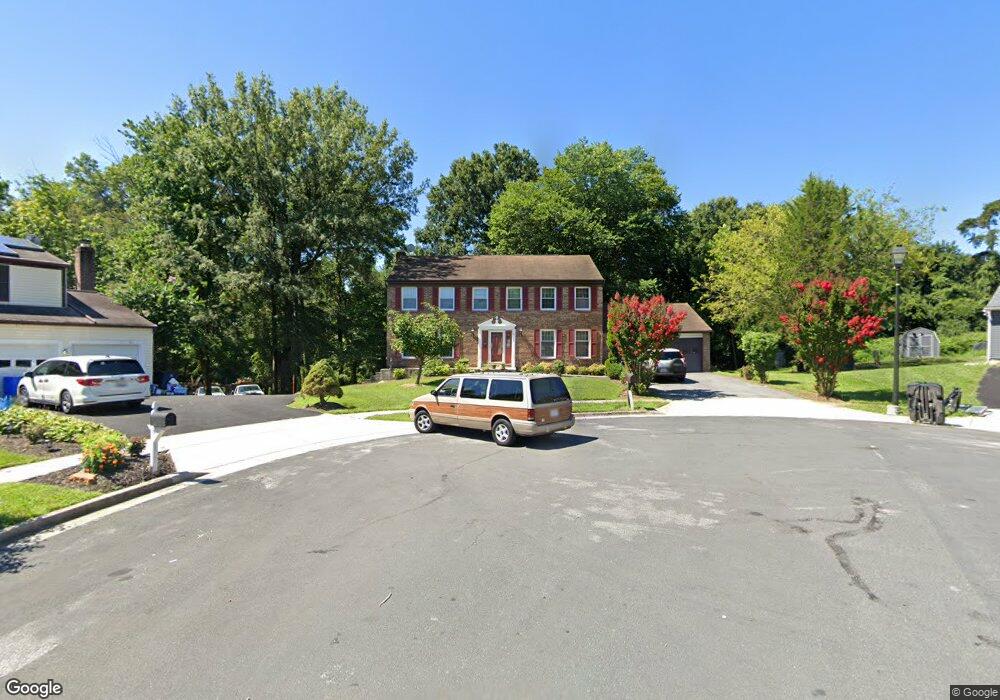
13600 Engleman Dr Laurel, MD 20708
South Laurel NeighborhoodEstimated Value: $573,161 - $634,000
Studio
3
Baths
2,352
Sq Ft
$259/Sq Ft
Est. Value
About This Home
This home is located at 13600 Engleman Dr, Laurel, MD 20708 and is currently estimated at $609,040, approximately $258 per square foot. 13600 Engleman Dr is a home located in Prince George's County with nearby schools including Oaklands Elementary School, Dwight D. Eisenhower Middle School, and Laurel High School.
Ownership History
Date
Name
Owned For
Owner Type
Purchase Details
Closed on
Jun 4, 2004
Sold by
Zaidi Baquer H
Bought by
Scott Juan
Current Estimated Value
Purchase Details
Closed on
May 28, 2004
Sold by
Zaidi Baquer H
Bought by
Scott Juan
Purchase Details
Closed on
Aug 25, 1995
Sold by
Kohler Richard C
Bought by
Zaidi Baquer H
Home Financials for this Owner
Home Financials are based on the most recent Mortgage that was taken out on this home.
Original Mortgage
$168,150
Interest Rate
7.32%
Purchase Details
Closed on
Sep 27, 1988
Sold by
Kohler Richard C
Bought by
Kohler Richard C and Gloria Damien
Create a Home Valuation Report for This Property
The Home Valuation Report is an in-depth analysis detailing your home's value as well as a comparison with similar homes in the area
Home Values in the Area
Average Home Value in this Area
Purchase History
We collect this data history from publicly available records. To have your information removed, we recommend requesting removal directly through your county’s website.
| Date | Buyer | Sale Price | Title Company |
|---|---|---|---|
| Scott Juan | $375,000 | -- | |
| Scott Juan | $375,000 | -- | |
| Zaidi Baquer H | $177,000 | -- | |
| Kohler Richard C | $29,500 | -- |
Source: Public Records
Mortgage History
We collect this data history from publicly available records. To have your information removed, we recommend requesting removal directly through your county’s website.
| Date | Status | Borrower | Loan Amount |
|---|---|---|---|
| Previous Owner | Zaidi Baquer H | $168,150 |
Source: Public Records
Tax History
| Year | Tax Paid | Tax Assessment Tax Assessment Total Assessment is a certain percentage of the fair market value that is determined by local assessors to be the total taxable value of land and additions on the property. | Land | Improvement |
|---|---|---|---|---|
| 2025 | $6,051 | $486,600 | $127,000 | $359,600 |
| 2024 | $6,051 | $456,700 | -- | -- |
| 2023 | $5,805 | $426,800 | $0 | $0 |
| 2022 | $5,501 | $396,900 | $102,000 | $294,900 |
| 2021 | $5,307 | $388,167 | $0 | $0 |
| 2020 | $5,235 | $379,433 | $0 | $0 |
| 2019 | $5,134 | $370,700 | $101,000 | $269,700 |
| 2018 | $4,971 | $354,833 | $0 | $0 |
| 2017 | $4,838 | $338,967 | $0 | $0 |
| 2016 | -- | $323,100 | $0 | $0 |
| 2015 | $4,484 | $308,267 | $0 | $0 |
| 2014 | $4,484 | $293,433 | $0 | $0 |
Source: Public Records
Map
Nearby Homes
- 13400 Oaklands Manor Dr
- 0 Railroad Ave
- 13203 Clarington Ct
- 14007 Briston St
- 14113 William St Unit 17-C
- 14111F William St
- 14019B Justin Way
- 14226 Yardarm Way Unit 109
- 14011 Vista Dr Unit 48
- 14405 Baltimore Ave
- 14010 Oxford Dr
- 7907 Crows Nest Ct Unit 11
- 14044 Vista Dr
- 0 Larchdale Rd Unit MDPG2200348
- 14042 Vista Dr Unit 109A
- 8493 Imperial Dr
- 14308 Bowsprit Ln Unit 11
- 7902 Bayshore Dr Unit 32
- 7906 Bayshore Dr
- 14220 Jib St
- 13602 Engleman Dr
- 13601 Engleman Dr
- 13604 Engleman Dr
- 13603 Engleman Dr
- 13606 Engleman Dr
- 13605 Engleman Dr
- 13608 Engleman Dr
- 13801 Brown Branch Rd
- 13607 Engleman Dr
- 13803 Brown Branch Rd
- 13610 Engleman Dr
- 8510 Briarcroft Ln
- 8512 Briarcroft Ln
- 13805 Brown Branch Rd
- 8413 Maple St
- 13800 Brown Branch Rd
- 8411 Maple St
- 13609 Engleman Dr
- 13612 Engleman Dr
- 13807 Brown Branch Rd
Your Personal Tour Guide
Ask me questions while you tour the home.