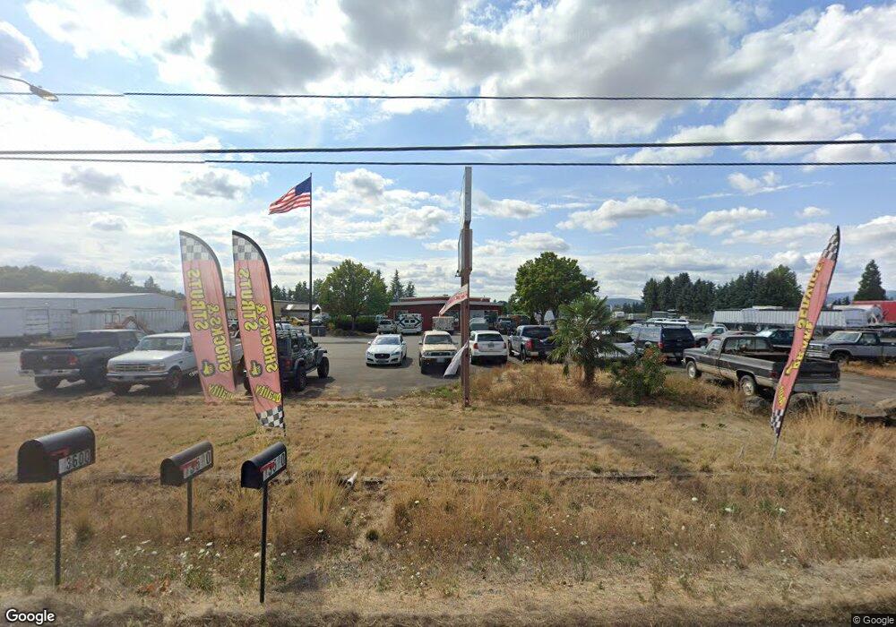
13600 SW Highway 99w McMinnville, OR 97128
Estimated Value: $622,000 - $972,000
2
Beds
3
Baths
1,600
Sq Ft
$505/Sq Ft
Est. Value
About This Home
This home is located at 13600 SW Highway 99w, McMinnville, OR 97128 and is currently estimated at $808,217, approximately $505 per square foot. 13600 SW Highway 99w is a home located in Yamhill County with nearby schools including Amity Elementary School, Amity Middle School, and Amity High School.
Ownership History
Date
Name
Owned For
Owner Type
Purchase Details
Closed on
Jul 15, 2022
Sold by
Squires Family 2 Llc
Bought by
Eagle Cap Industries Llc
Current Estimated Value
Home Financials for this Owner
Home Financials are based on the most recent Mortgage that was taken out on this home.
Original Mortgage
$800,000
Outstanding Balance
$589,072
Interest Rate
5.09%
Mortgage Type
Seller Take Back
Estimated Equity
$219,145
Purchase Details
Closed on
Feb 23, 2017
Sold by
Squires Robert V
Bought by
Squires Family 2 Llc
Purchase Details
Closed on
Aug 6, 2015
Sold by
Darling Phillip H and Darling Judith E
Bought by
Squires Robert V and Robert V Squires Trust
Create a Home Valuation Report for This Property
The Home Valuation Report is an in-depth analysis detailing your home's value as well as a comparison with similar homes in the area
Home Values in the Area
Average Home Value in this Area
Purchase History
| Date | Buyer | Sale Price | Title Company |
|---|---|---|---|
| Eagle Cap Industries Llc | $915,000 | First American Title | |
| Squires Family 2 Llc | -- | None Available | |
| Squires Robert V | $700,000 | First American Title |
Source: Public Records
Mortgage History
| Date | Status | Borrower | Loan Amount |
|---|---|---|---|
| Open | Eagle Cap Industries Llc | $800,000 |
Source: Public Records
Tax History Compared to Growth
Tax History
| Year | Tax Paid | Tax Assessment Tax Assessment Total Assessment is a certain percentage of the fair market value that is determined by local assessors to be the total taxable value of land and additions on the property. | Land | Improvement |
|---|---|---|---|---|
| 2024 | $4,123 | $299,723 | -- | -- |
| 2023 | $3,985 | $290,993 | $0 | $0 |
| 2022 | $3,630 | $282,517 | $0 | $0 |
| 2021 | $3,069 | $274,288 | $0 | $0 |
| 2020 | $2,975 | $266,299 | $0 | $0 |
| 2019 | $2,887 | $258,543 | $0 | $0 |
| 2018 | $2,838 | $251,013 | $0 | $0 |
| 2017 | $2,761 | $243,702 | $0 | $0 |
| 2016 | $2,682 | $236,604 | $0 | $0 |
| 2015 | $2,602 | $229,714 | $0 | $0 |
| 2014 | $2,512 | $217,925 | $0 | $0 |
Source: Public Records
Map
Nearby Homes
- 11946 SE Boyer Rd
- 0 SW River Bend Rd Unit 12202997
- 0 SW River Bend Rd Unit 23596154
- 4236 SE Whiteson Rd
- 0 SE Whiteson Rd
- 3406 SE Amity Dayton Hwy
- 1621 SW Mitchell Dr
- 1118 SW Wanetah Way
- 8720 SE Morgan Ln
- 1526 SW Cypress Ln
- 708 SW Taft St
- 0 SE Rice Ln Unit 608216853
- 0 SE Rice Ln Unit 826039
- 0 SE Rice Ln Unit 456061139
- 1501 SW Baker (#50) St Unit 50
- 1501 SW Baker St Unit 50
- 1501 SW Baker St Unit 13
- 1334 SW Blaine St
- 913 SE Angella Ct
- 1301 SW Melrose Ave
- 13580 SW Highway 99w
- 13580 SW Highway 99w Unit 1,2/8
- 13600 Oregon 99w
- 13999 SW Highway 99w
- 13180 SW Highway 99w
- 9005 SW Trestle View Ln
- 8628 SW River Bend Rd
- 9235 SW Trestle View Ln
- 9415 SW Trestle View Ln
- 8220 SW River Bend Rd
- 4231 SE Cherry Rd
- 14515 SE 1st St
- 14555 SE 1st St
- 4180 SE Cherry Rd
- 14650 SE 1st St
- 14680 SE 1st St
- 12300 SE Boyer Rd
- 8910 SW River Bend Rd
- 4230 SE Cherry Rd
- 4071 SE Whiteson Rd
