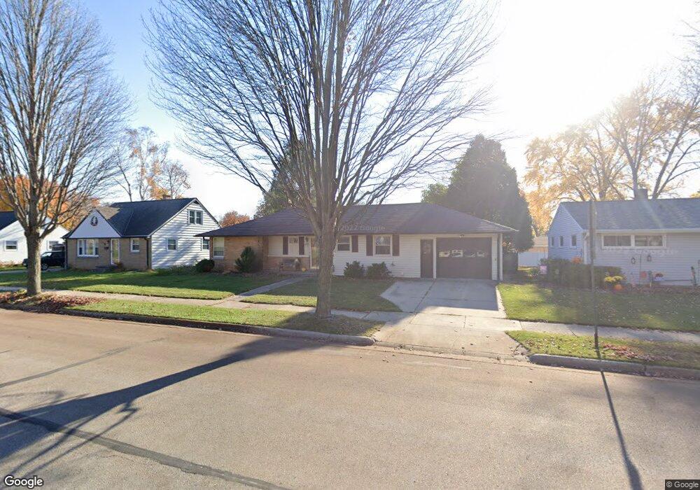
1361 Langlade Ave Green Bay, WI 54304
Colburn NeighborhoodEstimated Value: $278,022 - $303,000
--
Bed
--
Bath
--
Sq Ft
9,409
Sq Ft Lot
About This Home
This home is located at 1361 Langlade Ave, Green Bay, WI 54304 and is currently estimated at $294,506. 1361 Langlade Ave is a home located in Brown County with nearby schools including Jackson Elementary School, Franklin Middle School, and West High School.
Ownership History
Date
Name
Owned For
Owner Type
Purchase Details
Closed on
Dec 10, 1997
Sold by
Gardapee Allen P and Gardapee Sheri L
Bought by
Seif John D and Seif Susan M
Current Estimated Value
Home Financials for this Owner
Home Financials are based on the most recent Mortgage that was taken out on this home.
Original Mortgage
$84,150
Outstanding Balance
$14,400
Interest Rate
7.36%
Estimated Equity
$280,106
Create a Home Valuation Report for This Property
The Home Valuation Report is an in-depth analysis detailing your home's value as well as a comparison with similar homes in the area
Home Values in the Area
Average Home Value in this Area
Purchase History
| Date | Buyer | Sale Price | Title Company |
|---|---|---|---|
| Seif John D | $93,500 | Land Office Title Corporatio |
Source: Public Records
Mortgage History
| Date | Status | Borrower | Loan Amount |
|---|---|---|---|
| Open | Seif John D | $84,150 |
Source: Public Records
Tax History Compared to Growth
Tax History
| Year | Tax Paid | Tax Assessment Tax Assessment Total Assessment is a certain percentage of the fair market value that is determined by local assessors to be the total taxable value of land and additions on the property. | Land | Improvement |
|---|---|---|---|---|
| 2024 | $3,364 | $183,600 | $32,400 | $151,200 |
| 2023 | $3,199 | $183,600 | $32,400 | $151,200 |
| 2022 | $3,139 | $183,600 | $32,400 | $151,200 |
| 2021 | $2,631 | $118,500 | $22,600 | $95,900 |
| 2020 | $2,678 | $118,500 | $22,600 | $95,900 |
| 2019 | $2,586 | $118,500 | $22,600 | $95,900 |
| 2018 | $2,531 | $118,500 | $22,600 | $95,900 |
| 2017 | $2,511 | $118,500 | $22,600 | $95,900 |
| 2016 | $2,469 | $118,500 | $22,600 | $95,900 |
| 2015 | $2,575 | $118,500 | $22,600 | $95,900 |
| 2014 | $2,631 | $118,500 | $22,600 | $95,900 |
| 2013 | $2,631 | $118,500 | $22,600 | $95,900 |
Source: Public Records
Map
Nearby Homes
- 1348 Liberty St
- 1427 Russell St
- 1255 Loch Dr
- 1444 Liberty St
- 1252 Marian Ln
- 1428 Beauchamp St
- 1244 Liberty St
- 1500 S Fisk St
- 1212 9th St
- 1201 S Fisk St
- 1203 Spence St
- 1286 7th St
- 1181 Roscoe St
- 1526 Rockdale St
- 1123 S Fisk St
- 1122 Biemeret St
- 1507 Delores St
- 1110 Roscoe St
- 1527 N Mennen Ct
- 1749 S Oneida St Unit 1751
- 1367 Langlade Ave
- 1357 Langlade Ave
- 1362 Rockdale St
- 1356 Rockdale St
- 1366 Rockdale St
- 1373 Langlade Ave
- 1353 Langlade Ave
- 1362 Langlade Ave
- 1350 Rockdale St
- 1374 Rockdale St
- 1368 Langlade Ave
- 1345 Langlade Ave
- 1401 S Locust St
- 1372 Langlade Ave
- 1344 Rockdale St
- 1415 S Locust St
- 1378 Langlade Ave
- 1404 Briquelet St
- 1363 Russell St
- 1363 Rockdale St