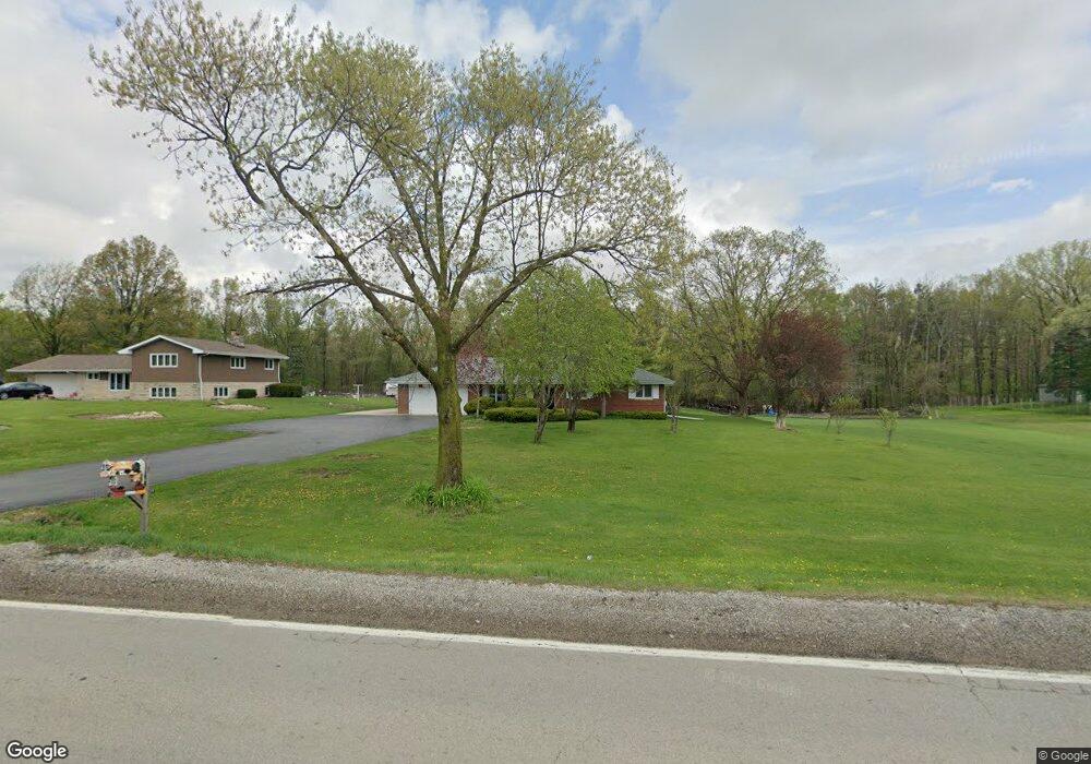
1361 W Maple Rd New Lenox, IL 60451
Estimated Value: $397,000 - $478,000
--
Bed
--
Bath
--
Sq Ft
1
Acres
About This Home
This home is located at 1361 W Maple Rd, New Lenox, IL 60451 and is currently estimated at $425,837. 1361 W Maple Rd is a home located in Will County with nearby schools including Oster-Oakview School, Haines Elementary School, and Lincoln Way West.
Ownership History
Date
Name
Owned For
Owner Type
Purchase Details
Closed on
May 17, 1995
Sold by
Wardinski Stanley G and Wardinski Debbie T
Bought by
Musial Joseph E and Musial Arlene E
Current Estimated Value
Home Financials for this Owner
Home Financials are based on the most recent Mortgage that was taken out on this home.
Original Mortgage
$76,000
Interest Rate
8.42%
Purchase Details
Closed on
Jun 27, 1991
Bought by
Musial Joseph E
Create a Home Valuation Report for This Property
The Home Valuation Report is an in-depth analysis detailing your home's value as well as a comparison with similar homes in the area
Home Values in the Area
Average Home Value in this Area
Purchase History
| Date | Buyer | Sale Price | Title Company |
|---|---|---|---|
| Musial Joseph E | $148,000 | Chicago Title Insurance Co | |
| Musial Joseph E | $118,500 | -- |
Source: Public Records
Mortgage History
| Date | Status | Borrower | Loan Amount |
|---|---|---|---|
| Closed | Musial Joseph E | $76,000 |
Source: Public Records
Tax History Compared to Growth
Tax History
| Year | Tax Paid | Tax Assessment Tax Assessment Total Assessment is a certain percentage of the fair market value that is determined by local assessors to be the total taxable value of land and additions on the property. | Land | Improvement |
|---|---|---|---|---|
| 2024 | $7,322 | $98,226 | $28,334 | $69,892 |
| 2023 | $7,322 | $89,541 | $25,829 | $63,712 |
| 2022 | $6,618 | $82,489 | $23,795 | $58,694 |
| 2021 | $5,835 | $77,578 | $22,378 | $55,200 |
| 2020 | $5,646 | $74,810 | $21,580 | $53,230 |
| 2019 | $5,385 | $72,490 | $20,911 | $51,579 |
| 2018 | $5,238 | $69,991 | $20,190 | $49,801 |
| 2017 | $4,959 | $67,979 | $19,610 | $48,369 |
| 2016 | $4,797 | $66,159 | $19,085 | $47,074 |
| 2015 | $4,617 | $64,076 | $18,484 | $45,592 |
| 2014 | $4,617 | $63,285 | $18,256 | $45,029 |
| 2013 | $4,617 | $64,138 | $18,502 | $45,636 |
Source: Public Records
Map
Nearby Homes
- 14119 W Maple Rd
- 3420 Avondale Ln
- 3301 Irondale Ct
- 1999 Silver Cross Blvd
- 0 Silver Cross Blvd
- 15711 Mueller Way
- 1001 Scottsdale Ln
- The Grace Plan at Prairie Ridge of New Lenox
- The Lauren Plan at Prairie Ridge of New Lenox
- The Katherine Front Porch Elevation Plan at Prairie Ridge of New Lenox
- 506 Navajo Dr
- 1106 Weston Way
- The Lauren Plan at Prairie Ridge North
- The Grace Plan at Prairie Ridge North
- The Katherine Front Porch Elevation Plan at Prairie Ridge North
- 1006 Mountain View Dr
- 15949 Prairie View Ct Unit T5
- 15959 Prairie View Ct Unit T6
- 1301 Silver Cross Blvd
- 16146 W Oak Ave
- 1361 W Maple Rd
- 1371 W Maple Rd
- 1331 W Maple Rd
- 1381 W Maple Rd
- 3701 Wimborne Ave
- 3627 Wimborne Ave
- 3703 Wimborne Ave
- 3623 Wimborne Ave
- 1391 W Maple Rd
- 3705 Wimborne Ave
- 3621 Wimborne Ave
- 1311 W Maple Rd
- 3702 Wimborne Ave
- 1401 W Maple Rd
- 3624 Wimborne Ave
- 3704 Wimborne Ave
- 3707 Wimborne Ave
- 3619 Wimborne Ave
- 3620 Wimborne Ave
- 3706 Wimborne Ave