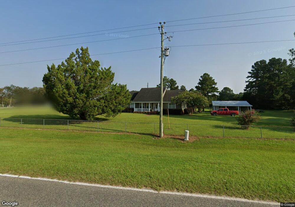
13610 Raybon Rd E Nahunta, GA 31553
Estimated Value: $289,000 - $382,000
3
Beds
2
Baths
1,933
Sq Ft
$173/Sq Ft
Est. Value
About This Home
This home is located at 13610 Raybon Rd E, Nahunta, GA 31553 and is currently estimated at $333,973, approximately $172 per square foot. 13610 Raybon Rd E is a home with nearby schools including Nahunta Primary School, Nahunta Elementary School, and Brantley County Middle School.
Ownership History
Date
Name
Owned For
Owner Type
Purchase Details
Closed on
Jul 29, 2005
Sold by
Boatwright Frankie
Bought by
Goss Emily D
Current Estimated Value
Create a Home Valuation Report for This Property
The Home Valuation Report is an in-depth analysis detailing your home's value as well as a comparison with similar homes in the area
Purchase History
| Date | Buyer | Sale Price | Title Company |
|---|---|---|---|
| Goss Emily D | $42,000 | -- |
Source: Public Records
Tax History
| Year | Tax Paid | Tax Assessment Tax Assessment Total Assessment is a certain percentage of the fair market value that is determined by local assessors to be the total taxable value of land and additions on the property. | Land | Improvement |
|---|---|---|---|---|
| 2025 | $2,371 | $115,428 | $7,399 | $108,029 |
| 2024 | $2,444 | $85,925 | $4,654 | $81,271 |
| 2023 | $322 | $85,501 | $4,230 | $81,271 |
| 2022 | $2,423 | $84,501 | $4,230 | $80,271 |
| 2021 | $1,948 | $55,428 | $4,230 | $51,198 |
| 2020 | $2,005 | $55,428 | $4,230 | $51,198 |
| 2019 | $2,003 | $55,428 | $4,230 | $51,198 |
| 2018 | $2,203 | $64,804 | $8,496 | $56,308 |
| 2017 | $2,203 | $64,804 | $8,496 | $56,308 |
| 2016 | $2,382 | $64,804 | $8,496 | $56,308 |
| 2015 | -- | $64,804 | $8,496 | $56,308 |
Source: Public Records
Map
Nearby Homes
- 14375 U S 301
- 3362 Seed Orchard Rd
- 0 Woodrow Ln
- 4452 Pembers Rd
- 4432 Pembers Rd
- 828 Knox St
- 86 Smith Dr
- 109 Rainge St
- 4921 Hwy 301 S Hwy
- 387 Burton St
- 20.55 ACRES Highway 82
- 154 Avalon St
- 92 Ervin St
- 1365 Ballfield Rd
- 255 Spell Landing Rd
- 4561 Buffalo Creek Dr
- 603 Cumberland Rd
- 00 Robin Ln
- 0 Robin Ln
- 751 Fort McIntosh Loop
- 115-A Raybon Rock Rd
- 14099 Highway 301 N
- 14188 Highway 301 N
- 97 Loblolly Ln
- 13491 Raybon Rd W
- 75 Loblolly Ln
- 133 Loblolly Ln
- 13454 Raybon Rd W
- 13404 Raybon Rd W
- 14375 Hwy 301 N
- 142 Laural Rd
- 13410 Raybon Rd W
- 0 Hwy 301 Unit TRACT 3039739
- 194 Laural Rd
- 397 McDonald Loop
- 13929 Raybon Rd E
- 14403 U S 301
- 13835 Raybon Rd E
- 382 McDonald Loop
- 247 Varnie Trail
Your Personal Tour Guide
Ask me questions while you tour the home.