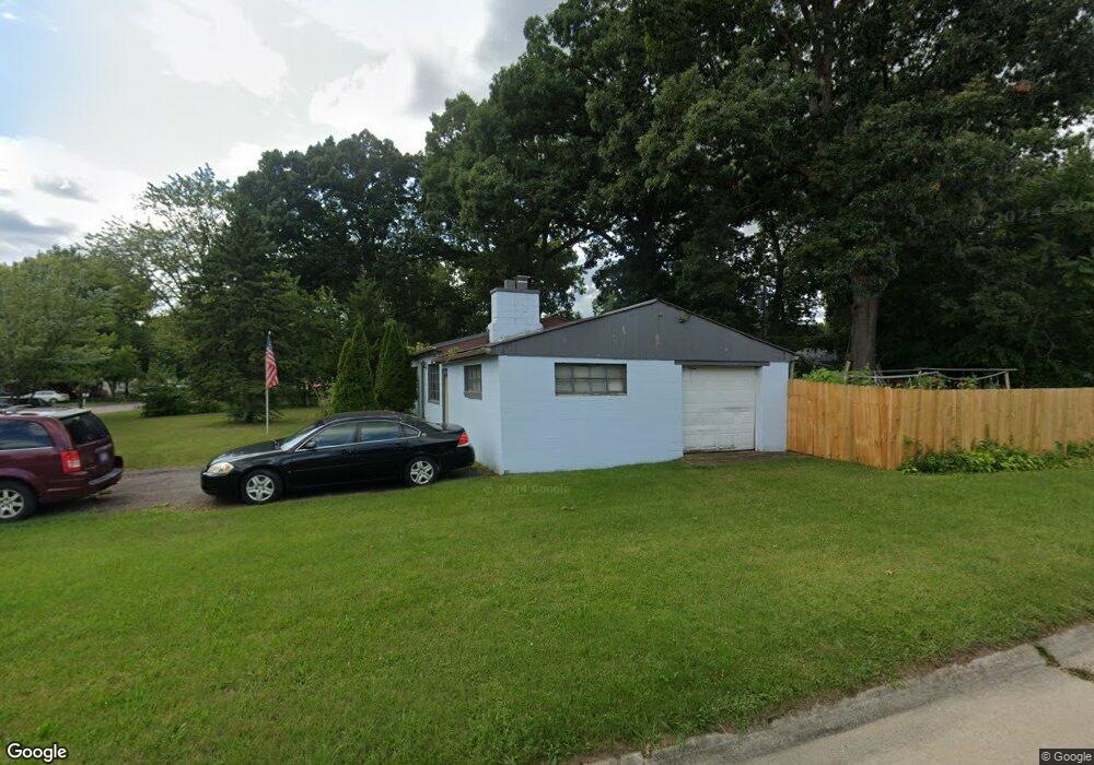
13616 Marvin St Taylor, MI 48180
Estimated Value: $155,000 - $172,000
3
Beds
1
Bath
1,000
Sq Ft
$163/Sq Ft
Est. Value
About This Home
This home is located at 13616 Marvin St, Taylor, MI 48180 and is currently estimated at $163,170, approximately $163 per square foot. 13616 Marvin St is a home located in Wayne County with nearby schools including Eureka Heights Elementary School, Hoover Middle School, and Taylor High School.
Ownership History
Date
Name
Owned For
Owner Type
Purchase Details
Closed on
Feb 3, 2010
Sold by
The Bank Of New York Trust Company Na
Bought by
Patel Piyush
Current Estimated Value
Purchase Details
Closed on
Jun 17, 2009
Sold by
Deangelis John
Bought by
The Bank Of New York Trust Company Na and The Bank Of New York Mellon Trust Compan
Purchase Details
Closed on
Sep 30, 2005
Sold by
Clark Russell E
Bought by
Deangelis John
Create a Home Valuation Report for This Property
The Home Valuation Report is an in-depth analysis detailing your home's value as well as a comparison with similar homes in the area
Home Values in the Area
Average Home Value in this Area
Purchase History
| Date | Buyer | Sale Price | Title Company |
|---|---|---|---|
| Patel Piyush | $10,000 | Rels Title | |
| The Bank Of New York Trust Company Na | $74,926 | None Available | |
| Deangelis John | $94,900 | Metropolitan Title Company |
Source: Public Records
Tax History Compared to Growth
Tax History
| Year | Tax Paid | Tax Assessment Tax Assessment Total Assessment is a certain percentage of the fair market value that is determined by local assessors to be the total taxable value of land and additions on the property. | Land | Improvement |
|---|---|---|---|---|
| 2025 | $1,287 | $66,800 | $0 | $0 |
| 2024 | $1,287 | $62,100 | $0 | $0 |
| 2023 | $1,568 | $52,900 | $0 | $0 |
| 2022 | $1,228 | $43,300 | $0 | $0 |
| 2021 | $1,376 | $37,800 | $0 | $0 |
| 2020 | $1,363 | $37,700 | $0 | $0 |
| 2019 | $135,866 | $31,000 | $0 | $0 |
| 2018 | $1,055 | $25,000 | $0 | $0 |
| 2017 | $1,072 | $24,400 | $0 | $0 |
| 2016 | $1,682 | $23,800 | $0 | $0 |
| 2015 | $2,640 | $26,400 | $0 | $0 |
| 2013 | $2,940 | $30,200 | $0 | $0 |
| 2012 | $1,255 | $29,800 | $14,100 | $15,700 |
Source: Public Records
Map
Nearby Homes
- 13744 Mcguire St
- 13717 Fellrath St
- 13753 Mcguire St
- 13529 Fellrath St
- 13161 Golf Pointe Dr
- 14611 Mcguire St
- 25158 Superior Rd
- 14634 Mcguire St
- 00000 Northline Rd
- 14712 Marvin St
- 25007 Cary St
- 26531 Eureka Rd
- 15354 Oldham St
- 15350 Gulley St
- 14442 Buck St
- 15425 Leader St
- 15684 Mcguire St
- 14621 New York St
- 15143 Siebert St
- 11693 Partridge Dr
- 13615 Fellrath St
- 13605 Fellrath St
- 13633 Fellrath St
- 13650 Marvin St
- 13613 Marvin St
- 13621 Marvin St
- 13605 Marvin St
- 13655 Fellrath St
- 13629 Marvin St
- 13641 Marvin St
- 13540 Marvin St
- 13653 Marvin St
- 13669 Fellrath St
- 13528 Marvin St
- 13565 Marvin St
- 13665 Marvin St Unit Bldg-Unit
- 13665 Marvin St
- 13675 Fellrath St
- 13673 Marvin St
- 13504 Marvin St