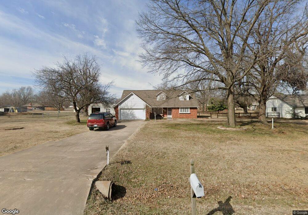
13616 S Mingo Rd Bixby, OK 74008
North Bixby NeighborhoodEstimated Value: $313,000 - $373,000
4
Beds
2
Baths
2,750
Sq Ft
$126/Sq Ft
Est. Value
About This Home
This home is located at 13616 S Mingo Rd, Bixby, OK 74008 and is currently estimated at $346,493, approximately $125 per square foot. 13616 S Mingo Rd is a home located in Tulsa County with nearby schools including Bixby East Elementary, Bixby Middle School, and Bixby High School.
Ownership History
Date
Name
Owned For
Owner Type
Purchase Details
Closed on
Jan 9, 2018
Sold by
Brant Scott and Brant Karen E
Bought by
Brant Scott and Brant Karen E
Current Estimated Value
Home Financials for this Owner
Home Financials are based on the most recent Mortgage that was taken out on this home.
Original Mortgage
$110,000
Interest Rate
3.94%
Mortgage Type
New Conventional
Purchase Details
Closed on
Aug 12, 2002
Sold by
Brant Karen E and Blair Wilma F
Bought by
Brant Karen E
Create a Home Valuation Report for This Property
The Home Valuation Report is an in-depth analysis detailing your home's value as well as a comparison with similar homes in the area
Home Values in the Area
Average Home Value in this Area
Purchase History
| Date | Buyer | Sale Price | Title Company |
|---|---|---|---|
| Brant Scott | -- | Chicago Title Oklahoma | |
| Brant Karen E | -- | Chicago Title Oklahoma | |
| Blair Wilma F | -- | -- |
Source: Public Records
Mortgage History
| Date | Status | Borrower | Loan Amount |
|---|---|---|---|
| Closed | Brant Scott | $110,000 |
Source: Public Records
Tax History Compared to Growth
Tax History
| Year | Tax Paid | Tax Assessment Tax Assessment Total Assessment is a certain percentage of the fair market value that is determined by local assessors to be the total taxable value of land and additions on the property. | Land | Improvement |
|---|---|---|---|---|
| 2024 | $3,114 | $23,373 | $3,003 | $20,370 |
| 2023 | $3,114 | $22,260 | $3,064 | $19,196 |
| 2022 | $2,979 | $21,200 | $3,910 | $17,290 |
| 2021 | $2,652 | $20,191 | $3,724 | $16,467 |
| 2020 | $2,618 | $19,807 | $3,653 | $16,154 |
| 2019 | $2,502 | $18,864 | $3,479 | $15,385 |
| 2018 | $2,367 | $18,007 | $3,321 | $14,686 |
| 2017 | $2,352 | $18,007 | $3,321 | $14,686 |
| 2016 | $2,288 | $17,733 | $3,321 | $14,412 |
| 2015 | $2,108 | $17,733 | $3,321 | $14,412 |
| 2014 | $2,004 | $16,269 | $3,047 | $13,222 |
Source: Public Records
Map
Nearby Homes
- 9533 E 136th St S
- 13503 102nd East Ave
- 13503 S 102nd East Ave
- 10101 E 134th Place S
- 13542 S 91st East Ave
- 10020 E 135th Place
- 10116 E 135th Place
- KINGSTON Plan at Haikey Creek Estates
- HUNTSVILLE Plan at Haikey Creek Estates
- HOLDEN Plan at Haikey Creek Estates
- JUSTIN Plan at Haikey Creek Estates
- IRVING Plan at Haikey Creek Estates
- CALI Plan at Haikey Creek Estates
- LAREDO Plan at Haikey Creek Estates
- 13450 S 101st East Ave
- 13468 S 101st East Ave
- 10204 E 131st Place S
- 9533 E 131st Place S
- 9516 E 131st Place S
- 10417 E 131st Place S
- 13704 S Mingo Rd
- 13620 S Mingo Rd
- 13617 S 95th East Ave
- 13705 S 95th East Ave
- 13609 S 95th East Ave
- 13712 S Mingo Rd
- 13600 S Mingo Rd
- 13713 S 95th East Ave
- 9512 E 136th St S
- 13507 S 95th Ave E
- 13720 S Mingo Rd
- 9499 E 137th St S
- 13721 S 95th East Ave
- 9498 E 137th St S
- 13608 S 95th East Ave
- 13428 S 95th Ave E
- 9517 E 136th St S
- 13800 S Mingo Rd
- 9493 E 137th St S
- 9501 E 136th St S