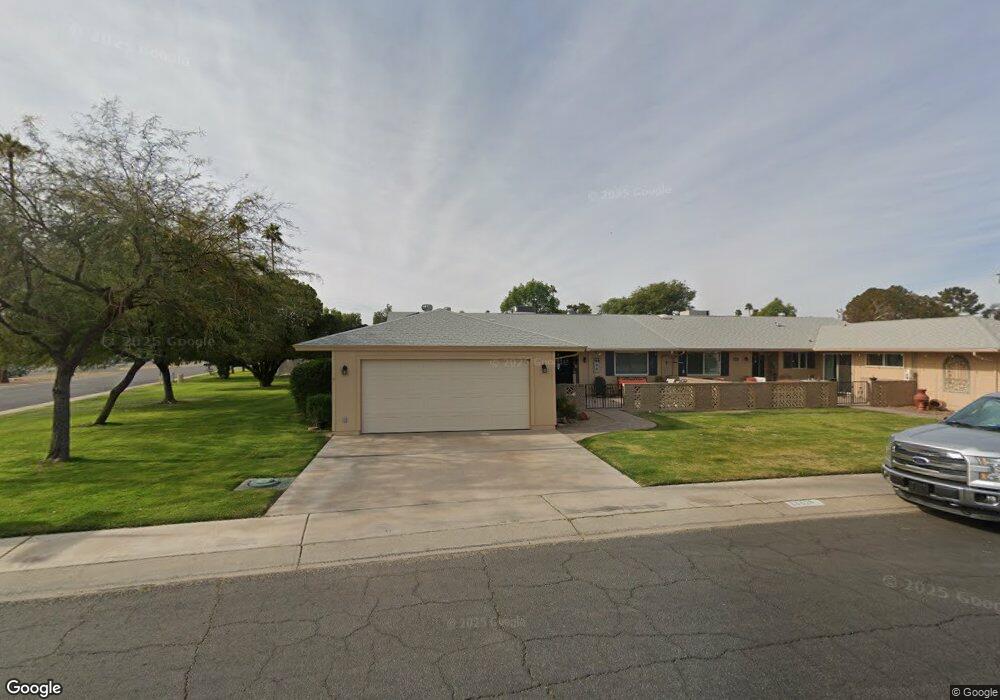
13618 N Lancaster Dr Sun City, AZ 85351
Estimated Value: $260,000 - $291,000
2
Beds
2
Baths
1,683
Sq Ft
$163/Sq Ft
Est. Value
About This Home
This home is located at 13618 N Lancaster Dr, Sun City, AZ 85351 and is currently estimated at $274,814, approximately $163 per square foot. 13618 N Lancaster Dr is a home located in Maricopa County with nearby schools including Desert Mirage Elementary School, Ombudsman - Northwest Charter, and Arrowhead Montessori.
Ownership History
Date
Name
Owned For
Owner Type
Purchase Details
Closed on
Jul 18, 2011
Sold by
Us Bank National Association
Bought by
Blair Cheryl A and Blair Duane E
Current Estimated Value
Purchase Details
Closed on
Sep 21, 2006
Sold by
Kinser Ranch L
Bought by
Kinser Connie L
Home Financials for this Owner
Home Financials are based on the most recent Mortgage that was taken out on this home.
Original Mortgage
$157,000
Interest Rate
6.75%
Mortgage Type
New Conventional
Purchase Details
Closed on
Apr 11, 2005
Sold by
Moffatt John H and Moffatt Marjorie M
Bought by
Kinser Rance L and Kinser Connie L
Purchase Details
Closed on
Feb 4, 2000
Sold by
Nigus Lawrence W and Nigus Shirley C
Bought by
Moffatt John H and Moffatt Marjorie M
Home Financials for this Owner
Home Financials are based on the most recent Mortgage that was taken out on this home.
Original Mortgage
$70,100
Interest Rate
8.26%
Create a Home Valuation Report for This Property
The Home Valuation Report is an in-depth analysis detailing your home's value as well as a comparison with similar homes in the area
Home Values in the Area
Average Home Value in this Area
Purchase History
| Date | Buyer | Sale Price | Title Company |
|---|---|---|---|
| Blair Cheryl A | -- | Servicelink | |
| Kinser Connie L | -- | Camelback Title Agency Llc | |
| Kinser Rance L | $142,500 | First American Title Ins Co | |
| Moffatt John H | $98,100 | First American Title |
Source: Public Records
Mortgage History
| Date | Status | Borrower | Loan Amount |
|---|---|---|---|
| Previous Owner | Kinser Connie L | $157,000 | |
| Previous Owner | Moffatt John H | $70,100 |
Source: Public Records
Tax History Compared to Growth
Tax History
| Year | Tax Paid | Tax Assessment Tax Assessment Total Assessment is a certain percentage of the fair market value that is determined by local assessors to be the total taxable value of land and additions on the property. | Land | Improvement |
|---|---|---|---|---|
| 2025 | $923 | $11,425 | -- | -- |
| 2024 | $832 | $10,881 | -- | -- |
| 2023 | $832 | $19,510 | $3,900 | $15,610 |
| 2022 | $783 | $16,980 | $3,390 | $13,590 |
| 2021 | $809 | $15,460 | $3,090 | $12,370 |
| 2020 | $788 | $13,770 | $2,750 | $11,020 |
| 2019 | $777 | $13,110 | $2,620 | $10,490 |
| 2018 | $748 | $11,630 | $2,320 | $9,310 |
| 2017 | $722 | $10,170 | $2,030 | $8,140 |
| 2016 | $677 | $8,280 | $1,650 | $6,630 |
| 2015 | $647 | $7,970 | $1,590 | $6,380 |
Source: Public Records
Map
Nearby Homes
- 13605 N Redwood Dr
- 13606 N Redwood Dr Unit 209
- 9935 W Thunderbird Blvd
- 13636 N Redwood Dr Unit 203
- 10019 W Thunderbird Blvd
- 10012 W Bolivar Dr
- 13614 N Hawthorn Dr
- 10072 W Lancaster Dr Unit 24B
- 13620 N Hawthorn Dr
- 9971 W Bolivar Dr
- 13428 N 100th Ave
- 13433 N Emberwood Dr
- 10038 W Lancaster Dr
- 10050 W Lancaster Dr
- 9961 W Bolivar Dr
- 10112 W Forrester Dr
- 13442 N Emberwood Dr
- 13832 N Crown Point
- 13420 N Emberwood Dr
- 13222 N 99th Dr
- 13618 N Lancaster Dr Unit 20
- 13622 N Lancaster Dr
- 13607 N Teakwood Dr Unit 20
- 13601 N Teakwood Dr Unit 225
- 13628 N Lancaster Dr
- 13615 N Teakwood Dr
- 13621 W Lancaster Dr
- 13632 N Lancaster Dr Unit 231
- 13619 N Teakwood Dr
- 13625 N Lancaster Dr
- 13627 N Teakwood Dr
- 9927 W Thunderbird Blvd Unit 24B
- 9933 W Thunderbird Blvd
- 9929 W Lancaster Dr
- 9931 W Lancaster Dr
- 9933 W Lancaster Dr
- 13631 N Teakwood Dr
- 9935 W Lancaster Dr
- 9937 W Thunderbird Blvd Unit 24B
- 10080 W Lancaster Dr