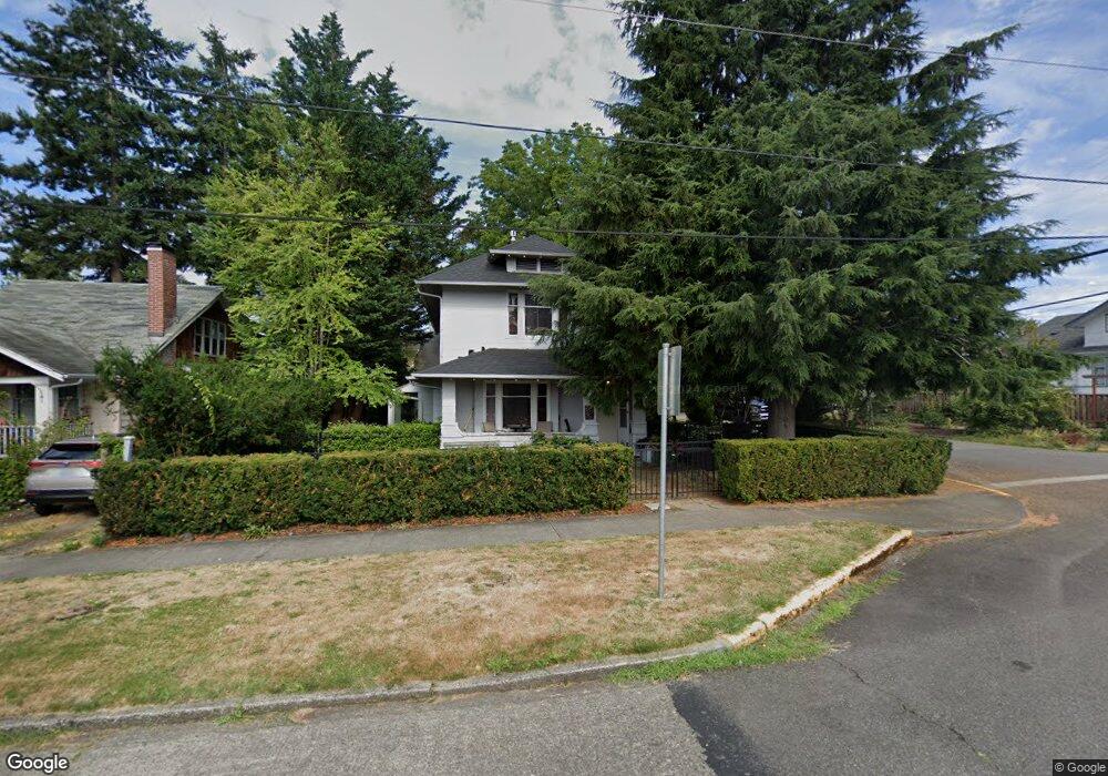
1362 Porter St Enumclaw, WA 98022
Estimated Value: $504,000 - $624,000
4
Beds
2
Baths
1,720
Sq Ft
$321/Sq Ft
Est. Value
About This Home
This home is located at 1362 Porter St, Enumclaw, WA 98022 and is currently estimated at $552,789, approximately $321 per square foot. 1362 Porter St is a home located in King County with nearby schools including Byron Kibler Elementary School, Enumclaw Middle School, and Enumclaw Senior High School.
Ownership History
Date
Name
Owned For
Owner Type
Purchase Details
Closed on
Apr 5, 2005
Sold by
Swain Linda D and Swain Linda Diane
Bought by
Swain Linda D and Eshpeter Tiffen
Current Estimated Value
Home Financials for this Owner
Home Financials are based on the most recent Mortgage that was taken out on this home.
Original Mortgage
$190,362
Interest Rate
5.72%
Purchase Details
Closed on
Dec 1, 1988
Sold by
Anthony Gregory N and Anthony Jerry S
Bought by
Eshpeter Linda Diane
Create a Home Valuation Report for This Property
The Home Valuation Report is an in-depth analysis detailing your home's value as well as a comparison with similar homes in the area
Home Values in the Area
Average Home Value in this Area
Purchase History
| Date | Buyer | Sale Price | Title Company |
|---|---|---|---|
| Swain Linda D | $54,561 | First American | |
| Eshpeter Linda Diane | $60,000 | -- |
Source: Public Records
Mortgage History
| Date | Status | Borrower | Loan Amount |
|---|---|---|---|
| Previous Owner | Swain Linda D | $190,362 |
Source: Public Records
Tax History
| Year | Tax Paid | Tax Assessment Tax Assessment Total Assessment is a certain percentage of the fair market value that is determined by local assessors to be the total taxable value of land and additions on the property. | Land | Improvement |
|---|---|---|---|---|
| 2024 | $4,570 | $476,000 | $170,000 | $306,000 |
| 2023 | $4,238 | $408,000 | $146,000 | $262,000 |
| 2022 | $3,845 | $466,000 | $167,000 | $299,000 |
| 2021 | $3,185 | $383,000 | $144,000 | $239,000 |
| 2020 | $2,908 | $289,000 | $93,000 | $196,000 |
| 2018 | $2,906 | $262,000 | $86,000 | $176,000 |
| 2017 | $2,578 | $237,000 | $79,000 | $158,000 |
| 2016 | $2,462 | $217,000 | $73,000 | $144,000 |
| 2015 | $2,483 | $204,000 | $69,000 | $135,000 |
| 2014 | -- | $197,000 | $76,000 | $121,000 |
| 2013 | -- | $152,000 | $61,000 | $91,000 |
Source: Public Records
Map
Nearby Homes
- 1318 Lafromboise St
- 1107 Griffin Ave
- 2054 Roosevelt Ave
- 1705 Marshall Ave
- 1722 Harding St
- 1137 Spruce Dr
- 1170 Cedar Dr
- 1730 Hillcrest Ave
- 431 Rainier Ave
- 823 Cottonwood Dr
- 806 Pine Dr
- 915 Mountain Villa Dr
- 930 Mountain Villa Dr
- 520 Willow Dr Unit 111
- 936 Mountain Villa Dr
- 525 Grand Fir Dr
- 607 Bathke Ave
- 1966 Wilson Ave
- 2707 Initial Place
- 1975 Wilson Ave
Your Personal Tour Guide
Ask me questions while you tour the home.