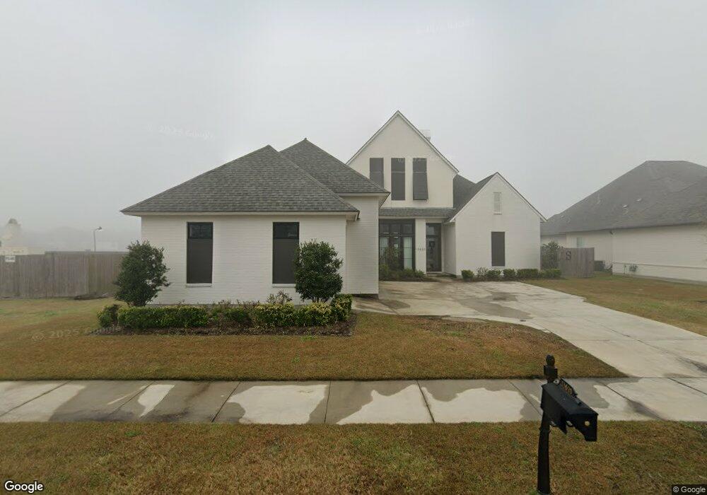
13620 Brook Point Dr Baton Rouge, LA 70810
Estimated Value: $616,000 - $836,000
--
Bed
--
Bath
--
Sq Ft
0.26
Acres
About This Home
This home is located at 13620 Brook Point Dr, Baton Rouge, LA 70810 and is currently estimated at $738,218. 13620 Brook Point Dr is a home with nearby schools including Magnolia Woods Elementary School, Westdale Middle School, and Tara High School.
Ownership History
Date
Name
Owned For
Owner Type
Purchase Details
Closed on
Jan 27, 2023
Sold by
Waters Edge Llc
Bought by
Level Construction & Development Llc
Current Estimated Value
Home Financials for this Owner
Home Financials are based on the most recent Mortgage that was taken out on this home.
Original Mortgage
$857,528
Outstanding Balance
$830,525
Interest Rate
6.31%
Mortgage Type
New Conventional
Estimated Equity
-$92,307
Purchase Details
Closed on
Nov 8, 2018
Sold by
Lexington Land Development Llc
Bought by
Stevens Chad Michael and Stevens Melissa Marie
Create a Home Valuation Report for This Property
The Home Valuation Report is an in-depth analysis detailing your home's value as well as a comparison with similar homes in the area
Home Values in the Area
Average Home Value in this Area
Purchase History
| Date | Buyer | Sale Price | Title Company |
|---|---|---|---|
| Level Construction & Development Llc | $857,528 | None Listed On Document | |
| Level Const & Development Llc | $857,528 | None Listed On Document | |
| Stevens Chad Michael | $129,900 | None Available |
Source: Public Records
Mortgage History
| Date | Status | Borrower | Loan Amount |
|---|---|---|---|
| Open | Level Const & Development Llc | $857,528 | |
| Closed | Level Const & Development Llc | $857,528 |
Source: Public Records
Tax History Compared to Growth
Tax History
| Year | Tax Paid | Tax Assessment Tax Assessment Total Assessment is a certain percentage of the fair market value that is determined by local assessors to be the total taxable value of land and additions on the property. | Land | Improvement |
|---|---|---|---|---|
| 2024 | $6,287 | $60,460 | $12,990 | $47,470 |
| 2023 | $6,287 | $52,460 | $12,990 | $39,470 |
| 2022 | $6,102 | $52,460 | $12,990 | $39,470 |
| 2021 | $5,987 | $52,460 | $12,990 | $39,470 |
| 2020 | $5,897 | $52,460 | $12,990 | $39,470 |
| 2019 | $1,522 | $12,990 | $12,990 | $0 |
Source: Public Records
Map
Nearby Homes
- 13621 Brook Point Dr
- 2855 Grand Way Ave
- 2713 Grand Way Ave
- 2538 Ebb Ave
- Breton Plan at Water's Edge
- Bourget Plan at Water's Edge
- Vermillion Plan at Water's Edge
- Amite Plan at Water's Edge
- Huron Plan at Water's Edge
- Seneca Plan at Water's Edge
- Lanier Plan at Water's Edge
- Cumberland Plan at Water's Edge
- Rayburn Plan at Water's Edge
- Victoria Plan at Water's Edge
- Martin Plan at Water's Edge
- Chicot Plan at Water's Edge
- Chelan Plan at Water's Edge
- Champlain Plan at Water's Edge
- Tensas Plan at Water's Edge
- Tahoe Plan at Water's Edge
- 13612 Brook Point Dr
- 13636 Brook Point Dr
- 13604 Brook Point Dr
- 13629 Brook Point Dr
- 13644 Brook Point Dr
- 13605 Brook Point Dr
- 2815 Grand Way Ave
- 13637 Brook Point Dr
- 2807 Grand Way Ave
- 13534 Grand Ridge Dr
- 13652 Brook Point Dr
- 13645 Brook Point Dr
- 2768 Grand Way Ave
- 2823 Grand Way Ave
- 2762 Grand Way Ave
- 2756 Grand Way Ave
- 13402 Kings Court Ave
- 2710 Shore Bend Ave
- 13526 Grand Ridge Dr
- 13660 Brook Point Dr