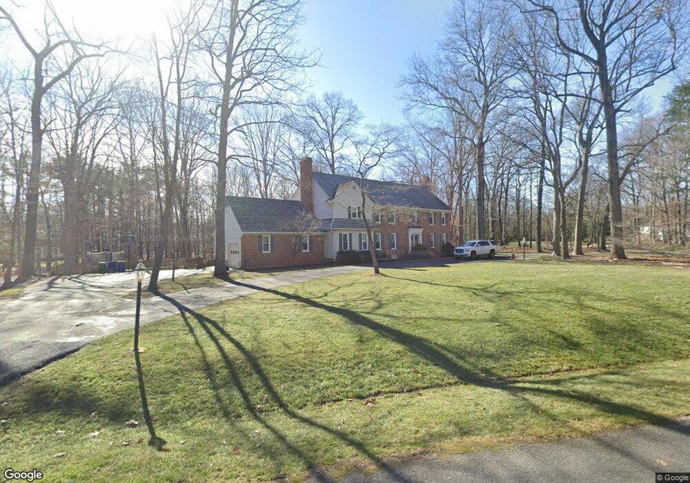
13621 Stonegate Rd Midlothian, VA 23113
Salisbury NeighborhoodEstimated Value: $674,000 - $1,013,000
5
Beds
4
Baths
3,964
Sq Ft
$219/Sq Ft
Est. Value
About This Home
This home is located at 13621 Stonegate Rd, Midlothian, VA 23113 and is currently estimated at $867,699, approximately $218 per square foot. 13621 Stonegate Rd is a home located in Chesterfield County with nearby schools including Bettie Weaver Elementary School, Midlothian Middle School, and Midlothian High School.
Ownership History
Date
Name
Owned For
Owner Type
Purchase Details
Closed on
May 26, 2021
Sold by
The Estate Of Dorothy M Heisler
Bought by
Nagle Ryan Kilpatrick
Current Estimated Value
Home Financials for this Owner
Home Financials are based on the most recent Mortgage that was taken out on this home.
Original Mortgage
$442,500
Outstanding Balance
$400,629
Interest Rate
2.9%
Mortgage Type
New Conventional
Estimated Equity
$467,070
Create a Home Valuation Report for This Property
The Home Valuation Report is an in-depth analysis detailing your home's value as well as a comparison with similar homes in the area
Home Values in the Area
Average Home Value in this Area
Purchase History
| Date | Buyer | Sale Price | Title Company |
|---|---|---|---|
| Nagle Ryan Kilpatrick | $595,000 | Attorney |
Source: Public Records
Mortgage History
| Date | Status | Borrower | Loan Amount |
|---|---|---|---|
| Open | Nagle Ryan Kilpatrick | $442,500 |
Source: Public Records
Tax History
| Year | Tax Paid | Tax Assessment Tax Assessment Total Assessment is a certain percentage of the fair market value that is determined by local assessors to be the total taxable value of land and additions on the property. | Land | Improvement |
|---|---|---|---|---|
| 2025 | $6,879 | $770,100 | $131,000 | $639,100 |
| 2024 | $6,879 | $718,500 | $111,000 | $607,500 |
| 2023 | $6,107 | $671,100 | $106,000 | $565,100 |
| 2022 | $5,821 | $632,700 | $103,000 | $529,700 |
| 2021 | $5,478 | $574,000 | $101,000 | $473,000 |
| 2020 | $5,290 | $554,200 | $101,000 | $453,200 |
| 2019 | $5,265 | $554,200 | $101,000 | $453,200 |
| 2018 | $4,985 | $529,200 | $101,000 | $428,200 |
| 2017 | $4,918 | $509,700 | $100,000 | $409,700 |
| 2016 | $4,822 | $502,300 | $96,000 | $406,300 |
| 2015 | $4,650 | $484,400 | $96,000 | $388,400 |
| 2014 | $4,479 | $466,600 | $96,000 | $370,600 |
Source: Public Records
Map
Nearby Homes
- 3030 Mount Hill Dr
- 2540 Kentford Rd
- 3000 Vistapoint Rd
- 13901 Dunkeld Terrace
- 13111 Powderham Ln
- 2303 Bream Dr
- 14113 Riverdowns South Dr
- 13637 Langford Dr
- 12901 River Hills Dr
- 14200 Southwell Ct
- 16033 Aspect Way
- 16112 Esteem Way
- 1175 Cardinal Crest Terrace
- 16037 Aspect Way
- 16116 Esteem Way
- 14321 Heathland Terrace
- 2940 River Hills Ln
- 3107 Handley Rd
- 13155 Sodbury Dr
- 14006 Grace Wood Place
- 13711 Lintel Ln
- 2701 Barrow Place
- 2711 Barrow Place
- 13620 Stonegate Rd
- 13630 Stonegate Rd
- 13700 Lintel Ln
- 2721 Barrow Place
- 13610 Stonegate Rd
- 13721 Lintel Ln
- 13720 Lintel Ln
- 13640 Stonegate Rd
- 13600 Stonegate Rd
- 13730 Lintel Ln
- 13731 Lintel Ln
- 2621 Ellesmere Dr
- 2700 Barrow Place
- 2741 Barrow Place
- 2631 Ellesmere Dr
- 2611 Ellesmere Dr
- 13651 Stonegate Rd
Your Personal Tour Guide
Ask me questions while you tour the home.