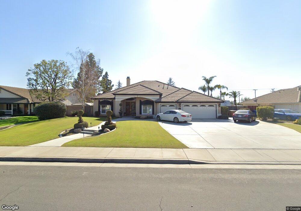
13621 Table Rock Ave Bakersfield, CA 93314
Estimated Value: $681,044 - $740,000
About This Home
This home is located at 13621 Table Rock Ave, Bakersfield, CA 93314 and is currently estimated at $718,011, approximately $271 per square foot. 13621 Table Rock Ave is a home located in Kern County with nearby schools including Patriot Elementary School, Freedom Middle School, and Frontier High School.
Ownership History
We collect this data history from publicly available records. To have your information removed, we recommend requesting removal directly through your county’s website.
Purchase Details
Purchase Details
Purchase Details
Home Financials for this Owner
Home Financials are based on the most recent Mortgage that was taken out on this home.Purchase Details
Home Financials for this Owner
Home Financials are based on the most recent Mortgage that was taken out on this home.Home Values in the Area
Average Home Value in this Area
Purchase History
We collect this data history from publicly available records. To have your information removed, we recommend requesting removal directly through your county’s website.
| Date | Buyer | Sale Price | Title Company |
|---|---|---|---|
| -- | None Available | ||
| -- | None Available | ||
| -- | Stewart Title | ||
| $325,000 | Stewart Title |
Mortgage History
We collect this data history from publicly available records. To have your information removed, we recommend requesting removal directly through your county’s website.
| Date | Status | Borrower | Loan Amount |
|---|---|---|---|
| Open | $175,000 |
Tax History
We collect this data history from publicly available records. To have your information removed, we recommend requesting removal directly through your county’s website.
| Year | Tax Paid | Tax Assessment Tax Assessment Total Assessment is a certain percentage of the fair market value that is determined by local assessors to be the total taxable value of land and additions on the property. | Land | Improvement |
|---|---|---|---|---|
| 2025 | $6,339 | $470,685 | $86,889 | $383,796 |
| 2024 | $6,149 | $461,457 | $85,186 | $376,271 |
| 2023 | $6,149 | $452,410 | $83,516 | $368,894 |
| 2022 | $6,024 | $443,540 | $81,879 | $361,661 |
| 2021 | $5,888 | $434,844 | $80,274 | $354,570 |
| 2020 | $5,805 | $430,386 | $79,451 | $350,935 |
| 2019 | $5,714 | $430,386 | $79,451 | $350,935 |
| 2018 | $5,587 | $413,675 | $76,367 | $337,308 |
| 2017 | $5,506 | $405,565 | $74,870 | $330,695 |
| 2016 | $5,120 | $397,613 | $73,402 | $324,211 |
| 2015 | $5,071 | $391,642 | $72,300 | $319,342 |
| 2014 | $4,949 | $383,971 | $70,884 | $313,087 |
Map
- 4214 Carosam Rd
- 3849 Jenkins Rd
- 14005 Austin Creek Ave
- 13620 Philip Phelps Ave
- 14104 La Cascada Ct
- 0 Rosedale Unit 202511650
- 13507 Velma Pearl Way
- 13544 Velma Pearl Way
- 13615 Velma Pearl Way
- 13508 Velma Pearl Way
- 14332 Table Rock Ave
- 55 Allen Rd
- 14328 Austin Creek Ave
- 13440 Atrium Ct
- 13307 Cheyenne Mountain Dr
- 13208 Cheyenne Mountain Dr
- 13201 Meacham Rd
- 13511 Cheyenne Mountain Dr
- 13101 Meacham Rd
- 13317 Boyd Lake Dr
- 13641 Table Rock Ave
- 13601 Table Rock Ave
- 13541 Table Rock Ave
- 13640 Table Rock Ave
- 13703 Table Rock Ave
- 13640 Smoke Creek Ave
- 13521 Table Rock Ave
- 13620 Smoke Creek Ave
- 13540 Table Rock Ave
- 13660 Smoke Creek Ave
- 13600 Smoke Creek Ave
- 13702 Table Rock Ave
- 13621 Cedar Creek Ave
- 13709 Table Rock Ave
- 13501 Table Rock Ave
- 13641 Cedar Creek Ave
- 13540 Smoke Creek Ave
- 13520 Table Rock Ave
- 13601 Cedar Creek Ave
- 13708 Table Rock Ave
Ask me questions while you tour the home.