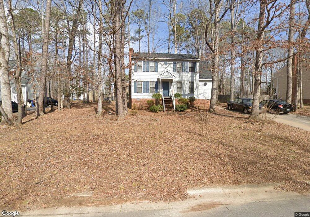
13624 Swale Ln Midlothian, VA 23112
Estimated Value: $348,000 - $376,000
3
Beds
3
Baths
1,640
Sq Ft
$222/Sq Ft
Est. Value
About This Home
This home is located at 13624 Swale Ln, Midlothian, VA 23112 and is currently estimated at $364,279, approximately $222 per square foot. 13624 Swale Ln is a home located in Chesterfield County with nearby schools including Alberta Smith Elementary School, Bailey Bridge Middle School, and Manchester High.
Ownership History
Date
Name
Owned For
Owner Type
Purchase Details
Closed on
Jan 31, 2003
Sold by
Hunsberger Leon G
Bought by
Battle Arthur R
Current Estimated Value
Home Financials for this Owner
Home Financials are based on the most recent Mortgage that was taken out on this home.
Original Mortgage
$141,058
Outstanding Balance
$61,028
Interest Rate
6.09%
Mortgage Type
VA
Estimated Equity
$303,251
Purchase Details
Closed on
Jun 6, 2002
Sold by
Cook Keith R
Bought by
Hunsberger Sandra J
Home Financials for this Owner
Home Financials are based on the most recent Mortgage that was taken out on this home.
Original Mortgage
$127,890
Interest Rate
6.9%
Mortgage Type
FHA
Purchase Details
Closed on
Nov 3, 1998
Sold by
Curley Kevin M and Curley Rosemarie A
Bought by
Cook Keith R and Cook Bridgett J
Create a Home Valuation Report for This Property
The Home Valuation Report is an in-depth analysis detailing your home's value as well as a comparison with similar homes in the area
Home Values in the Area
Average Home Value in this Area
Purchase History
| Date | Buyer | Sale Price | Title Company |
|---|---|---|---|
| Battle Arthur R | $136,950 | -- | |
| Hunsberger Sandra J | $129,000 | -- | |
| Cook Keith R | $109,500 | -- |
Source: Public Records
Mortgage History
| Date | Status | Borrower | Loan Amount |
|---|---|---|---|
| Open | Cook Keith R | $141,058 | |
| Previous Owner | Cook Keith R | $127,890 |
Source: Public Records
Tax History
| Year | Tax Paid | Tax Assessment Tax Assessment Total Assessment is a certain percentage of the fair market value that is determined by local assessors to be the total taxable value of land and additions on the property. | Land | Improvement |
|---|---|---|---|---|
| 2025 | $2,847 | $317,100 | $62,000 | $255,100 |
| 2024 | $2,847 | $305,700 | $60,000 | $245,700 |
| 2023 | $2,611 | $286,900 | $57,000 | $229,900 |
| 2022 | $2,421 | $263,100 | $54,000 | $209,100 |
| 2021 | $2,188 | $227,700 | $52,000 | $175,700 |
| 2020 | $2,052 | $216,000 | $50,000 | $166,000 |
| 2019 | $1,935 | $203,700 | $48,000 | $155,700 |
| 2018 | $1,897 | $199,700 | $47,000 | $152,700 |
| 2017 | $1,811 | $188,600 | $44,000 | $144,600 |
| 2016 | $1,736 | $180,800 | $43,000 | $137,800 |
| 2015 | $1,678 | $172,200 | $42,000 | $130,200 |
| 2014 | $1,610 | $165,100 | $41,000 | $124,100 |
Source: Public Records
Map
Nearby Homes
- 13624 Lucky Debonair Ln
- 7706 Northern Dancer Ct
- 13836 Buck Rub Dr
- 6903 Whistlers Cove Dr
- 13925 Buck Rub Dr
- 13903 Deer Thicket Ln
- 14000 Key Deer Dr
- 7112 Harbourside Ct
- 14001 Palomino Way
- 9506 Buffalo Springs Dr
- 13924 Spyglass Hill Cir
- 9400 Kinnerton Dr
- 13830 Spyglass Hill Cir
- 5910 Harbourwood Place
- 5900 Harbourwood Place
- 12507 Erika Hill Way
- 9640 Old Chestnut Dr
- 12900 Craftsbury Ct
- 13006 Hensley Rd
- 5713 Promontory Place
- 13630 Swale Ln
- 13618 Swale Ln
- 7305 Cannonade Ct
- 7303 Cannonade Ct
- 13636 Swale Ln
- 13625 Swale Ln
- 13612 Swale Ln
- 13619 Swale Ln
- 13631 Swale Ln
- 7304 Cannonade Ct
- 13619 Cannonade Ln
- 13613 Swale Ln
- 13637 Swale Ln
- 7301 Cannonade Ct
- 13642 Swale Ln
- 13606 Swale Ln
- 7329 Proud Clarion Ln
- 13607 Swale Ln
- 7302 Cannonade Ct
- 13613 Cannonade Ln
Your Personal Tour Guide
Ask me questions while you tour the home.