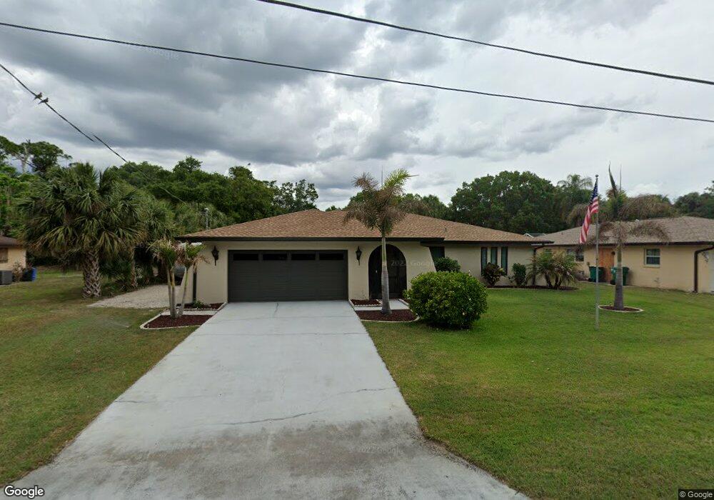
1363 Mohawk Dr Port Charlotte, FL 33952
Estimated Value: $283,000 - $328,000
2
Beds
2
Baths
1,916
Sq Ft
$159/Sq Ft
Est. Value
About This Home
This home is located at 1363 Mohawk Dr, Port Charlotte, FL 33952 and is currently estimated at $305,386, approximately $159 per square foot. 1363 Mohawk Dr is a home located in Charlotte County with nearby schools including Neil Armstrong Elementary School, Murdock Middle School, and Port Charlotte High School.
Ownership History
Date
Name
Owned For
Owner Type
Purchase Details
Closed on
Dec 19, 2024
Sold by
Dugan James Patrick and Dugan Vicki Lou
Bought by
Dugan James Patrick and Dugan Vicki Lou
Current Estimated Value
Purchase Details
Closed on
Jul 25, 2018
Sold by
Bale Juanita L
Bought by
Dugan James P and Dugan Vicki L
Purchase Details
Closed on
Jan 11, 2018
Sold by
Bale Juanita L
Bought by
Bale Juanita L and Bale Martin L
Create a Home Valuation Report for This Property
The Home Valuation Report is an in-depth analysis detailing your home's value as well as a comparison with similar homes in the area
Home Values in the Area
Average Home Value in this Area
Purchase History
| Date | Buyer | Sale Price | Title Company |
|---|---|---|---|
| Dugan James Patrick | $100 | None Listed On Document | |
| Dugan James Patrick | $100 | None Listed On Document | |
| Dugan James P | $120,000 | Hometown Title & Closing Svc | |
| Bale Juanita L | -- | Attorney |
Source: Public Records
Tax History Compared to Growth
Tax History
| Year | Tax Paid | Tax Assessment Tax Assessment Total Assessment is a certain percentage of the fair market value that is determined by local assessors to be the total taxable value of land and additions on the property. | Land | Improvement |
|---|---|---|---|---|
| 2023 | $3,221 | $197,719 | $0 | $0 |
| 2022 | $3,105 | $191,960 | $0 | $0 |
| 2021 | $3,101 | $186,369 | $0 | $0 |
| 2020 | $3,045 | $183,796 | $0 | $0 |
| 2019 | $2,845 | $173,762 | $4,675 | $169,087 |
| 2018 | $1,213 | $83,182 | $0 | $0 |
| 2017 | $1,201 | $81,471 | $0 | $0 |
| 2016 | $1,186 | $79,795 | $0 | $0 |
| 2015 | $1,169 | $79,240 | $0 | $0 |
| 2014 | $1,144 | $78,611 | $0 | $0 |
Source: Public Records
Map
Nearby Homes
- 20260 Tralee Dr
- 20170 Tralee Dr
- 1357 Nimrod St
- 20246 Rutherford Ave
- 1317 Arrow St
- 20191 Rutherford Ave
- 20297 Kinderkemac Ave
- 1302 Arrow St
- 20118 Quesada Ave
- 20246 Hamilton Ave
- 20214 Hamilton Ave
- 20296 Rutherford Ave
- 20159 Holland Ave
- 20307 Zelda Ave
- 20190 Rutherford Ave
- 1366 Preston St
- 20136 Susan Ave
- 20191 Gladstone Ave
- 1483 Salyers St
- 20159 Gladstone Ave