13632 Mullein Unit EM59 Sisters, OR 97759
Estimated Value: $2,162,000 - $3,667,000
5
Beds
5
Baths
4,532
Sq Ft
$664/Sq Ft
Est. Value
About This Home
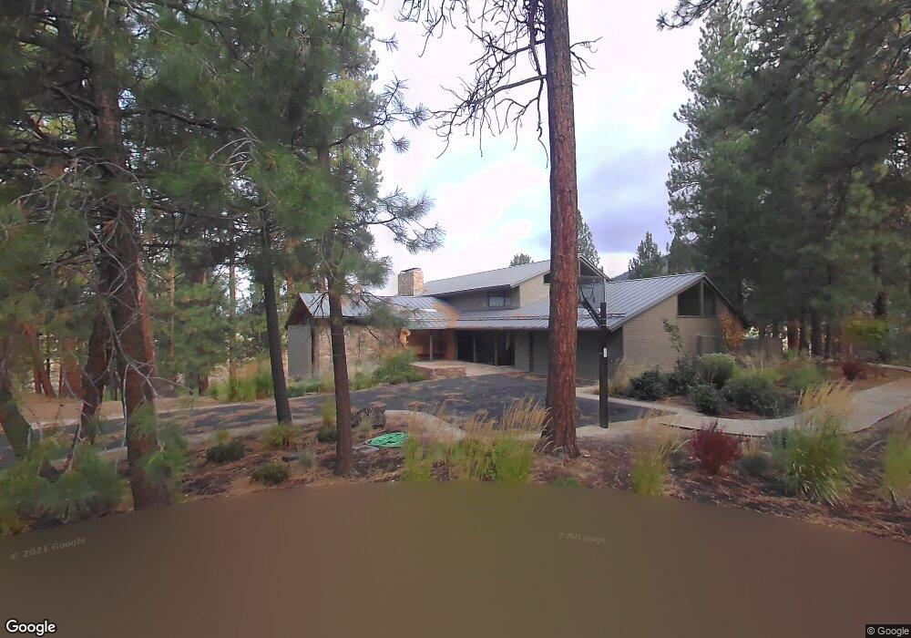
This home is located at 13632 Mullein Unit EM59, Sisters, OR 97759 and is currently estimated at $3,009,178, approximately $663 per square foot. 13632 Mullein Unit EM59 is a home with nearby schools including Sisters Elementary School, Sisters Middle School, and Sisters High School.
Ownership History
Date
Name
Owned For
Owner Type
Purchase Details
Closed on
Dec 31, 2024
Sold by
Bill And Leslie Cornog Living Trust and Cornog William L
Bought by
Cornog Family Limited Partnership
Current Estimated Value
Purchase Details
Closed on
Jul 25, 2014
Sold by
Cornog Family Limited Partnership
Bought by
The Bill & Leslie Cornog Living Trust
Purchase Details
Closed on
Sep 23, 2010
Sold by
Cornog William L and Cornog Leslie
Bought by
Cornog Family Limited Partnership
Purchase Details
Closed on
Mar 23, 2007
Sold by
Bbr Investments Llc
Bought by
Cornog William L and Cornog Leslie
Home Financials for this Owner
Home Financials are based on the most recent Mortgage that was taken out on this home.
Original Mortgage
$1,275,000
Interest Rate
6.29%
Mortgage Type
Unknown
Create a Home Valuation Report for This Property
The Home Valuation Report is an in-depth analysis detailing your home's value as well as a comparison with similar homes in the area
Home Values in the Area
Average Home Value in this Area
Purchase History
| Date | Buyer | Sale Price | Title Company |
|---|---|---|---|
| Cornog Family Limited Partnership | -- | None Listed On Document | |
| The Bill & Leslie Cornog Living Trust | -- | None Available | |
| Cornog Family Limited Partnership | -- | None Available | |
| Cornog William L | $1,700,000 | Western Title & Escrow Co |
Source: Public Records
Mortgage History
| Date | Status | Borrower | Loan Amount |
|---|---|---|---|
| Previous Owner | Cornog William L | $1,275,000 | |
| Previous Owner | Bbr Investments Llc | $880,000 | |
| Previous Owner | Bbr Investments Llc | $350,000 |
Source: Public Records
Tax History Compared to Growth
Tax History
| Year | Tax Paid | Tax Assessment Tax Assessment Total Assessment is a certain percentage of the fair market value that is determined by local assessors to be the total taxable value of land and additions on the property. | Land | Improvement |
|---|---|---|---|---|
| 2024 | $26,487 | $1,695,520 | -- | -- |
| 2023 | $25,405 | $1,646,140 | $0 | $0 |
| 2022 | $23,584 | $1,551,660 | $0 | $0 |
| 2021 | $23,829 | $1,506,470 | $0 | $0 |
| 2020 | $22,603 | $1,506,470 | $0 | $0 |
| 2019 | $21,908 | $1,462,600 | $0 | $0 |
| 2018 | $21,218 | $1,420,000 | $0 | $0 |
| 2017 | $20,425 | $1,378,650 | $0 | $0 |
| 2016 | $19,492 | $1,281,840 | $0 | $0 |
| 2015 | $17,193 | $1,211,790 | $0 | $0 |
| 2014 | $16,605 | $1,129,660 | $0 | $0 |
Source: Public Records
Map
Nearby Homes
- 13579 Sundew Unit SM34
- 70789 Goldenrod Unit SM16
- 13584 Nine Bark
- 70780 Bitter Root
- 70755 Ponderosa Ln Unit SM 177
- 13461 Hawks Beard Unit SH43
- 70786 Blazing Star Unit RR 64
- 70684 Steeple Bush Unit SM 153
- 70701 Pasque Flower Unit SM94
- 13400 Foxtail Unit GCC 103
- 13400 Foxtail Unit 99
- 12960 Hawks Beard Unit 63
- 70686 Buck Brush Unit SM85
- 70661 Steeple Bush Unit SM202
- 70665 Buck Brush Unit SM 89
- 70948 Mules Ear
- 71183 Bracken Ln Unit GH76
- 13251 Snowbrush Unit GH 266
- 13168 Hawks Beard Unit GH 133
- 71059 Bracken Ln Unit GH 91A
- 13632 Mullein
- 13640 Mullein Em58
- 13658 Bishops Cap
- 13672 Bishops Cap
- 13618 Bishops Cap
- 70866 Rockrose
- 13684 Bishops Cap Unit EM55
- 70862 Rockrose
- 13600 Wakas Unit SM 50
- 13600 Wakas
- 70854 Rockrose
- 70865 Rockrose
- 70943 Lomatium Em 47
- 70943 Lomatium Unit EM 47
- 13698 Bishops Cap
- 13596 Wakas
- 70853 Rockrose
- 70939 Lomatium
- 70947 Lomatium
- 13701 Bishops Cap