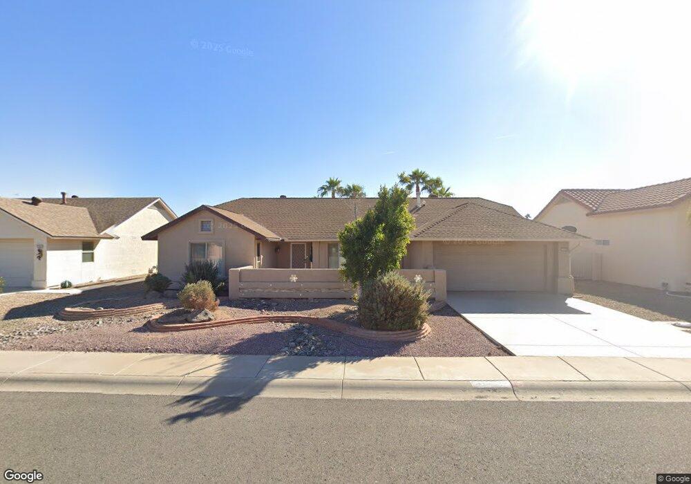
13635 W Sky Hawk Dr Sun City West, AZ 85375
Estimated Value: $318,745 - $372,000
--
Bed
2
Baths
1,356
Sq Ft
$254/Sq Ft
Est. Value
About This Home
This home is located at 13635 W Sky Hawk Dr, Sun City West, AZ 85375 and is currently estimated at $343,936, approximately $253 per square foot. 13635 W Sky Hawk Dr is a home located in Maricopa County.
Ownership History
Date
Name
Owned For
Owner Type
Purchase Details
Closed on
Apr 23, 2001
Sold by
Barnes Robert M and Barnes Elinor J
Bought by
Dawson Gary A and Dawson Colleen
Current Estimated Value
Home Financials for this Owner
Home Financials are based on the most recent Mortgage that was taken out on this home.
Original Mortgage
$94,400
Interest Rate
7.14%
Mortgage Type
New Conventional
Purchase Details
Closed on
Nov 10, 2000
Sold by
Faulkner Newman Sandra L and Newman Harry B
Bought by
Barnes Robert M and Barnes Elinor J
Purchase Details
Closed on
Jul 22, 1997
Sold by
Nuss George and Nuss Ruth K
Bought by
Newman Harry B and Faulkner Sandra L
Home Financials for this Owner
Home Financials are based on the most recent Mortgage that was taken out on this home.
Original Mortgage
$92,800
Interest Rate
7.43%
Mortgage Type
New Conventional
Purchase Details
Closed on
Feb 24, 1997
Sold by
Gacioh Norbert P and Gacioh Margaret E
Bought by
Nuss George and Nuss Ruth K
Create a Home Valuation Report for This Property
The Home Valuation Report is an in-depth analysis detailing your home's value as well as a comparison with similar homes in the area
Home Values in the Area
Average Home Value in this Area
Purchase History
| Date | Buyer | Sale Price | Title Company |
|---|---|---|---|
| Dawson Gary A | $118,000 | First American Title | |
| Barnes Robert M | $110,000 | First American Title | |
| Newman Harry B | $116,000 | First American Title | |
| Nuss George | $94,605 | First American Title |
Source: Public Records
Mortgage History
| Date | Status | Borrower | Loan Amount |
|---|---|---|---|
| Previous Owner | Dawson Gary A | $94,400 | |
| Previous Owner | Newman Harry B | $92,800 |
Source: Public Records
Tax History Compared to Growth
Tax History
| Year | Tax Paid | Tax Assessment Tax Assessment Total Assessment is a certain percentage of the fair market value that is determined by local assessors to be the total taxable value of land and additions on the property. | Land | Improvement |
|---|---|---|---|---|
| 2025 | $1,208 | $16,642 | -- | -- |
| 2024 | $1,091 | $15,849 | -- | -- |
| 2023 | $1,091 | $26,530 | $5,300 | $21,230 |
| 2022 | $1,022 | $21,550 | $4,310 | $17,240 |
| 2021 | $1,065 | $19,550 | $3,910 | $15,640 |
| 2020 | $1,039 | $18,060 | $3,610 | $14,450 |
| 2019 | $1,018 | $15,980 | $3,190 | $12,790 |
| 2018 | $980 | $13,510 | $2,700 | $10,810 |
| 2017 | $943 | $12,650 | $2,530 | $10,120 |
| 2016 | $902 | $11,810 | $2,360 | $9,450 |
| 2015 | $866 | $10,650 | $2,130 | $8,520 |
Source: Public Records
Map
Nearby Homes
- 13709 W Whitewood Dr
- 13547 W Sky Hawk Dr
- 13718 W Gable Hill Dr
- 13711 W Gable Hill Dr
- 13725 W Springdale Dr
- 21627 N 139th Dr
- 14010 W Pavillion Dr
- 13451 W Ballad Dr
- 13447 W Ballad Dr
- 13450 W Stardust Blvd Unit 20A
- 14102 W Whitewood Dr
- 13819 W Elmbrook Dr
- 14105 W Sky Hawk Dr Unit 40
- 14111 W Circle Ridge Dr
- 13919 W Gable Hill Dr
- 14123 W Circle Ridge Dr Unit 40
- 14121 W Casa Linda Dr
- 14140 W Circle Ridge Dr
- 21433 N 142nd Dr
- 13907 W Terra Vista Dr
- 13627 W Sky Hawk Dr
- 13703 W Sky Hawk Dr
- 13707 W Sky Hawk Dr Unit 39
- 13619 W Sky Hawk Dr
- 13634 W Sky Hawk Dr
- 13626 W Sky Hawk Dr
- 13702 W Sky Hawk Dr
- 13634 W Gable Hill Dr
- 13630 W Gable Hill Dr
- 13618 W Sky Hawk Dr
- 13711 W Sky Hawk Dr
- 13611 W Sky Hawk Dr
- 13706 W Sky Hawk Dr
- 13702 W Gable Hill Dr
- 13626 W Gable Hill Dr
- 13610 W Sky Hawk Dr
- 13703 W White Wood Dr
- 13710 W Sky Hawk Dr
- 13706 W Gable Hill Dr
- 13705 W White Wood Dr