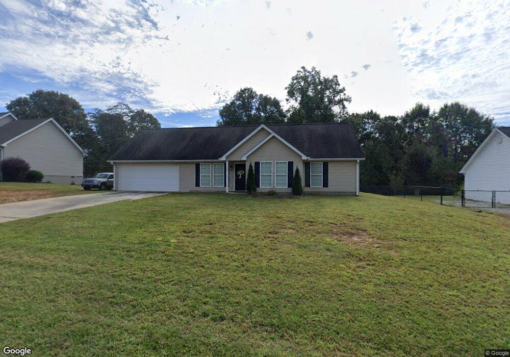
1364 Bill Presley Rd Unit 3 Cleveland, GA 30528
Estimated Value: $308,000 - $352,000
3
Beds
2
Baths
1,412
Sq Ft
$230/Sq Ft
Est. Value
About This Home
This home is located at 1364 Bill Presley Rd Unit 3, Cleveland, GA 30528 and is currently estimated at $324,902, approximately $230 per square foot. 1364 Bill Presley Rd Unit 3 is a home located in White County with nearby schools including Mossy Creek Elementary School, White County 9th Grade Academy, and White County Middle School.
Ownership History
Date
Name
Owned For
Owner Type
Purchase Details
Closed on
Oct 12, 2016
Sold by
Clore Tyler and Clore William A
Bought by
Parris Michael A
Current Estimated Value
Home Financials for this Owner
Home Financials are based on the most recent Mortgage that was taken out on this home.
Original Mortgage
$122,735
Outstanding Balance
$100,151
Interest Rate
4.12%
Mortgage Type
FHA
Estimated Equity
$224,751
Purchase Details
Closed on
Nov 25, 2009
Sold by
Kemp Jimmy
Bought by
Clore Tyler
Home Financials for this Owner
Home Financials are based on the most recent Mortgage that was taken out on this home.
Original Mortgage
$117,335
Interest Rate
5.01%
Mortgage Type
FHA
Create a Home Valuation Report for This Property
The Home Valuation Report is an in-depth analysis detailing your home's value as well as a comparison with similar homes in the area
Home Values in the Area
Average Home Value in this Area
Purchase History
| Date | Buyer | Sale Price | Title Company |
|---|---|---|---|
| Parris Michael A | $125,000 | -- | |
| Clore Tyler | $119,500 | -- |
Source: Public Records
Mortgage History
| Date | Status | Borrower | Loan Amount |
|---|---|---|---|
| Open | Parris Michael A | $122,735 | |
| Previous Owner | Clore Tyler | $117,335 |
Source: Public Records
Tax History Compared to Growth
Tax History
| Year | Tax Paid | Tax Assessment Tax Assessment Total Assessment is a certain percentage of the fair market value that is determined by local assessors to be the total taxable value of land and additions on the property. | Land | Improvement |
|---|---|---|---|---|
| 2025 | $2,137 | $102,604 | $12,000 | $90,604 |
| 2024 | $2,137 | $102,604 | $12,000 | $90,604 |
| 2023 | $1,870 | $82,440 | $10,000 | $72,440 |
| 2022 | $1,632 | $68,776 | $6,000 | $62,776 |
| 2021 | $1,548 | $57,756 | $6,000 | $51,756 |
| 2020 | $1,463 | $51,972 | $6,000 | $45,972 |
| 2019 | $1,467 | $51,972 | $6,000 | $45,972 |
| 2018 | $1,467 | $51,972 | $6,000 | $45,972 |
| 2017 | $1,319 | $47,160 | $6,000 | $41,160 |
| 2016 | $1,320 | $47,160 | $6,000 | $41,160 |
| 2015 | $1,383 | $129,530 | $8,000 | $43,812 |
| 2014 | $1,282 | $119,810 | $0 | $0 |
Source: Public Records
Map
Nearby Homes
- 201 Quail View Ridge
- 44 Quail Knoll Ln
- 2459 New Bridge Rd
- 234 Mossy Creek Church Rd
- 1779 New Bridge Rd
- 125 King Bird Dr
- 0 Webster Lake Rd Unit 10621290
- 320 Hickory Ridge Dr
- 3532 New Bridge Rd
- 139 Maple Ridge Dr
- 0 Hiawassee Ln Unit 10489443
- LOT 19 Walnut Ridge Dr
- 185 Walnut Ridge Dr
- 694 Old Cherokee Rd
- LOT 5 Fowler Creek Dr
- 309 Fowler Creek Dr
- 2011 Lothridge Rd
- 375 Buckwood Trail
- 00 Limber Lost Trail
- 0 Limber Lost Trail Unit 10493698
- 1364 Bill Presley Rd
- 1382 Bill Presley Rd
- 1360 Bill Presley Rd
- 1418 Bill Presley Rd
- 1367 Bill Presley Rd
- 1422 Bill Presley Rd
- 1494 Bill Presley Rd
- 1438 Bill Presley Rd
- 1458 Bill Presley Rd
- 224 Quail View Ridge
- 206 Quail View
- 0 Quail View Ridge Unit 10205207
- 0 Quail View Ridge Unit 10205204
- 0 Quail View Ridge Unit 7278520
- 0 Quail View Ridge Unit 7278519
- 0 Quail View Ridge Unit 8804156
- 0 Quail View Ridge Unit 8812289
- 0 Quail View Ridge Unit 8824019
- 0 Quail View Ridge Unit 6613239
- 0 Quail View Ridge Unit 6613241