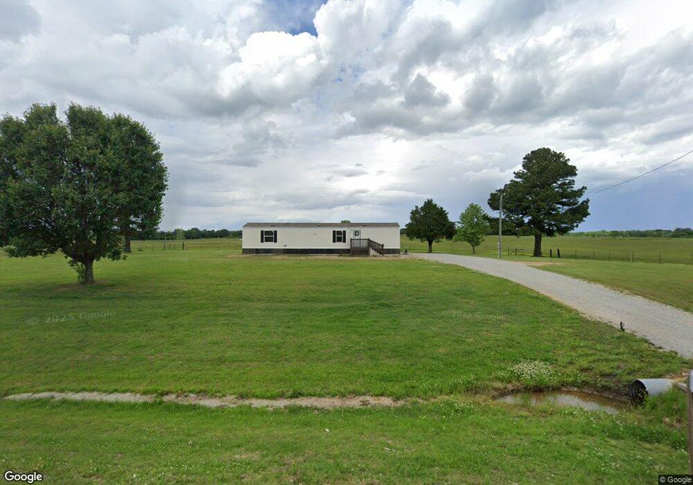
1364 Highway 34 W Paragould, AR 72450
Estimated Value: $11,259 - $224,000
3
Beds
2
Baths
1,300
Sq Ft
$107/Sq Ft
Est. Value
About This Home
This home is located at 1364 Highway 34 W, Paragould, AR 72450 and is currently estimated at $138,815, approximately $106 per square foot. 1364 Highway 34 W is a home located in Greene County with nearby schools including Paragould High School.
Ownership History
Date
Name
Owned For
Owner Type
Purchase Details
Closed on
Nov 17, 2021
Sold by
Morris Samuel J and Morris Jessica
Bought by
Murray Gaylon Wade and Murray Karen Renee
Current Estimated Value
Purchase Details
Closed on
Feb 7, 2008
Sold by
Cook Brandy Murray and Burns Brandy Murray
Bought by
Morris Samuel J and Morris Jessica
Home Financials for this Owner
Home Financials are based on the most recent Mortgage that was taken out on this home.
Original Mortgage
$52,771
Interest Rate
5.88%
Mortgage Type
FHA
Purchase Details
Closed on
Dec 27, 1999
Bought by
Brandy Murray Burns
Create a Home Valuation Report for This Property
The Home Valuation Report is an in-depth analysis detailing your home's value as well as a comparison with similar homes in the area
Home Values in the Area
Average Home Value in this Area
Purchase History
| Date | Buyer | Sale Price | Title Company |
|---|---|---|---|
| Murray Gaylon Wade | $10,000 | None Listed On Document | |
| Morris Samuel J | $54,000 | None Available | |
| Brandy Murray Burns | $2,000 | -- |
Source: Public Records
Mortgage History
| Date | Status | Borrower | Loan Amount |
|---|---|---|---|
| Previous Owner | Morris Samuel J | $52,771 |
Source: Public Records
Tax History Compared to Growth
Tax History
| Year | Tax Paid | Tax Assessment Tax Assessment Total Assessment is a certain percentage of the fair market value that is determined by local assessors to be the total taxable value of land and additions on the property. | Land | Improvement |
|---|---|---|---|---|
| 2025 | $61 | $1,400 | $1,400 | $0 |
| 2024 | $61 | $1,400 | $1,400 | $0 |
| 2023 | $65 | $1,500 | $1,500 | $0 |
| 2022 | $65 | $1,500 | $1,500 | $0 |
| 2021 | $227 | $7,230 | $1,500 | $5,730 |
| 2020 | $207 | $4,780 | $1,300 | $3,480 |
| 2019 | $207 | $4,780 | $1,300 | $3,480 |
| 2018 | $207 | $4,780 | $1,300 | $3,480 |
| 2017 | $202 | $4,780 | $1,300 | $3,480 |
| 2016 | $202 | $4,780 | $1,300 | $3,480 |
| 2015 | $255 | $6,790 | $2,000 | $4,790 |
| 2014 | -- | $6,790 | $2,000 | $4,790 |
Source: Public Records
Map
Nearby Homes
- 5.38 AC Highway 135 N
- 1 Acre Hwy 34 W
- 146 Messer Dr
- 205 Raymond
- 181 Misty Marie
- 422 Sunset Dr
- 0 Greene 611 Tract A East Rd
- TBD Greene Road 611
- 522 Vaughn Dr
- 193 Granny Jean Ln
- 233 Lois Ln
- 44 Oak Grove Rd
- 9496 Arkansas 135
- 2844 Greene Road 624
- 3 Highway 135 N
- 00 Off Hwy 135 N
- 1094 Greene Road 508
- 197 Greene Road 535
- 1387 Greene Road 517
- Tract 4 Greene 726 Rd
- 1299 Highway 34 W
- 1260 Arkansas 34
- 1260 Highway 34 W
- 1265 Highway 34 W
- 1243 Highway 34 W
- 1192 Highway 34 W
- 1458 Highway 34 W
- 1049 Highway 34 W
- 1049 Highway 34 W
- 968 Highway 34 W
- 520 Greene 628 Rd
- 1727 Highway 34 W
- 918 Highway 34 W
- 247 Greene 138 Rd
- 672 Greene 628 Rd
- 342 Greene 138 Rd
- 1834 Highway 34 W
- 34 W Hwy & Gr 628 Rd
- 625 Greene 628 Rd
- 750 Greene 628 Rd