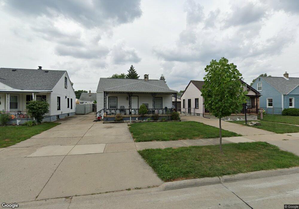
13644 Agnes St Southgate, MI 48195
Estimated Value: $163,482 - $208,000
3
Beds
2
Baths
965
Sq Ft
$191/Sq Ft
Est. Value
About This Home
This home is located at 13644 Agnes St, Southgate, MI 48195 and is currently estimated at $184,621, approximately $191 per square foot. 13644 Agnes St is a home located in Wayne County with nearby schools including Fordline Elementary School, Davidson Middle School, and Southgate Anderson High School.
Ownership History
Date
Name
Owned For
Owner Type
Purchase Details
Closed on
Jan 24, 2018
Sold by
Oberdorf Christopher W and Oberdorf Jennifer N
Bought by
Oberdorf Catherine A
Current Estimated Value
Purchase Details
Closed on
Jun 4, 2010
Sold by
Oberdorf Christopher W
Bought by
Oberdorf Christopher W
Purchase Details
Closed on
Feb 27, 2010
Sold by
Us Bank Na
Bought by
Federal National Mortgage Association
Purchase Details
Closed on
Jan 27, 2010
Sold by
Eastom Ruth Ann and Eastom Rodney D
Bought by
Us Bank Na
Create a Home Valuation Report for This Property
The Home Valuation Report is an in-depth analysis detailing your home's value as well as a comparison with similar homes in the area
Home Values in the Area
Average Home Value in this Area
Purchase History
| Date | Buyer | Sale Price | Title Company |
|---|---|---|---|
| Oberdorf Catherine A | -- | None Available | |
| Oberdorf Christopher W | -- | None Available | |
| Federal National Mortgage Association | -- | None Available | |
| Us Bank Na | $99,118 | None Available |
Source: Public Records
Tax History
| Year | Tax Paid | Tax Assessment Tax Assessment Total Assessment is a certain percentage of the fair market value that is determined by local assessors to be the total taxable value of land and additions on the property. | Land | Improvement |
|---|---|---|---|---|
| 2025 | $2,785 | $78,900 | $0 | $0 |
| 2024 | $2,680 | $74,100 | $0 | $0 |
| 2023 | $2,554 | $66,600 | $0 | $0 |
| 2022 | $2,812 | $60,000 | $0 | $0 |
| 2021 | $2,734 | $54,100 | $0 | $0 |
| 2020 | $2,690 | $48,500 | $0 | $0 |
| 2019 | $2,653 | $44,000 | $0 | $0 |
| 2018 | $2,158 | $38,700 | $0 | $0 |
| 2017 | $911 | $36,000 | $0 | $0 |
| 2016 | $1,879 | $36,100 | $0 | $0 |
| 2015 | $3,231 | $34,800 | $0 | $0 |
| 2013 | $3,130 | $32,800 | $0 | $0 |
| 2012 | $1,373 | $30,800 | $5,200 | $25,600 |
Source: Public Records
Map
Nearby Homes
- 14036 Longtin St
- 14070 Longtin St
- 14056 Irene St
- 13366 Trenton Rd
- 13367 Fordline St
- 0 Fordline Unit 20261010397
- 14231 Fordline St
- 0 Poplar St
- 13621 Mulberry St
- 13741 Chestnut St
- 14509 Poplar St
- 14257 Mulberry St
- 14212 Northline Rd
- 13080 Poplar St
- 13139 Mulberry St
- 14618 Fordline St
- 13360 Jobin St
- 12855 Dix Toledo Rd
- 13820 Catalpa St
- 14717 Poplar St
- 13656 Agnes St
- 13632 Agnes St
- 13668 Agnes St
- 13620 Agnes St
- 13645 Pearl St
- 13645 Agnes St
- 13657 Pearl St
- 13633 Pearl St Unit Bldg-Unit
- 13633 Pearl St
- 13669 Pearl St
- 13621 Pearl St
- 13692 Agnes St
- 13657 Agnes St
- 13681 Pearl St
- 13669 Agnes St
- 13621 Agnes St
- 13542 Agnes St
- 13704 Agnes St
- 13693 Pearl St
- 13681 Agnes St
Your Personal Tour Guide
Ask me questions while you tour the home.