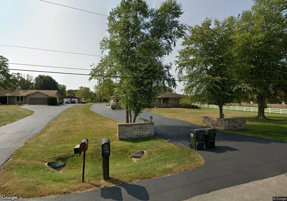
13645 W 21st St Wadsworth, IL 60083
Estimated Value: $522,535 - $650,000
4
Beds
3
Baths
2,915
Sq Ft
$202/Sq Ft
Est. Value
About This Home
This home is located at 13645 W 21st St, Wadsworth, IL 60083 and is currently estimated at $587,884, approximately $201 per square foot. 13645 W 21st St is a home located in Lake County with nearby schools including Kenneth Murphy School, Beach Park Middle School, and Zion-Benton Township High School.
Ownership History
Date
Name
Owned For
Owner Type
Purchase Details
Closed on
May 12, 2011
Sold by
Amelio Arthur F and Amelio Katherine M
Bought by
Arthur F Amelio Trust
Current Estimated Value
Purchase Details
Closed on
Apr 26, 2002
Sold by
North Star Trust Company
Bought by
Amelio Arthur F and Amelio Katherine M
Purchase Details
Closed on
May 3, 1994
Sold by
Cline James and Cline Maureen
Bought by
Bank Of Northern Illinois N A
Home Financials for this Owner
Home Financials are based on the most recent Mortgage that was taken out on this home.
Original Mortgage
$233,000
Interest Rate
7.84%
Purchase Details
Closed on
Apr 25, 1994
Sold by
Bank Of Northern Illinois N A
Bought by
Cline James and Cline Maureen
Home Financials for this Owner
Home Financials are based on the most recent Mortgage that was taken out on this home.
Original Mortgage
$233,000
Interest Rate
7.84%
Create a Home Valuation Report for This Property
The Home Valuation Report is an in-depth analysis detailing your home's value as well as a comparison with similar homes in the area
Home Values in the Area
Average Home Value in this Area
Purchase History
| Date | Buyer | Sale Price | Title Company |
|---|---|---|---|
| Arthur F Amelio Trust | -- | None Available | |
| Amelio Arthur F | $400,000 | First American Title | |
| Bank Of Northern Illinois N A | -- | Ticor Title Insurance Compan | |
| Cline James | -- | Ticor Title Insurance Compan |
Source: Public Records
Mortgage History
| Date | Status | Borrower | Loan Amount |
|---|---|---|---|
| Previous Owner | Cline James | $233,000 |
Source: Public Records
Tax History Compared to Growth
Tax History
| Year | Tax Paid | Tax Assessment Tax Assessment Total Assessment is a certain percentage of the fair market value that is determined by local assessors to be the total taxable value of land and additions on the property. | Land | Improvement |
|---|---|---|---|---|
| 2024 | $9,848 | $114,146 | $20,452 | $93,694 |
| 2023 | $10,828 | $112,973 | $19,086 | $93,887 |
| 2022 | $10,828 | $115,937 | $17,791 | $98,146 |
| 2021 | $11,242 | $114,220 | $17,406 | $96,814 |
| 2020 | $11,212 | $111,562 | $16,898 | $94,664 |
| 2019 | $11,540 | $107,238 | $16,157 | $91,081 |
| 2018 | $11,779 | $106,912 | $16,050 | $90,862 |
| 2017 | $11,911 | $104,920 | $15,667 | $89,253 |
| 2016 | $11,840 | $101,479 | $15,074 | $86,405 |
| 2015 | $11,789 | $96,031 | $14,204 | $81,827 |
| 2014 | $10,330 | $93,474 | $13,778 | $79,696 |
| 2012 | $10,495 | $94,871 | $13,915 | $80,956 |
Source: Public Records
Map
Nearby Homes
- 40827 N Delany Rd
- 40661 N Delany Rd
- 41616 N Delany Rd
- 41320 N Green Bay Rd
- 41616 N Delaney Rd
- 1916 Sunshine Ct
- 2010 Sunset Ct
- 4533 Illinois 173
- 4539 Illinois 173
- 2031 Dawn Ln
- 42334 N Heritage Lot 7 Trail
- 13058 W 29th St
- 42008 N Delany Rd
- 13051 Bucksburn Ct
- 14067 W Pratum Terra Dr
- 13661 W Adams Rd
- 13551 W Adams Rd
- 39787 Torry Ln
- 40485 N Belle Foret Dr
- 40417 N Belle Foret Dr
- 13587 W 21st St
- 13705 W 21st St
- 13563 W 21st St
- 13525 W 21st St
- 13487 W 21st St
- 13484 W 21st St
- 40920 N Timberland Trail
- 40990 N Timberland Trail
- 40890 N Timberland Trail
- 13462 W 21st St
- 40860 N Timberland Trail
- 13440 W 21st St
- 40989 N Timberland Trail
- 40836 N Timberland Trail
- 40820 N Timberland Trail
- 13400 W 21st St
- 13399 W 21st St
- 40925 N Timberland Trail
- 40895 N Timberland Trail
- 40800 N Timberland Trail