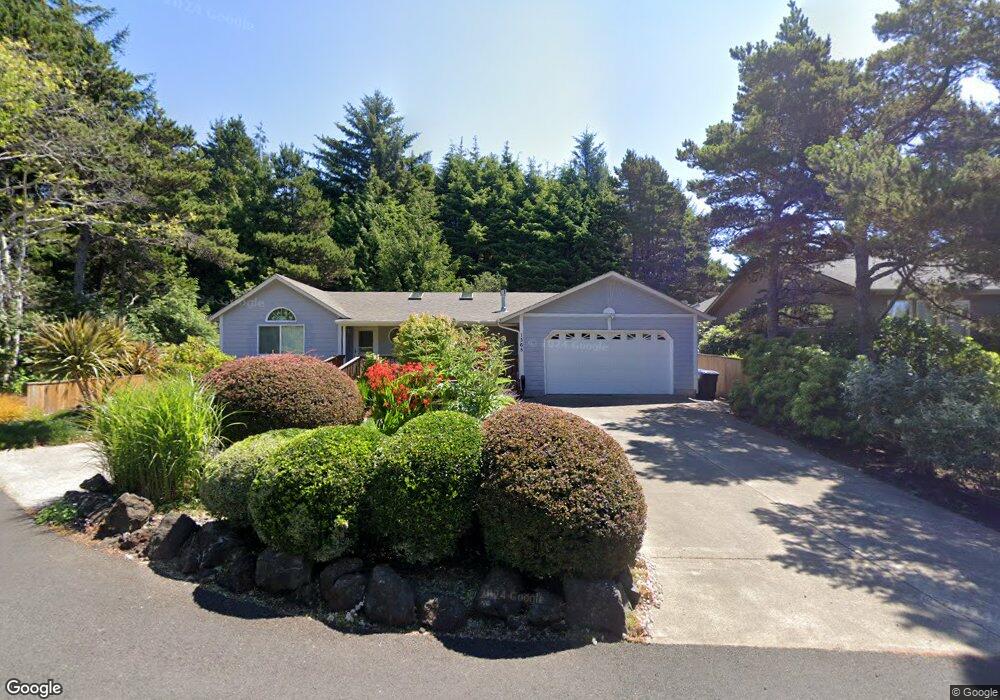
1365 SW Crest Cir Waldport, OR 97394
Estimated Value: $473,000 - $633,000
3
Beds
3
Baths
1,700
Sq Ft
$320/Sq Ft
Est. Value
About This Home
This home is located at 1365 SW Crest Cir, Waldport, OR 97394 and is currently estimated at $544,337, approximately $320 per square foot. 1365 SW Crest Cir is a home located in Lincoln County with nearby schools including Crestview Heights School, Waldport High and Middle School, and Angell JCC.
Ownership History
Date
Name
Owned For
Owner Type
Purchase Details
Closed on
Mar 17, 2011
Sold by
Scott Elsie K
Bought by
Scott Elsie K and Elsie Scott Revocable Trust
Current Estimated Value
Purchase Details
Closed on
Mar 15, 2005
Sold by
Schweich Daniel
Bought by
Scott Elsie K
Home Financials for this Owner
Home Financials are based on the most recent Mortgage that was taken out on this home.
Original Mortgage
$114,000
Outstanding Balance
$57,023
Interest Rate
5.61%
Mortgage Type
Fannie Mae Freddie Mac
Estimated Equity
$487,314
Create a Home Valuation Report for This Property
The Home Valuation Report is an in-depth analysis detailing your home's value as well as a comparison with similar homes in the area
Home Values in the Area
Average Home Value in this Area
Purchase History
| Date | Buyer | Sale Price | Title Company |
|---|---|---|---|
| Scott Elsie K | -- | None Available | |
| Scott Elsie K | $261,900 | Western Title & Escrow Co |
Source: Public Records
Mortgage History
| Date | Status | Borrower | Loan Amount |
|---|---|---|---|
| Open | Scott Elsie K | $114,000 |
Source: Public Records
Tax History Compared to Growth
Tax History
| Year | Tax Paid | Tax Assessment Tax Assessment Total Assessment is a certain percentage of the fair market value that is determined by local assessors to be the total taxable value of land and additions on the property. | Land | Improvement |
|---|---|---|---|---|
| 2025 | $4,481 | $262,250 | -- | -- |
| 2024 | $4,242 | $254,620 | -- | -- |
| 2023 | $4,118 | $247,210 | $0 | $0 |
| 2022 | $3,977 | $240,010 | $0 | $0 |
| 2021 | $3,877 | $233,020 | $0 | $0 |
| 2020 | $3,801 | $226,240 | $0 | $0 |
| 2019 | $3,657 | $219,650 | $0 | $0 |
| 2018 | $3,589 | $213,260 | $0 | $0 |
| 2017 | $3,474 | $207,050 | $0 | $0 |
| 2016 | $3,389 | $201,020 | $0 | $0 |
| 2015 | $2,831 | $195,170 | $0 | $0 |
| 2014 | $2,781 | $189,490 | $0 | $0 |
| 2013 | -- | $183,970 | $0 | $0 |
Source: Public Records
Map
Nearby Homes
- 760 SW Range Dr
- TL 10200 SW Chad Dr
- 1420 SW Fairway Dr
- 1590 SW Fairway Dr
- 700 Blk SW Kelsie Ln
- 1345 SW Fairway Dr
- 1410 SW Forest Pkwy
- 1200 Blk Sw Norwood Drive Tl0120
- 1200 Blk Norwood Dr Tl012
- 600 SW Pacific Coast Hwy
- 415 SW Range Dr
- 925 SW Dolores Dr
- TL 300 SW Dolores Dr
- 1409 SW Adahi Ave
- 125 SW Range Dr
- TL 600 SW Sailfish Loop
- TL-700 SW Sailfish
- 1215 SW Ocean Hills Dr
- 2220 SW Green Ln
- 1445 S Crestline Dr
- 1325 SW Crest Cir
- 1320 SW Crest Cir
- 1320 Sw Crest
- 740 SW Range Dr
- 1420 SW Crest Cir
- 1520 SW Chad Dr
- 1500 SW Chad Dr
- 1345 SW Ocean Terrace
- 725 SW Range Dr
- 840 SW Range Dr
- 825 SW Range Dr
- 1325 SW Ocean Terrace
- 32 SW Chad Dr
- 131130BB SW Chad Dr
- TL 10800 SW Chad Dr
- TL7800 SW Chad Dr
- TL 10500+ SW Chad Dr
- xxxx SW Chad Dr
- 37 SW Chad Dr
- 33 SW Chad Dr