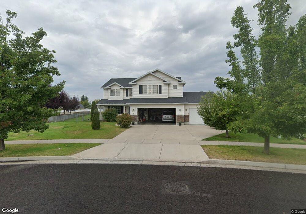
1365 W Henrys Pt Dr Logan, UT 84321
Woodruff NeighborhoodEstimated Value: $483,000 - $515,000
--
Bed
--
Bath
2,581
Sq Ft
$193/Sq Ft
Est. Value
About This Home
This home is located at 1365 W Henrys Pt Dr, Logan, UT 84321 and is currently estimated at $498,746, approximately $193 per square foot. 1365 W Henrys Pt Dr is a home with nearby schools including Woodruff School, Mount Logan Middle School, and Logan High School.
Ownership History
Date
Name
Owned For
Owner Type
Purchase Details
Closed on
Dec 15, 2020
Sold by
Mcclay David A and Mcclay Shirley Anne
Bought by
Mcclay David and Mcclay Shirley
Current Estimated Value
Home Financials for this Owner
Home Financials are based on the most recent Mortgage that was taken out on this home.
Original Mortgage
$238,000
Outstanding Balance
$211,891
Interest Rate
2.7%
Mortgage Type
New Conventional
Estimated Equity
$286,855
Purchase Details
Closed on
Jan 30, 2006
Sold by
Venture Net Llc
Bought by
Mcclay David A and Mcclay Shirley Anne
Home Financials for this Owner
Home Financials are based on the most recent Mortgage that was taken out on this home.
Original Mortgage
$180,000
Interest Rate
10%
Mortgage Type
Purchase Money Mortgage
Create a Home Valuation Report for This Property
The Home Valuation Report is an in-depth analysis detailing your home's value as well as a comparison with similar homes in the area
Home Values in the Area
Average Home Value in this Area
Purchase History
| Date | Buyer | Sale Price | Title Company |
|---|---|---|---|
| Mcclay David | -- | Advanced Title | |
| Mcclay David A | -- | Cache Title Company |
Source: Public Records
Mortgage History
| Date | Status | Borrower | Loan Amount |
|---|---|---|---|
| Open | Mcclay David | $238,000 | |
| Closed | Mcclay David A | $180,000 |
Source: Public Records
Tax History Compared to Growth
Tax History
| Year | Tax Paid | Tax Assessment Tax Assessment Total Assessment is a certain percentage of the fair market value that is determined by local assessors to be the total taxable value of land and additions on the property. | Land | Improvement |
|---|---|---|---|---|
| 2025 | $219 | $283,575 | $0 | $0 |
| 2024 | $2,253 | $282,265 | $0 | $0 |
| 2023 | $2,330 | $278,190 | $0 | $0 |
| 2022 | $2,179 | $242,990 | $0 | $0 |
| 2021 | $2,090 | $359,953 | $48,000 | $311,953 |
| 2020 | $2,059 | $319,264 | $48,000 | $271,264 |
| 2019 | $2,152 | $319,264 | $48,000 | $271,264 |
| 2018 | $2,143 | $290,200 | $48,000 | $242,200 |
| 2017 | $2,056 | $147,180 | $0 | $0 |
| 2016 | $2,131 | $120,370 | $0 | $0 |
| 2015 | $1,745 | $120,370 | $0 | $0 |
| 2014 | $1,577 | $120,370 | $0 | $0 |
| 2013 | -- | $120,370 | $0 | $0 |
Source: Public Records
Map
Nearby Homes
- 1506 Silver Canoe Loop
- 1506 Silver Canoe Loop Unit 102
- 763 S 1500 W
- Hemlock Plan at Sugar Creek - Logan
- Eucalyptus Plan at Sugar Creek - Logan
- Blackberry Plan at Sugar Creek - Logan
- Magnolia Plan at Sugar Creek - Logan
- 1239 W 575 S Unit 152
- 552 Rivergate Dr
- 2157 S 1580 W
- 524 Rivergate Dr
- 548 S 1225 W Unit 115
- 542 S 1225 W Unit 116
- 1585 W Silver Canoe Way
- 1220 W 575 S
- 1615 Silver Canoe Way
- 518 S 1225 W
- 420 S 1400 W
- 506 S 1225 W
- 1603 Silver Canoe Way
- 1369 Henrys Point Dr
- 1369 W Henry's Point Dr
- 699 S 1360 W
- 683 S 1360 W Unit 27
- 683 S 1360 W
- 1366 W Henrys Pt Dr
- 1371 W Henrys Pt Dr
- 1362 W Henrys Pt Dr
- 677 S 1360 W Unit 28
- 679 Legend Dr
- 1379 W Henrys Pt Dr
- 1379 W Henrys Pt Dr
- 623 Legend Dr
- 694 S 1360 W
- 716 Legend Dr
- 719 S 1360 W
- 720 Legend Dr
- 1380 Henrys Point Dr
- 1380 Henrys Point Dr Unit 54
- 734 S 1430 W