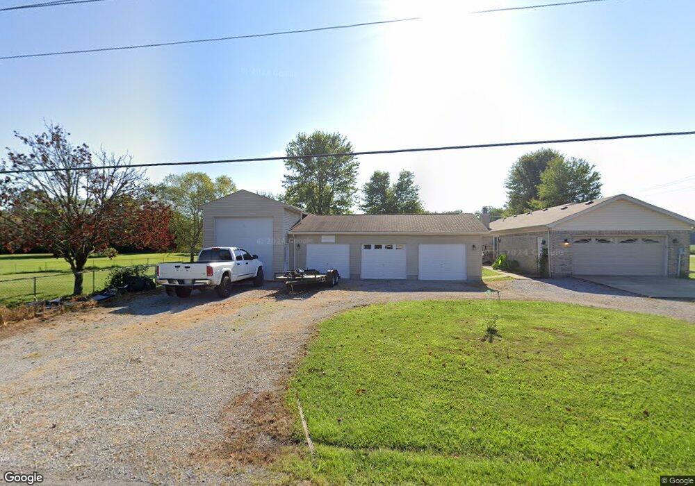
13650 New Harmony Salem Rd Mount Orab, OH 45154
Estimated Value: $214,000 - $298,871
3
Beds
2
Baths
1,595
Sq Ft
$166/Sq Ft
Est. Value
About This Home
This home is located at 13650 New Harmony Salem Rd, Mount Orab, OH 45154 and is currently estimated at $264,968, approximately $166 per square foot. 13650 New Harmony Salem Rd is a home located in Brown County with nearby schools including Western Brown High School.
Ownership History
Date
Name
Owned For
Owner Type
Purchase Details
Closed on
Nov 5, 2021
Sold by
Leimberger Robert A and Leimberger Beverly A
Bought by
Leimberger Robert
Current Estimated Value
Home Financials for this Owner
Home Financials are based on the most recent Mortgage that was taken out on this home.
Original Mortgage
$116,500
Interest Rate
3.92%
Mortgage Type
New Conventional
Purchase Details
Closed on
Aug 21, 1997
Sold by
Maple Grove Dev Corp
Bought by
Robert and Leimberger Beverly A
Home Financials for this Owner
Home Financials are based on the most recent Mortgage that was taken out on this home.
Original Mortgage
$77,000
Interest Rate
7.56%
Mortgage Type
New Conventional
Create a Home Valuation Report for This Property
The Home Valuation Report is an in-depth analysis detailing your home's value as well as a comparison with similar homes in the area
Home Values in the Area
Average Home Value in this Area
Purchase History
| Date | Buyer | Sale Price | Title Company |
|---|---|---|---|
| Leimberger Robert | $125 | None Listed On Document | |
| Robert | $7,000 | -- |
Source: Public Records
Mortgage History
| Date | Status | Borrower | Loan Amount |
|---|---|---|---|
| Previous Owner | Leimberger Robert | $116,500 | |
| Previous Owner | Robert | $77,000 |
Source: Public Records
Tax History Compared to Growth
Tax History
| Year | Tax Paid | Tax Assessment Tax Assessment Total Assessment is a certain percentage of the fair market value that is determined by local assessors to be the total taxable value of land and additions on the property. | Land | Improvement |
|---|---|---|---|---|
| 2024 | $1,997 | $80,270 | $9,550 | $70,720 |
| 2023 | $1,997 | $62,210 | $6,930 | $55,280 |
| 2022 | $1,560 | $62,210 | $6,930 | $55,280 |
| 2021 | $1,542 | $62,210 | $6,930 | $55,280 |
| 2020 | $1,288 | $51,850 | $5,780 | $46,070 |
| 2019 | $1,382 | $51,850 | $5,780 | $46,070 |
| 2018 | $1,373 | $51,850 | $5,780 | $46,070 |
| 2017 | $1,193 | $45,790 | $5,780 | $40,010 |
| 2016 | $1,193 | $45,790 | $5,780 | $40,010 |
| 2015 | $1,184 | $45,790 | $5,780 | $40,010 |
| 2014 | $1,184 | $45,260 | $5,250 | $40,010 |
| 2013 | $1,181 | $45,260 | $5,250 | $40,010 |
Source: Public Records
Map
Nearby Homes
- 3722 Coon Ave
- 1993 Old State Rd
- 3644 Deer Trace
- 3614 Bootjack Corner Rd
- 12570 Liming van Thompson Rd
- 0 Deer Trace Rd
- 2437 Tri County Hwy
- 3631 Bass Rd
- 133 Kelly Dr
- 101 Julian Ln
- 3690 Todds Run Foster Rd
- 153 Willow Run Rd
- 110 Copper Sun Ct
- 3685 Happy Hollow Rd
- 111 Copper Sun Ct
- Bellamy Plan at Cornerstone Crossing
- Fairton Plan at Cornerstone Crossing
- Harmony Plan at Cornerstone Crossing
- Aldridge Plan at Cornerstone Crossing
- 130 Cornerstone Dr
- 13647 New Harmony Salem Rd
- 0 New Harmony Salem Rd Unit 1138374
- 2 New Harmony Salem Rd
- 0 New Harmony Salem Rd Unit 1099998
- 0 New Harmony Salem Rd Unit 1685774
- 1694 New Harmony Shiloh Rd
- 1665 New Harmony Shiloh Rd
- 1673 New Harmony Shiloh Rd
- 13676 New Harmony Salem Rd
- 13671 New Harmony Salem Rd
- 13687 New Harmony Salem Rd
- 1160 New Harmony Shiloh Rd
- 13716 New Harmony-Salem Rd
- 1783 New Harmony Shiloh Rd
- 1782 New Harmony Shiloh Rd
- 1826 New Harmony Shiloh Rd
- 13744 New Harmony Salem Rd
- 1749 New Harmony Shiloh Rd
- 1839 New Harmony Shiloh Rd
- 13794 New Harmony Salem Rd